Government Wash Topo Map Nevada
To zoom in, hover over the map of Government Wash
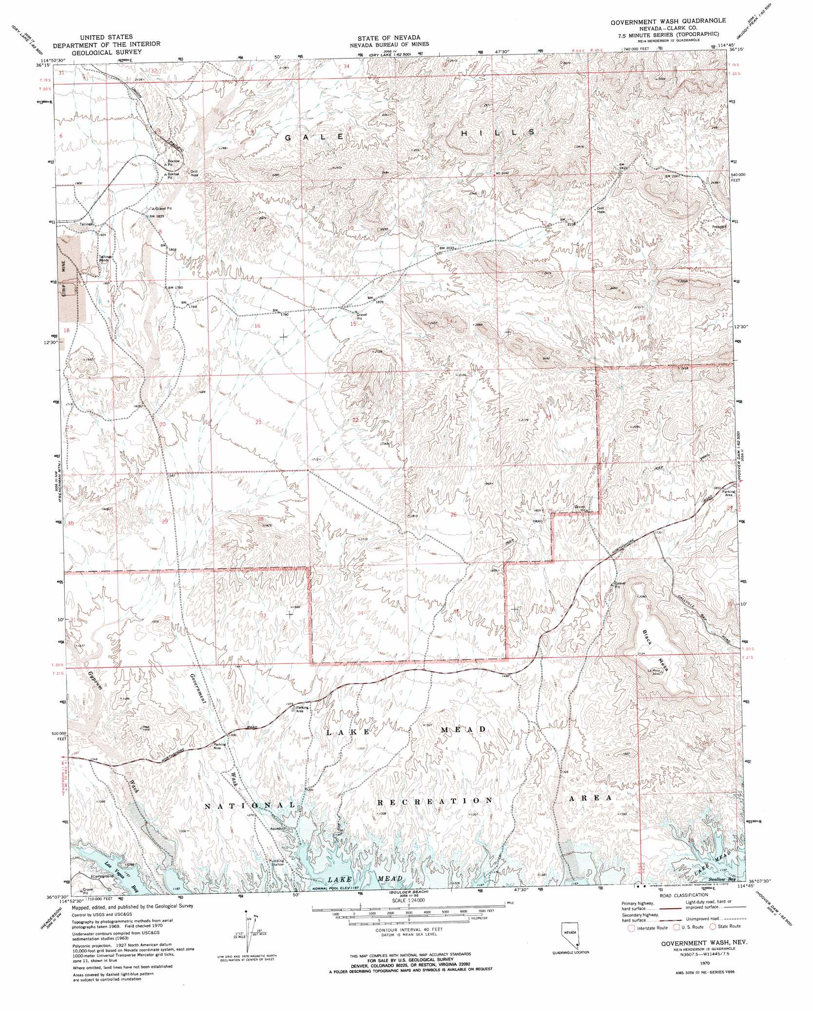
USGS Topo Quad 36114b7 - 1:24,000 scale
| Topo Map Name: | Government Wash |
| USGS Topo Quad ID: | 36114b7 |
| Print Size: | ca. 21 1/4" wide x 27" high |
| Southeast Coordinates: | 36.125° N latitude / 114.75° W longitude |
| Map Center Coordinates: | 36.1875° N latitude / 114.8125° W longitude |
| U.S. State: | NV |
| Filename: | o36114b7.jpg |
| Download Map JPG Image: | Government Wash topo map 1:24,000 scale |
| Map Type: | Topographic |
| Topo Series: | 7.5´ |
| Map Scale: | 1:24,000 |
| Source of Map Images: | United States Geological Survey (USGS) |
| Alternate Map Versions: |
Government Wash NV 1970, updated 1973 Download PDF Buy paper map Government Wash NV 2012 Download PDF Buy paper map Government Wash NV 2014 Download PDF Buy paper map |
1:24,000 Topo Quads surrounding Government Wash
Gass Peak Ne |
Dry Lake Nw |
Dry Lake |
Piute Point |
Valley Of Fire West |
Valley |
Apex |
Dry Lake Se |
Muddy Peak |
Bitter Spring |
Las Vegas Ne |
Frenchman Mountain |
Government Wash |
Callville Bay |
Boulder Canyon |
Las Vegas Se |
Henderson |
Boulder Beach |
Hoover Dam |
Petroglyph Wash |
Sloan Ne |
Boulder City Nw |
Boulder City |
Ringbolt Rapids |
Mount Wilson |
> Back to 36114a1 at 1:100,000 scale
> Back to 36114a1 at 1:250,000 scale
> Back to U.S. Topo Maps home
Government Wash topo map: Gazetteer
Government Wash: Bays
Crawdad Cove elevation 367m 1204′Hidden Cove elevation 367m 1204′
Lower Government Wash Cove elevation 367m 1204′
Lower Gypsum Wash Cove elevation 367m 1204′
Upper Government Wash Cove elevation 367m 1204′
Government Wash: Ranges
Gale Hills elevation 676m 2217′Government Wash: Streams
Government Wash elevation 367m 1204′Gypsum Wash elevation 367m 1204′
Government Wash: Summits
Black Mesa elevation 671m 2201′Government Wash digital topo map on disk
Buy this Government Wash topo map showing relief, roads, GPS coordinates and other geographical features, as a high-resolution digital map file on DVD:
Southern Sierra Nevada, California & Southern Nevada
Buy digital topo maps: Southern Sierra Nevada, California & Southern Nevada