Westhaven Topo Map California
To zoom in, hover over the map of Westhaven
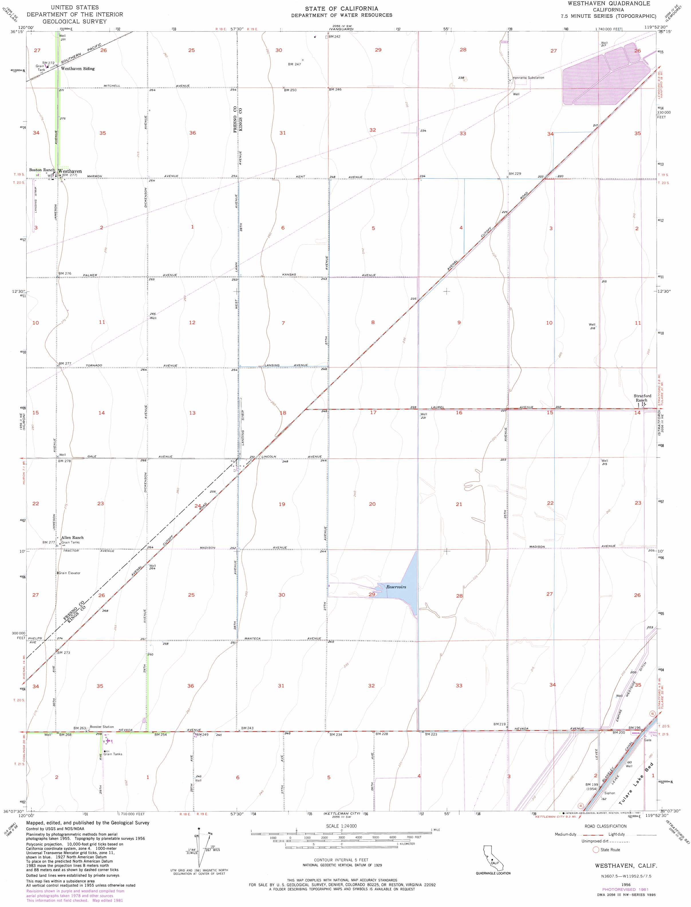
USGS Topo Quad 36119b8 - 1:24,000 scale
| Topo Map Name: | Westhaven |
| USGS Topo Quad ID: | 36119b8 |
| Print Size: | ca. 21 1/4" wide x 27" high |
| Southeast Coordinates: | 36.125° N latitude / 119.875° W longitude |
| Map Center Coordinates: | 36.1875° N latitude / 119.9375° W longitude |
| U.S. State: | CA |
| Filename: | o36119b8.jpg |
| Download Map JPG Image: | Westhaven topo map 1:24,000 scale |
| Map Type: | Topographic |
| Topo Series: | 7.5´ |
| Map Scale: | 1:24,000 |
| Source of Map Images: | United States Geological Survey (USGS) |
| Alternate Map Versions: |
Westhaven CA 1956, updated 1957 Download PDF Buy paper map Westhaven CA 1956, updated 1973 Download PDF Buy paper map Westhaven CA 1956, updated 1977 Download PDF Buy paper map Westhaven CA 1956, updated 1981 Download PDF Buy paper map Westhaven CA 2012 Download PDF Buy paper map Westhaven CA 2015 Download PDF Buy paper map |
1:24,000 Topo Quads surrounding Westhaven
Westside |
Five Points |
Burrel |
Riverdale |
Laton |
Harris Ranch |
Calflax |
Vanguard |
Lemoore |
Hanford |
Guijarral Hills |
Huron |
Westhaven |
Stratford |
Guernsey |
Avenal |
La Cima |
Kettleman City |
Stratford Se |
El Rico Ranch |
Garza Peak |
Kettleman Plain |
Los Viejos |
Dudley Ridge |
Hacienda Ranch Nw |
> Back to 36119a1 at 1:100,000 scale
> Back to 36118a1 at 1:250,000 scale
> Back to U.S. Topo Maps home
Westhaven topo map: Gazetteer
Westhaven: Airports
Stone Land Company Airport elevation 80m 262′Westhaven: Canals
Empire Westside Ditch elevation 61m 200′Westhaven: Populated Places
Westhaven elevation 85m 278′Westhaven digital topo map on disk
Buy this Westhaven topo map showing relief, roads, GPS coordinates and other geographical features, as a high-resolution digital map file on DVD:
Southern Sierra Nevada, California & Southern Nevada
Buy digital topo maps: Southern Sierra Nevada, California & Southern Nevada