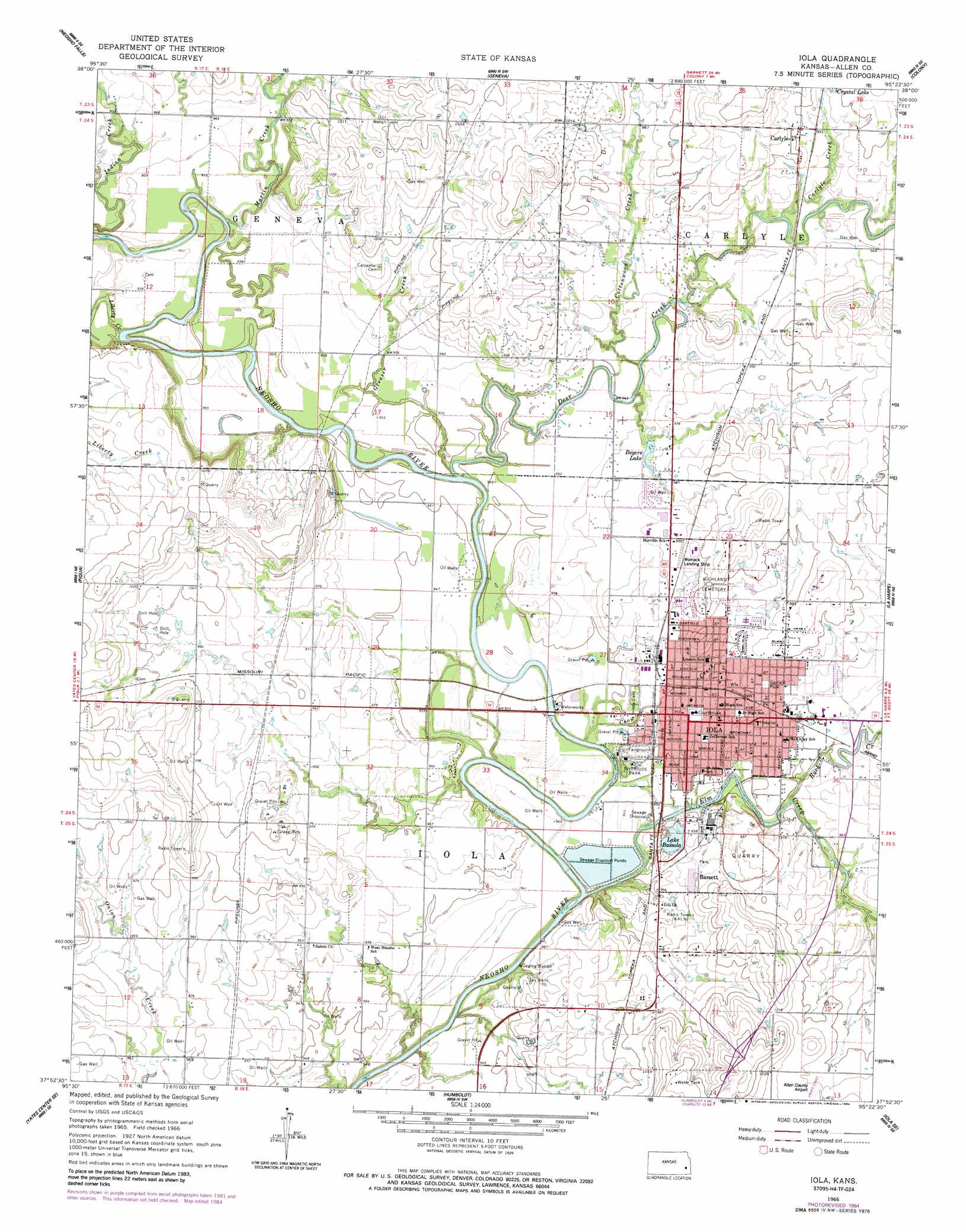
Iola Topo Map Kansas
To zoom in, hover over the map of Iola
USGS Topo Quad 37095h4 - 1:24,000 scale
| Topo Map Name: | Iola |
| USGS Topo Quad ID: | 37095h4 |
| Print Size: | ca. 21 1/4" wide x 27" high |
| Southeast Coordinates: | 37.875° N latitude / 95.375° W longitude |
| Map Center Coordinates: | 37.9375° N latitude / 95.4375° W longitude |
| U.S. State: | KS |
| Filename: | o37095h4.jpg |
| Download Map JPG Image: | Iola topo map 1:24,000 scale |
| Map Type: | Topographic |
| Topo Series: | 7.5´ |
| Map Scale: | 1:24,000 |
| Source of Map Images: | United States Geological Survey (USGS) |
| Alternate Map Versions: |
Iola KS 1966, updated 1967 Download PDF Buy paper map Iola KS 1966, updated 1984 Download PDF Buy paper map Iola KS 2009 Download PDF Buy paper map Iola KS 2012 Download PDF Buy paper map Iola KS 2015 Download PDF Buy paper map |
1:24,000 Topo Quads surrounding Iola
Burlington |
Aliceville |
Westphalia |
Welda |
Bush City |
Le Roy |
Neosho Falls |
Geneva |
Colony |
Kincaid |
Yates Center |
Piqua |
Iola |
La Harpe |
Moran |
Rose |
Yates Center Se |
Humboldt |
Iola Se |
Elsmore |
Buffalo |
Vilas |
Chanute |
Rollin |
Stark |
> Back to 37095e1 at 1:100,000 scale
> Back to 37094a1 at 1:250,000 scale
> Back to U.S. Topo Maps home
Iola topo map: Gazetteer
Iola: Airports
Allen County Airport elevation 314m 1030′Allen County Hospital Airport elevation 292m 958′
Womack Airport elevation 300m 984′
Iola: Dams
Lake Bassola Dam elevation 290m 951′Iola: Lakes
Boyers Lake elevation 294m 964′Iola: Parks
Garfield Park elevation 300m 984′Riverside Park elevation 287m 941′
Iola: Populated Places
Bassett elevation 299m 980′Carlyle elevation 305m 1000′
Iola elevation 296m 971′
Iola: Post Offices
Iola Post Office elevation 293m 961′Iola: Reservoirs
Lake Bassola elevation 290m 951′Iola: Streams
Carlyle Creek elevation 293m 961′Coon Creek elevation 283m 928′
Cottonwood Creek elevation 290m 951′
Deer Creek elevation 286m 938′
Elm Creek elevation 279m 915′
Greaser Creek elevation 286m 938′
Liberty Creek elevation 286m 938′
Martin Creek elevation 288m 944′
Rock Creek elevation 286m 938′
Iola digital topo map on disk
Buy this Iola topo map showing relief, roads, GPS coordinates and other geographical features, as a high-resolution digital map file on DVD: