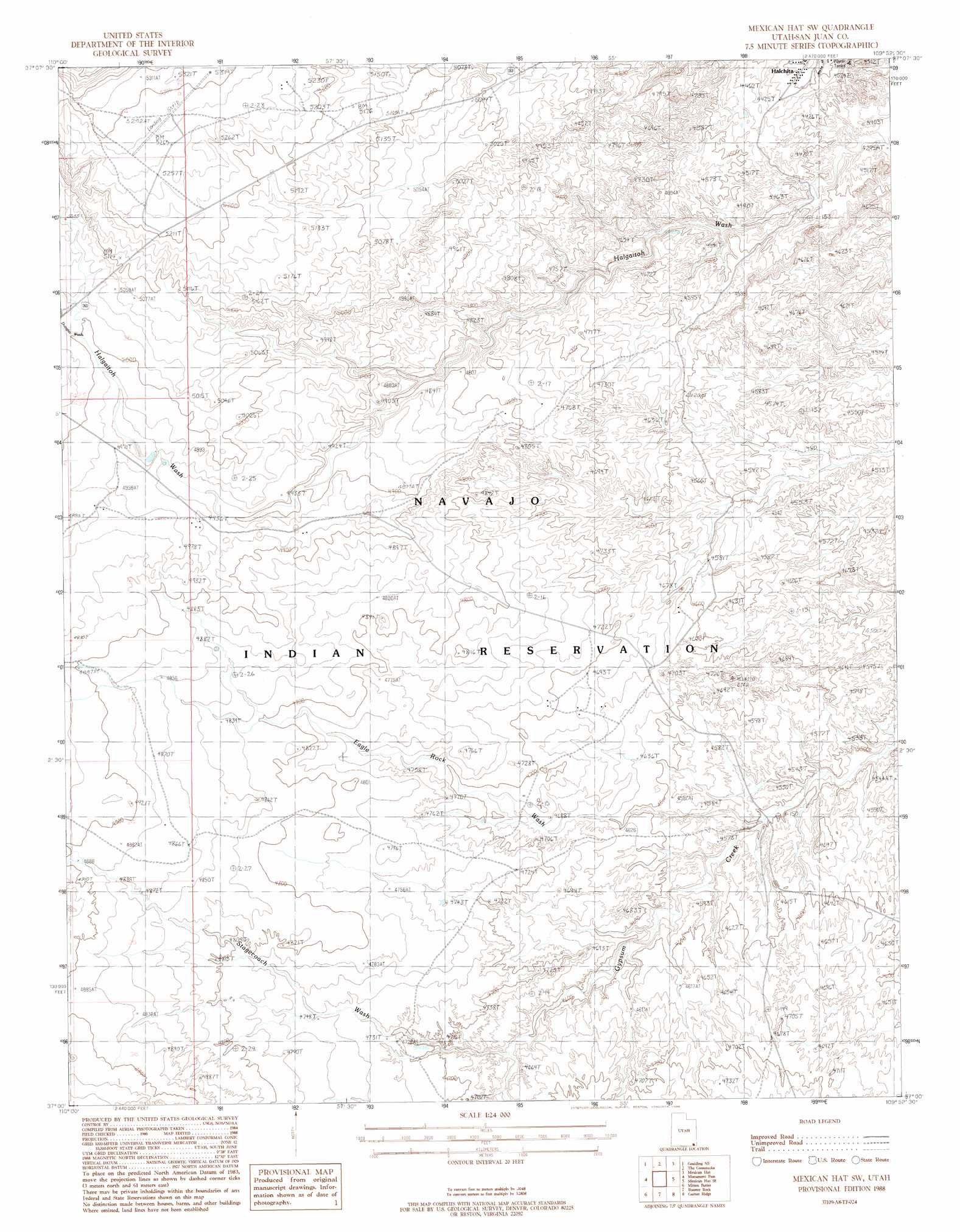
Mexican Hat Sw Topo Map Utah
To zoom in, hover over the map of Mexican Hat Sw
USGS Topo Quad 37109a8 - 1:24,000 scale
| Topo Map Name: | Mexican Hat Sw |
| USGS Topo Quad ID: | 37109a8 |
| Print Size: | ca. 21 1/4" wide x 27" high |
| Southeast Coordinates: | 37° N latitude / 109.875° W longitude |
| Map Center Coordinates: | 37.0625° N latitude / 109.9375° W longitude |
| U.S. State: | UT |
| Filename: | o37109a8.jpg |
| Download Map JPG Image: | Mexican Hat Sw topo map 1:24,000 scale |
| Map Type: | Topographic |
| Topo Series: | 7.5´ |
| Map Scale: | 1:24,000 |
| Source of Map Images: | United States Geological Survey (USGS) |
| Alternate Map Versions: |
Bluff 3 SW UT 1952, updated 1954 Download PDF Buy paper map Mexican Hat SW UT 1988, updated 1988 Download PDF Buy paper map Mexican Hat SW UT 2011 Download PDF Buy paper map Mexican Hat SW UT 2014 Download PDF Buy paper map |
1:24,000 Topo Quads surrounding Mexican Hat Sw
Slickhorn Canyon West |
Slickhorn Canyon East |
Cedar Mesa South |
Cigarette Spring Cave |
Bluff Sw |
Goulding Nw |
Goulding Ne |
The Goosenecks |
Mexican Hat |
San Juan Hill |
Goulding |
Monument Pass |
Mexican Hat Sw |
Mexican Hat Se |
Moses Rock |
Mystery Valley |
Mitten Buttes |
Rooster Rock |
Garnet Ridge |
Mexican Water |
Agathla Peak |
Baby Rocks |
Red Point |
Dennehotso |
Mexican Water Sw |
> Back to 37109a1 at 1:100,000 scale
> Back to 37108a1 at 1:250,000 scale
> Back to U.S. Topo Maps home
Mexican Hat Sw topo map: Gazetteer
Mexican Hat Sw: Airports
A Z Minerals Corporation Airport elevation 1615m 5298′Mexican Hat Sw: Springs
Halgaitoh Spring elevation 1513m 4963′Mexican Hat Sw: Valleys
Douglas Wash elevation 1524m 5000′Eagle Rock Wash elevation 1371m 4498′
Stagecoach Wash elevation 1408m 4619′
Mexican Hat Sw digital topo map on disk
Buy this Mexican Hat Sw topo map showing relief, roads, GPS coordinates and other geographical features, as a high-resolution digital map file on DVD: