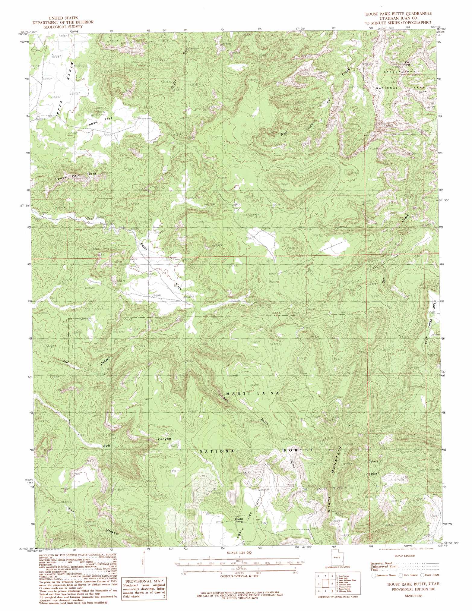
House Park Butte Topo Map Utah
To zoom in, hover over the map of House Park Butte
USGS Topo Quad 37109h7 - 1:24,000 scale
| Topo Map Name: | House Park Butte |
| USGS Topo Quad ID: | 37109h7 |
| Print Size: | ca. 21 1/4" wide x 27" high |
| Southeast Coordinates: | 37.875° N latitude / 109.75° W longitude |
| Map Center Coordinates: | 37.9375° N latitude / 109.8125° W longitude |
| U.S. State: | UT |
| Filename: | o37109h7.jpg |
| Download Map JPG Image: | House Park Butte topo map 1:24,000 scale |
| Map Type: | Topographic |
| Topo Series: | 7.5´ |
| Map Scale: | 1:24,000 |
| Source of Map Images: | United States Geological Survey (USGS) |
| Alternate Map Versions: |
Elk Ridge 2 NE UT 1954 Download PDF Buy paper map House Park Butte UT 1985, updated 1985 Download PDF Buy paper map House Park Butte UT 2001, updated 2004 Download PDF Buy paper map House Park Butte UT 2011 Download PDF Buy paper map House Park Butte UT 2014 Download PDF Buy paper map |
| FStopo: | US Forest Service topo House Park Butte is available: Download FStopo PDF Download FStopo TIF |
1:24,000 Topo Quads surrounding House Park Butte
Elaterite Basin |
Spanish Bottom |
The Loop |
North Six-Shooter Peak |
Harts Point North |
Teapot Rock |
Cross Canyon |
Druid Arch |
South Six-Shooter Peak |
Harts Point South |
Bowdie Canyon East |
Fable Valley |
House Park Butte |
Cathedral Butte |
Shay Mountain |
Black Steer Canyon |
Warren Canyon |
Poison Canyon |
Chippean Rocks |
Mount Linnaeus |
The Cheesebox |
Woodenshoe Buttes |
Kigalia Point |
Cream Pots |
Mancos Jim Butte |
> Back to 37109e1 at 1:100,000 scale
> Back to 37108a1 at 1:250,000 scale
> Back to U.S. Topo Maps home
House Park Butte topo map: Gazetteer
House Park Butte: Arches
Kirk Arch elevation 1940m 6364′House Park Butte: Flats
Middle Park elevation 1995m 6545′House Park Butte: Springs
Crystal Spring elevation 2619m 8592′House Park Butte: Summits
House Park elevation 2040m 6692′House Park Butte elevation 2211m 7253′
House Park Butte: Trails
Bright Angel Trail elevation 1986m 6515′House Park Butte: Valleys
Bull Canyon elevation 1984m 6509′House Park Butte digital topo map on disk
Buy this House Park Butte topo map showing relief, roads, GPS coordinates and other geographical features, as a high-resolution digital map file on DVD: