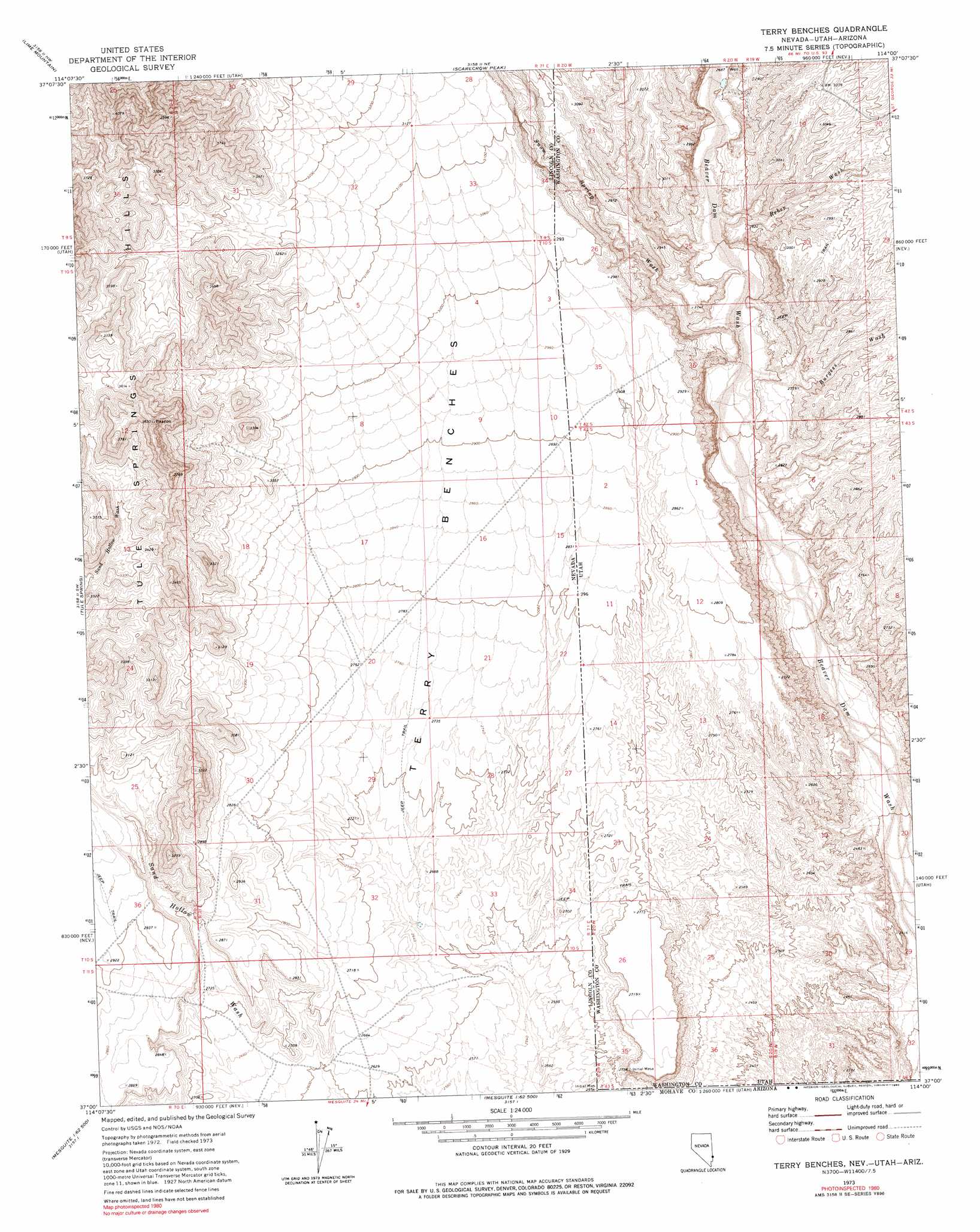
Terry Benches Topo Map Nevada
To zoom in, hover over the map of Terry Benches
USGS Topo Quad 37114a1 - 1:24,000 scale
| Topo Map Name: | Terry Benches |
| USGS Topo Quad ID: | 37114a1 |
| Print Size: | ca. 21 1/4" wide x 27" high |
| Southeast Coordinates: | 37° N latitude / 114° W longitude |
| Map Center Coordinates: | 37.0625° N latitude / 114.0625° W longitude |
| U.S. States: | NV, AZ, UT |
| Filename: | o37114a1.jpg |
| Download Map JPG Image: | Terry Benches topo map 1:24,000 scale |
| Map Type: | Topographic |
| Topo Series: | 7.5´ |
| Map Scale: | 1:24,000 |
| Source of Map Images: | United States Geological Survey (USGS) |
| Alternate Map Versions: |
Terry Benches NV 1973, updated 1976 Download PDF Buy paper map Terry Benches NV 1973, updated 1980 Download PDF Buy paper map Terry Benches NV 2011 Download PDF Buy paper map Terry Benches NV 2012 Download PDF Buy paper map Terry Benches NV 2014 Download PDF Buy paper map |
1:24,000 Topo Quads surrounding Terry Benches
Garden Spring |
Jacks Mountain |
Dodge Spring |
Motoqua |
Gunlock |
Blue Nose Peak |
Lime Mountain |
Scarecrow Peak |
West Mountain Peak |
Shivwits |
Toquop Gap |
Tule Spring |
Terry Benches |
Castle Cliff |
Jarvis Peak |
Davidson Peak |
Mesquite Nw |
Mesquite Ne |
Littlefield |
Mountain Sheep Spring |
Moapa Peak Se |
Flat Top Mesa |
Mesquite |
Elbow Canyon |
Mount Bangs |
> Back to 37114a1 at 1:100,000 scale
> Back to 37114a1 at 1:250,000 scale
> Back to U.S. Topo Maps home
Terry Benches topo map: Gazetteer
Terry Benches: Benches
Terry Benches elevation 858m 2814′Terry Benches: Streams
Snow Spring Wash elevation 781m 2562′Terry Benches: Valleys
Burgess Wash elevation 775m 2542′Reber Wash elevation 805m 2641′
Snow Spring Wash elevation 782m 2565′
Terry Benches digital topo map on disk
Buy this Terry Benches topo map showing relief, roads, GPS coordinates and other geographical features, as a high-resolution digital map file on DVD: