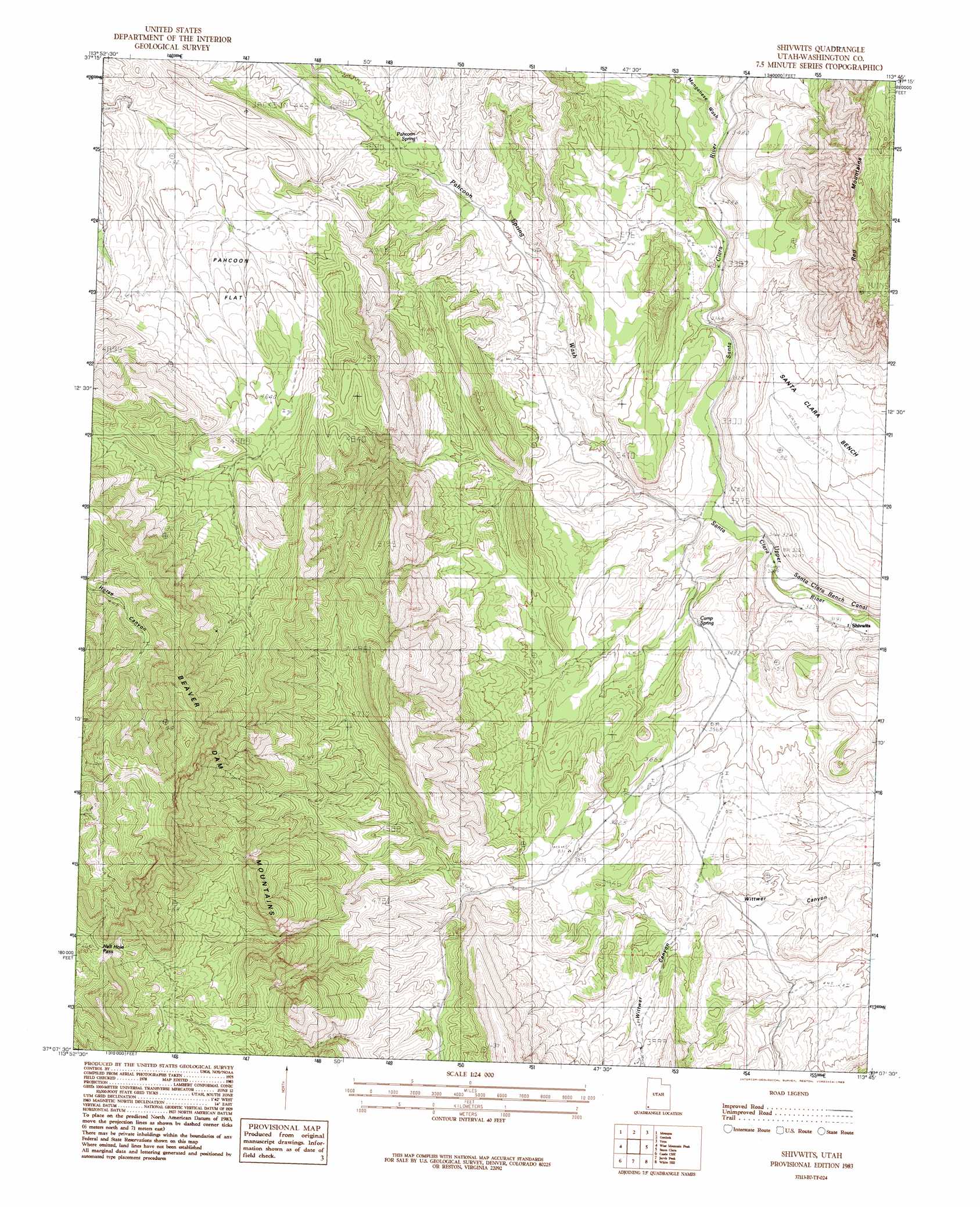
Shivwits Topo Map Utah
To zoom in, hover over the map of Shivwits
USGS Topo Quad 37113b7 - 1:24,000 scale
| Topo Map Name: | Shivwits |
| USGS Topo Quad ID: | 37113b7 |
| Print Size: | ca. 21 1/4" wide x 27" high |
| Southeast Coordinates: | 37.125° N latitude / 113.75° W longitude |
| Map Center Coordinates: | 37.1875° N latitude / 113.8125° W longitude |
| U.S. State: | UT |
| Filename: | o37113b7.jpg |
| Download Map JPG Image: | Shivwits topo map 1:24,000 scale |
| Map Type: | Topographic |
| Topo Series: | 7.5´ |
| Map Scale: | 1:24,000 |
| Source of Map Images: | United States Geological Survey (USGS) |
| Alternate Map Versions: |
Beaver Dam Mts NE UT 1954 Download PDF Buy paper map Beaver Dam Mts NE UT 1954, updated 1956 Download PDF Buy paper map Shivwits UT 1983, updated 1983 Download PDF Buy paper map Shivwits UT 2011 Download PDF Buy paper map Shivwits UT 2014 Download PDF Buy paper map |
1:24,000 Topo Quads surrounding Shivwits
Docs Pass |
Goldstrike |
Maple Ridge |
Central West |
Central East |
Dodge Spring |
Motoqua |
Gunlock |
Veyo |
Saddle Mountain |
Scarecrow Peak |
West Mountain Peak |
Shivwits |
Santa Clara |
Washington |
Terry Benches |
Castle Cliff |
Jarvis Peak |
White Hills |
Saint George |
Mesquite Ne |
Littlefield |
Mountain Sheep Spring |
Purgatory Canyon |
Lizard Point |
> Back to 37113a1 at 1:100,000 scale
> Back to 37112a1 at 1:250,000 scale
> Back to U.S. Topo Maps home
Shivwits topo map: Gazetteer
Shivwits: Dams
Gunlock Dam elevation 1122m 3681′Shivwits: Flats
Pahcoon Flat elevation 1336m 4383′Shivwits: Populated Places
Shem elevation 988m 3241′Shivwits elevation 976m 3202′
Shivwits: Reservoirs
Gunlock Reservoir elevation 1122m 3681′Shivwits: Springs
Camp Spring elevation 1051m 3448′Pahcoon Spring elevation 1154m 3786′
Shivwits: Valleys
Manganese Wash elevation 1058m 3471′Pahcoon Spring Wash elevation 998m 3274′
Shivwits digital topo map on disk
Buy this Shivwits topo map showing relief, roads, GPS coordinates and other geographical features, as a high-resolution digital map file on DVD: