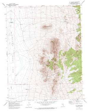
Ely Springs Topo Map Nevada
To zoom in, hover over the map of Ely Springs
USGS Topo Quad 37114h6 - 1:24,000 scale
| Topo Map Name: | Ely Springs |
| USGS Topo Quad ID: | 37114h6 |
| Print Size: | ca. 21 1/4" wide x 27" high |
| Southeast Coordinates: | 37.875° N latitude / 114.625° W longitude |
| Map Center Coordinates: | 37.9375° N latitude / 114.6875° W longitude |
| U.S. State: | NV |
| Filename: | o37114h6.jpg |
| Download Map JPG Image: | Ely Springs topo map 1:24,000 scale |
| Map Type: | Topographic |
| Topo Series: | 7.5´ |
| Map Scale: | 1:24,000 |
| Source of Map Images: | United States Geological Survey (USGS) |
| Alternate Map Versions: |
Ely Springs NV 1970, updated 1973 Download PDF Buy paper map Ely Springs NV 2012 Download PDF Buy paper map Ely Springs NV 2014 Download PDF Buy paper map |
1:24,000 Topo Quads surrounding Ely Springs
> Back to 37114e1 at 1:100,000 scale
> Back to 37114a1 at 1:250,000 scale
> Back to U.S. Topo Maps home
Ely Springs topo map: Gazetteer
Ely Springs: Mines
El Rey Mine elevation 1895m 6217′King Midas Mine elevation 1676m 5498′
Mathews Mine elevation 1911m 6269′
Ely Springs: Ranges
Ely Springs Range elevation 2047m 6715′Ely Springs: Reservoirs
Bullfrog Reservoir elevation 1455m 4773′Thorley Reservoir elevation 1449m 4753′
Ely Springs: Springs
Bullfrog Spring elevation 1708m 5603′Delmues Spring elevation 1809m 5935′
Ely Springs elevation 1662m 5452′
Iron Tank Spring elevation 1855m 6085′
Reindeer Spring elevation 1756m 5761′
Simpson Spring elevation 1895m 6217′
Smith Spring elevation 1775m 5823′
Tex Spring elevation 1701m 5580′
Ely Springs: Summits
Black Rock Knoll elevation 1758m 5767′Tank Hill elevation 1933m 6341′
Yellow Hill elevation 1833m 6013′
Ely Springs: Valleys
Ely Springs Canyon elevation 1550m 5085′Swiss Bob Canyon elevation 1554m 5098′
Ely Springs: Wells
Swiss Bob Well elevation 1724m 5656′Ely Springs digital topo map on disk
Buy this Ely Springs topo map showing relief, roads, GPS coordinates and other geographical features, as a high-resolution digital map file on DVD:


