Tempiute Mountain South Topo Map Nevada
To zoom in, hover over the map of Tempiute Mountain South
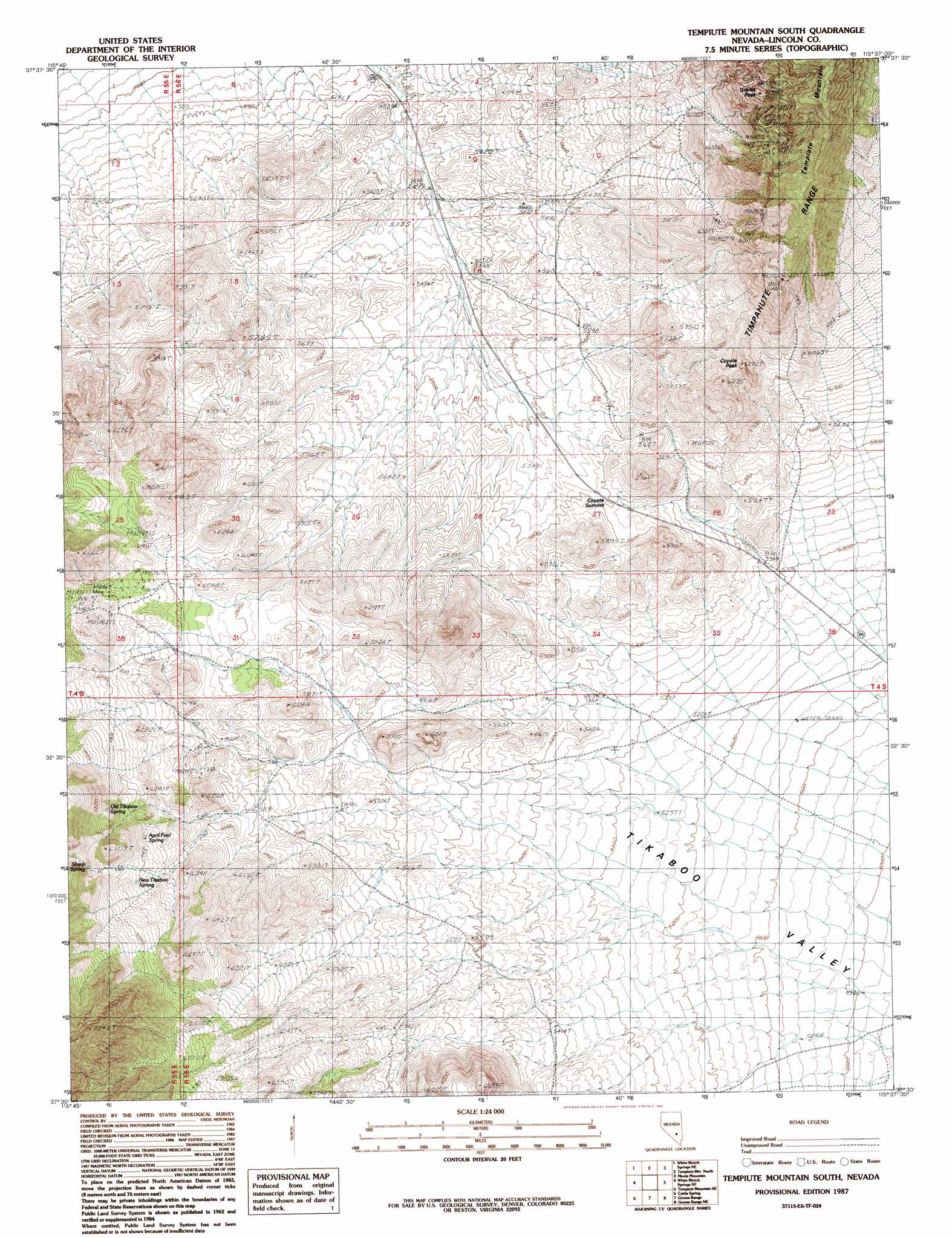
USGS Topo Quad 37115e6 - 1:24,000 scale
| Topo Map Name: | Tempiute Mountain South |
| USGS Topo Quad ID: | 37115e6 |
| Print Size: | ca. 21 1/4" wide x 27" high |
| Southeast Coordinates: | 37.5° N latitude / 115.625° W longitude |
| Map Center Coordinates: | 37.5625° N latitude / 115.6875° W longitude |
| U.S. State: | NV |
| Filename: | o37115e6.jpg |
| Download Map JPG Image: | Tempiute Mountain South topo map 1:24,000 scale |
| Map Type: | Topographic |
| Topo Series: | 7.5´ |
| Map Scale: | 1:24,000 |
| Source of Map Images: | United States Geological Survey (USGS) |
| Alternate Map Versions: |
Tempiute Mountain South NV 1987, updated 1987 Download PDF Buy paper map Tempiute Mountain South NV 2012 Download PDF Buy paper map Tempiute Mountain South NV 2015 Download PDF Buy paper map |
1:24,000 Topo Quads surrounding Tempiute Mountain South
Black Top |
Honest John Well |
Worthington Peak Sw |
Meeker Peak |
Murphy Gap |
White Blotch Springs Nw |
White Blotch Springs Ne |
Timpiute Mountain North |
Monte Mountain |
Mount Irish |
White Blotch Springs |
White Blotch Springs Se |
Tempiute Mountain South |
Tempiute Mountain Se |
Crescent Spring |
Groom Mine Nw |
Cattle Spring |
Groom Range |
Groom Range Ne |
Crescent Reservoir |
Groom Mine Sw |
Groom Mine |
Groom Range Sw |
Groom Range Se |
Cutler Reservoir |
> Back to 37115e1 at 1:100,000 scale
> Back to 37114a1 at 1:250,000 scale
> Back to U.S. Topo Maps home
Tempiute Mountain South topo map: Gazetteer
Tempiute Mountain South: Mines
Andies Mine elevation 1903m 6243′Don Dale Mine elevation 1928m 6325′
Old Tem Piute Mine elevation 2015m 6610′
Tempiute Mountain South: Reservoirs
Charco Pit Reservoir elevation 1720m 5643′Tempiute Mountain South: Springs
April Fool Spring elevation 1888m 6194′New Tikaboo Spring elevation 1923m 6309′
Old Tikaboo Spring elevation 1989m 6525′
Sharp Spring elevation 2006m 6581′
Tempiute Mountain South: Summits
Coyote Peak elevation 1882m 6174′Coyote Summit elevation 1708m 5603′
Grants Peak elevation 2134m 7001′
Tempiute Mountain elevation 2361m 7746′
Tempiute Mountain South: Valleys
Wildcat Canyon elevation 1719m 5639′Tempiute Mountain South digital topo map on disk
Buy this Tempiute Mountain South topo map showing relief, roads, GPS coordinates and other geographical features, as a high-resolution digital map file on DVD: