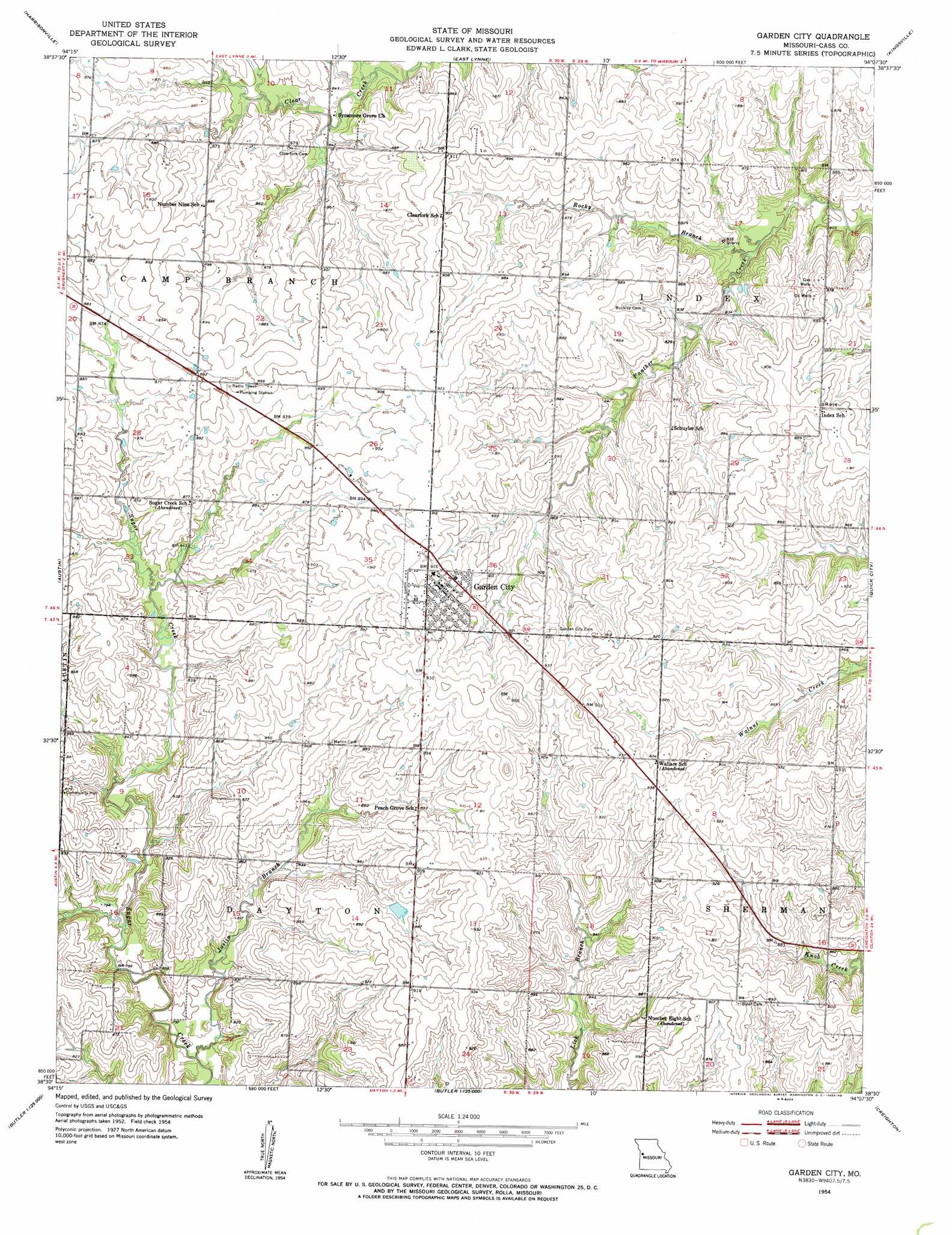
Garden City Topo Map Missouri
To zoom in, hover over the map of Garden City
USGS Topo Quad 38094e2 - 1:24,000 scale
| Topo Map Name: | Garden City |
| USGS Topo Quad ID: | 38094e2 |
| Print Size: | ca. 21 1/4" wide x 27" high |
| Southeast Coordinates: | 38.5° N latitude / 94.125° W longitude |
| Map Center Coordinates: | 38.5625° N latitude / 94.1875° W longitude |
| U.S. State: | MO |
| Filename: | o38094e2.jpg |
| Download Map JPG Image: | Garden City topo map 1:24,000 scale |
| Map Type: | Topographic |
| Topo Series: | 7.5´ |
| Map Scale: | 1:24,000 |
| Source of Map Images: | United States Geological Survey (USGS) |
| Alternate Map Versions: |
Garden City MO 1954, updated 1955 Download PDF Buy paper map Garden City MO 2011 Download PDF Buy paper map Garden City MO 2014 Download PDF Buy paper map |
1:24,000 Topo Quads surrounding Garden City
Raymore |
Pleasant Hill |
Strasburg |
Elm |
Pittsville |
Peculiar |
Harrisonville |
East Lynne |
Kingsville |
Holden |
Everett |
Austin |
Garden City |
Quick City |
Blairstown |
Main City |
Adrian |
Dayton |
Creighton |
Hartwell |
Virginia |
Butler |
Spruce |
Johnstown |
Montrose |
> Back to 38094e1 at 1:100,000 scale
> Back to 38094a1 at 1:250,000 scale
> Back to U.S. Topo Maps home
Garden City topo map: Gazetteer
Garden City: Airports
Breed Ranch Airport elevation 286m 938′Garden City: Dams
Garden City Lake Dam elevation 272m 892′Ivy Wall Lake Dam elevation 268m 879′
Schrock Lake Dam elevation 257m 843′
Garden City: Populated Places
Garden City elevation 282m 925′Rockford (historical) elevation 256m 839′
Garden City: Reservoirs
Garden City Lake elevation 272m 892′Schrock Lake elevation 257m 843′
Garden City: Streams
Joslin Branch elevation 240m 787′Rocky Branch elevation 243m 797′
Garden City digital topo map on disk
Buy this Garden City topo map showing relief, roads, GPS coordinates and other geographical features, as a high-resolution digital map file on DVD: