Lindsborg Topo Map Kansas
To zoom in, hover over the map of Lindsborg
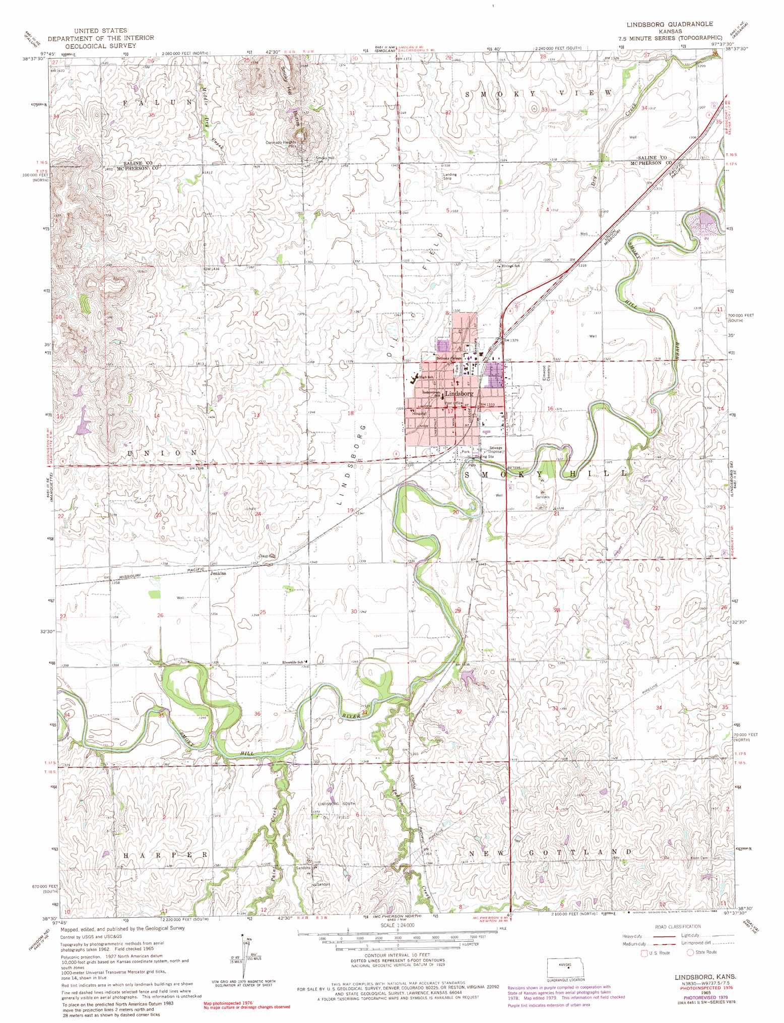
USGS Topo Quad 38097e6 - 1:24,000 scale
| Topo Map Name: | Lindsborg |
| USGS Topo Quad ID: | 38097e6 |
| Print Size: | ca. 21 1/4" wide x 27" high |
| Southeast Coordinates: | 38.5° N latitude / 97.625° W longitude |
| Map Center Coordinates: | 38.5625° N latitude / 97.6875° W longitude |
| U.S. State: | KS |
| Filename: | o38097e6.jpg |
| Download Map JPG Image: | Lindsborg topo map 1:24,000 scale |
| Map Type: | Topographic |
| Topo Series: | 7.5´ |
| Map Scale: | 1:24,000 |
| Source of Map Images: | United States Geological Survey (USGS) |
| Alternate Map Versions: |
Lindsborg KS 1965, updated 1966 Download PDF Buy paper map Lindsborg KS 1965, updated 1980 Download PDF Buy paper map Lindsborg KS 1965, updated 1983 Download PDF Buy paper map Lindsborg KS 2010 Download PDF Buy paper map Lindsborg KS 2012 Download PDF Buy paper map Lindsborg KS 2015 Download PDF Buy paper map |
1:24,000 Topo Quads surrounding Lindsborg
Brookville Sw |
Brookville |
Salina Sw |
Salina |
Kipp |
Venango |
Falun |
Smolan |
Assaria |
Gypsum |
Langley |
Marquette |
Lindsborg |
Lindsborg Se |
Roxbury |
Windom |
Windom Ne |
Mcpherson North |
Galva |
Canton |
Windom Sw |
Conway |
Mcpherson South |
Mcpherson Se |
Canton Sw |
> Back to 38097e1 at 1:100,000 scale
> Back to 38096a1 at 1:250,000 scale
> Back to U.S. Topo Maps home
Lindsborg topo map: Gazetteer
Lindsborg: Oilfields
Lindsborg Oil Field elevation 406m 1332′Lindsborg South Oil Field elevation 416m 1364′
Lindsborg: Parks
Coronado Heights Park elevation 466m 1528′Lindsborg: Populated Places
Jenkins elevation 415m 1361′Lindsborg elevation 406m 1332′
Lindsborg: Post Offices
Lindsborg Post Office elevation 406m 1332′Lindsborg: Streams
Indian Creek elevation 401m 1315′Paint Creek elevation 404m 1325′
Lindsborg digital topo map on disk
Buy this Lindsborg topo map showing relief, roads, GPS coordinates and other geographical features, as a high-resolution digital map file on DVD: