Trenton Topo Map Kansas
To zoom in, hover over the map of Trenton
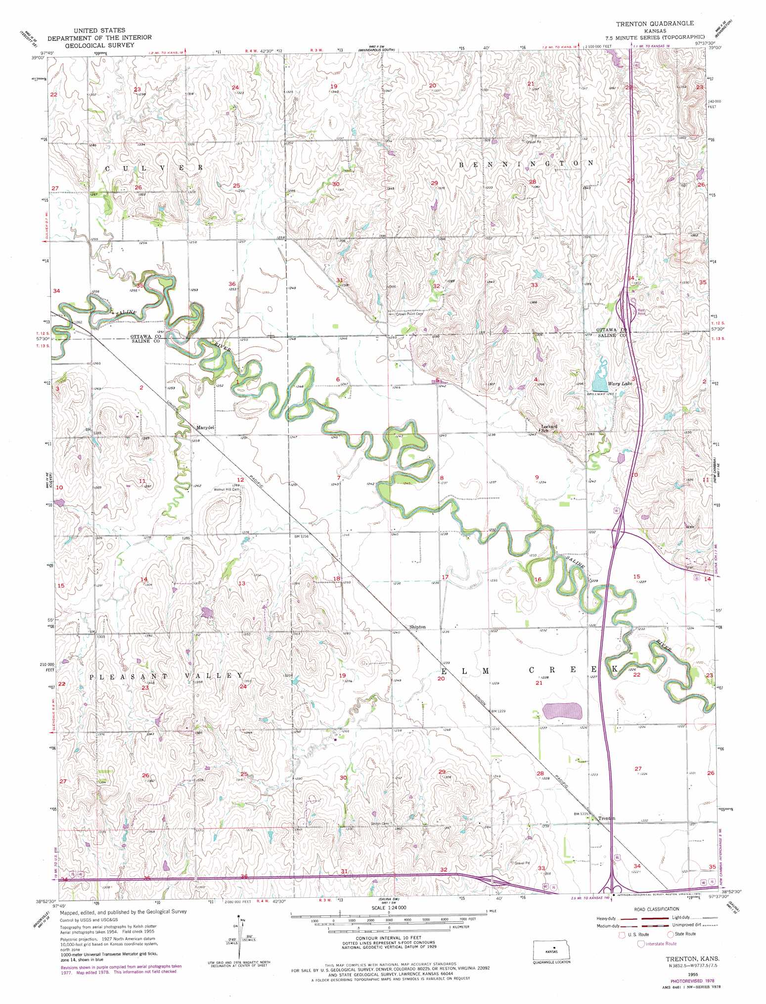
USGS Topo Quad 38097h6 - 1:24,000 scale
| Topo Map Name: | Trenton |
| USGS Topo Quad ID: | 38097h6 |
| Print Size: | ca. 21 1/4" wide x 27" high |
| Southeast Coordinates: | 38.875° N latitude / 97.625° W longitude |
| Map Center Coordinates: | 38.9375° N latitude / 97.6875° W longitude |
| U.S. State: | KS |
| Filename: | o38097h6.jpg |
| Download Map JPG Image: | Trenton topo map 1:24,000 scale |
| Map Type: | Topographic |
| Topo Series: | 7.5´ |
| Map Scale: | 1:24,000 |
| Source of Map Images: | United States Geological Survey (USGS) |
| Alternate Map Versions: |
Trenton KS 1955, updated 1956 Download PDF Buy paper map Trenton KS 1955, updated 1978 Download PDF Buy paper map Trenton KS 2009 Download PDF Buy paper map Trenton KS 2012 Download PDF Buy paper map Trenton KS 2015 Download PDF Buy paper map |
1:24,000 Topo Quads surrounding Trenton
Ada |
Tescott Ne |
Minneapolis North |
Wells |
Manchester Nw |
Tescott |
Tescott Se |
Minneapolis South |
Bennington |
Vine Creek |
Juniata |
Culver |
Trenton |
New Cambria |
Niles |
Brookville Sw |
Brookville |
Salina Sw |
Salina |
Kipp |
Venango |
Falun |
Smolan |
Assaria |
Gypsum |
> Back to 38097e1 at 1:100,000 scale
> Back to 38096a1 at 1:250,000 scale
> Back to U.S. Topo Maps home
Trenton topo map: Gazetteer
Trenton: Dams
Saline County State Lake Dam elevation 374m 1227′Trenton: Populated Places
Marydel elevation 384m 1259′Shipton elevation 378m 1240′
Trenton elevation 373m 1223′
Trenton: Reservoirs
Saline County State Lake elevation 374m 1227′Wary Lake elevation 385m 1263′
Trenton digital topo map on disk
Buy this Trenton topo map showing relief, roads, GPS coordinates and other geographical features, as a high-resolution digital map file on DVD: