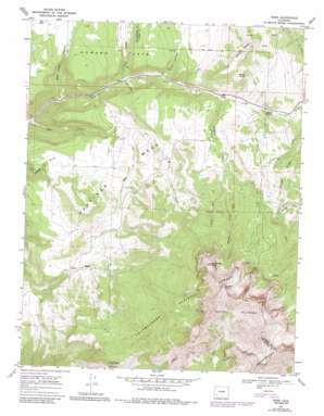
Sams Topo Map Colorado
To zoom in, hover over the map of Sams
USGS Topo Quad 38107a8 - 1:24,000 scale
| Topo Map Name: | Sams |
| USGS Topo Quad ID: | 38107a8 |
| Print Size: | ca. 21 1/4" wide x 27" high |
| Southeast Coordinates: | 38° N latitude / 107.875° W longitude |
| Map Center Coordinates: | 38.0625° N latitude / 107.9375° W longitude |
| U.S. State: | CO |
| Filename: | o38107a8.jpg |
| Download Map JPG Image: | Sams topo map 1:24,000 scale |
| Map Type: | Topographic |
| Topo Series: | 7.5´ |
| Map Scale: | 1:24,000 |
| Source of Map Images: | United States Geological Survey (USGS) |
| Alternate Map Versions: |
Sams CO 1967, updated 1971 Download PDF Buy paper map Sams CO 1967, updated 1971 Download PDF Buy paper map Sams CO 1967, updated 1975 Download PDF Buy paper map Sams CO 1967, updated 1984 Download PDF Buy paper map Sams CO 2011 Download PDF Buy paper map Sams CO 2013 Download PDF Buy paper map Sams CO 2016 Download PDF Buy paper map |
| FStopo: | US Forest Service topo Sams is available: Download FStopo PDF Download FStopo TIF |
1:24,000 Topo Quads surrounding Sams
> Back to 38107a1 at 1:100,000 scale
> Back to 38106a1 at 1:250,000 scale
> Back to U.S. Topo Maps home
Sams topo map: Gazetteer
Sams: Airports
Wilson Ranch Airport elevation 2745m 9005′Sams: Flats
Howard Flats elevation 2669m 8756′Sams: Gaps
Dallas Divide elevation 2738m 8982′Sams: Mines
A1 Mine elevation 2745m 9005′Bear Creek Mine elevation 2724m 8937′
Yellow Medicine Mine elevation 2879m 9445′
Sams: Populated Places
Noel elevation 2681m 8795′Sams: Ridges
Spruce Ridge elevation 2975m 9760′Sams: Springs
Moston Spring elevation 2767m 9078′Sams: Streams
East Fork Leopard Creek elevation 2787m 9143′Hay Creek elevation 2439m 8001′
Middle Fork Leopard Creek elevation 2836m 9304′
West Fork Leopard Creek elevation 2834m 9297′
Willow Creek elevation 2663m 8736′
Sams: Summits
Hastings Mesa elevation 2932m 9619′Hayden Peak elevation 3946m 12946′
Last Dollar Mountain elevation 3391m 11125′
North Pole Peak elevation 3694m 12119′
Ruffner Mountain elevation 3947m 12949′
West Baldy elevation 2981m 9780′
Sams: Trails
Alder Creek Trail elevation 3241m 10633′Sams: Valleys
Buck Canyon elevation 2572m 8438′Dead Horse Canyon elevation 2474m 8116′
Price Canyon elevation 2628m 8622′
Sams digital topo map on disk
Buy this Sams topo map showing relief, roads, GPS coordinates and other geographical features, as a high-resolution digital map file on DVD:


