The Frying Pan Topo Map Utah
To zoom in, hover over the map of The Frying Pan
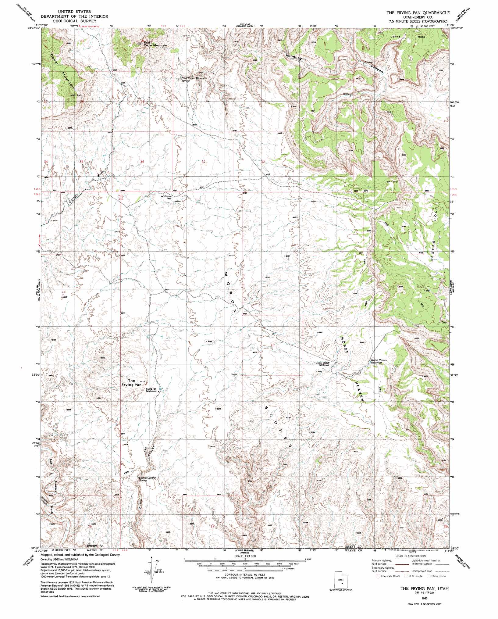
USGS Topo Quad 38111e1 - 1:24,000 scale
| Topo Map Name: | The Frying Pan |
| USGS Topo Quad ID: | 38111e1 |
| Print Size: | ca. 21 1/4" wide x 27" high |
| Southeast Coordinates: | 38.5° N latitude / 111° W longitude |
| Map Center Coordinates: | 38.5625° N latitude / 111.0625° W longitude |
| U.S. State: | UT |
| Filename: | o38111e1.jpg |
| Download Map JPG Image: | The Frying Pan topo map 1:24,000 scale |
| Map Type: | Topographic |
| Topo Series: | 7.5´ |
| Map Scale: | 1:24,000 |
| Source of Map Images: | United States Geological Survey (USGS) |
| Alternate Map Versions: |
Emery 4 SE UT 1953, updated 1954 Download PDF Buy paper map The Frying Pan UT 1983, updated 1983 Download PDF Buy paper map The Frying Pan UT 1983, updated 1991 Download PDF Buy paper map The Frying Pan UT 1983, updated 1991 Download PDF Buy paper map The Frying Pan UT 2010 Download PDF Buy paper map The Frying Pan UT 2014 Download PDF Buy paper map |
1:24,000 Topo Quads surrounding The Frying Pan
Walker Flat |
Mesa Butte |
Big Bend Draw |
Copper Globe |
San Rafael Knob |
Willow Springs |
Mussentuchit Flat |
Ireland Mesa |
Tomsich Butte |
Horse Valley |
Solomons Temple |
Salvation Creek |
The Frying Pan |
Hunt Draw |
Little Wild Horse Mesa |
Cathedral Mountain |
Fruita Nw |
Caine Springs |
Factory Butte |
Skyline Rim |
Twin Rocks |
Fruita |
Caineville |
Town Point |
Steamboat Point |
> Back to 38111e1 at 1:100,000 scale
> Back to 38110a1 at 1:250,000 scale
> Back to U.S. Topo Maps home
The Frying Pan topo map: Gazetteer
The Frying Pan: Basins
Frying Pan Catchment elevation 1806m 5925′Johns Hole elevation 1869m 6131′
Moroni Slopes Catchment elevation 1946m 6384′
The Frying Pan: Reservoirs
Horse Heaven Reservoir elevation 1962m 6437′The Frying Pan: Slopes
Moroni Slopes elevation 1879m 6164′The Frying Pan: Springs
Corral Canyon Spring elevation 1743m 5718′East Cedar Mountain Spring elevation 1796m 5892′
The Frying Pan: Streams
Salvation Creek elevation 1571m 5154′The Frying Pan: Summits
Cedar Mountain elevation 2149m 7050′East Cedar Mountain elevation 2148m 7047′
Horse Heaven Summit elevation 1958m 6423′
Table Mountain elevation 1855m 6085′
The Frying Pan elevation 1857m 6092′
The Frying Pan: Valleys
Chimney Canyon elevation 1958m 6423′The Frying Pan: Wells
Last Chance Well elevation 1814m 5951′The Frying Pan digital topo map on disk
Buy this The Frying Pan topo map showing relief, roads, GPS coordinates and other geographical features, as a high-resolution digital map file on DVD: