Sevier Lake Sw Topo Map Utah
To zoom in, hover over the map of Sevier Lake Sw
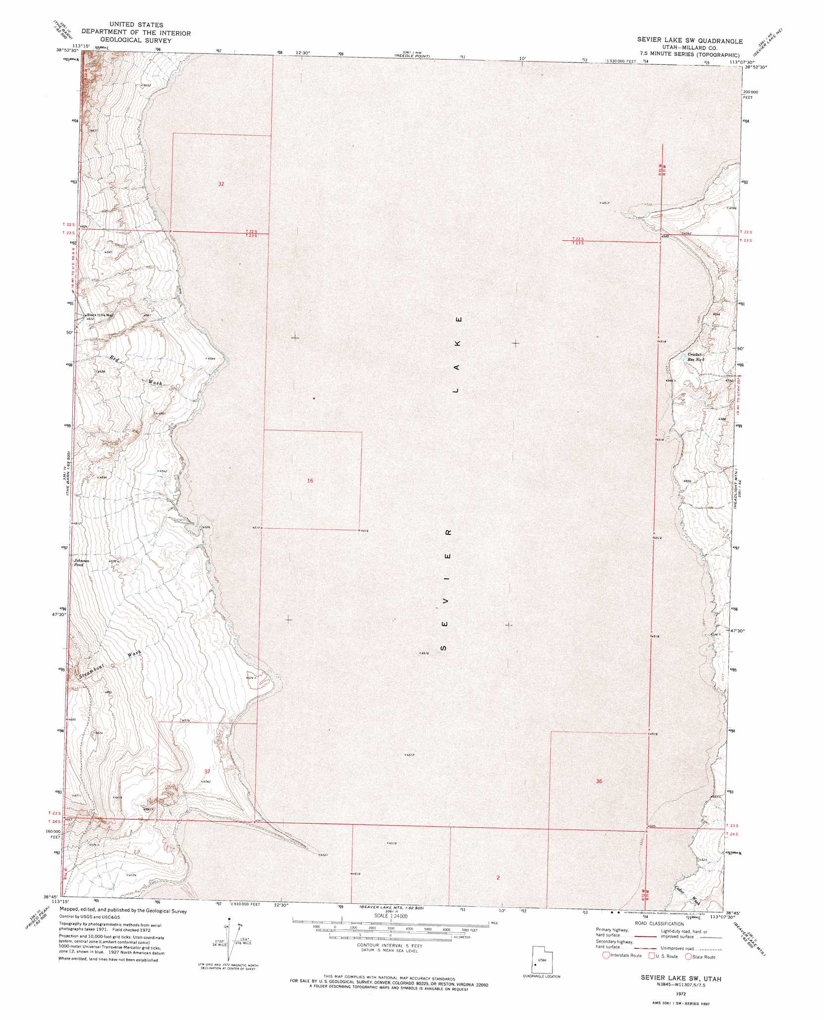
USGS Topo Quad 38113g2 - 1:24,000 scale
| Topo Map Name: | Sevier Lake Sw |
| USGS Topo Quad ID: | 38113g2 |
| Print Size: | ca. 21 1/4" wide x 27" high |
| Southeast Coordinates: | 38.75° N latitude / 113.125° W longitude |
| Map Center Coordinates: | 38.8125° N latitude / 113.1875° W longitude |
| U.S. State: | UT |
| Filename: | o38113g2.jpg |
| Download Map JPG Image: | Sevier Lake Sw topo map 1:24,000 scale |
| Map Type: | Topographic |
| Topo Series: | 7.5´ |
| Map Scale: | 1:24,000 |
| Source of Map Images: | United States Geological Survey (USGS) |
| Alternate Map Versions: |
Sevier Lake SW UT 1972, updated 1974 Download PDF Buy paper map Sevier Lake SW UT 2010 Download PDF Buy paper map Sevier Lake SW UT 2014 Download PDF Buy paper map |
1:24,000 Topo Quads surrounding Sevier Lake Sw
Hell'N Maria Canyon |
Skull Rock Pass |
Long Ridge Sw |
Long Ridge Se |
Red Pass |
The Barn |
Burnout Canyon |
Needle Point |
Sevier Lake Ne |
Candland Spring |
Warm Point |
Red Tops |
Sevier Lake Sw |
Headlight Mountain |
Cat Canyon |
Fifteenmile Point |
Brown Knoll |
Iron Mine Pass |
Red Rock Knoll |
Black Rock |
Wah Wah Cove |
Frisco Peak |
High Rock |
Lime Mountain |
Read |
> Back to 38113e1 at 1:100,000 scale
> Back to 38112a1 at 1:250,000 scale
> Back to U.S. Topo Maps home
Sevier Lake Sw topo map: Gazetteer
Sevier Lake Sw: Arroyos
Red Wash elevation 1380m 4527′Steamboat Wash elevation 1380m 4527′
Sevier Lake Sw: Reservoirs
Cricket Reservoir elevation 1382m 4534′Cricket Reservoir Number 2 elevation 1384m 4540′
Sevier Lake Sw: Valleys
Cedar Wash elevation 1380m 4527′Sevier Lake Sw: Wells
Black Hills Well elevation 1413m 4635′Sevier Lake Sw digital topo map on disk
Buy this Sevier Lake Sw topo map showing relief, roads, GPS coordinates and other geographical features, as a high-resolution digital map file on DVD: