Long Ridge Sw Topo Map Utah
To zoom in, hover over the map of Long Ridge Sw
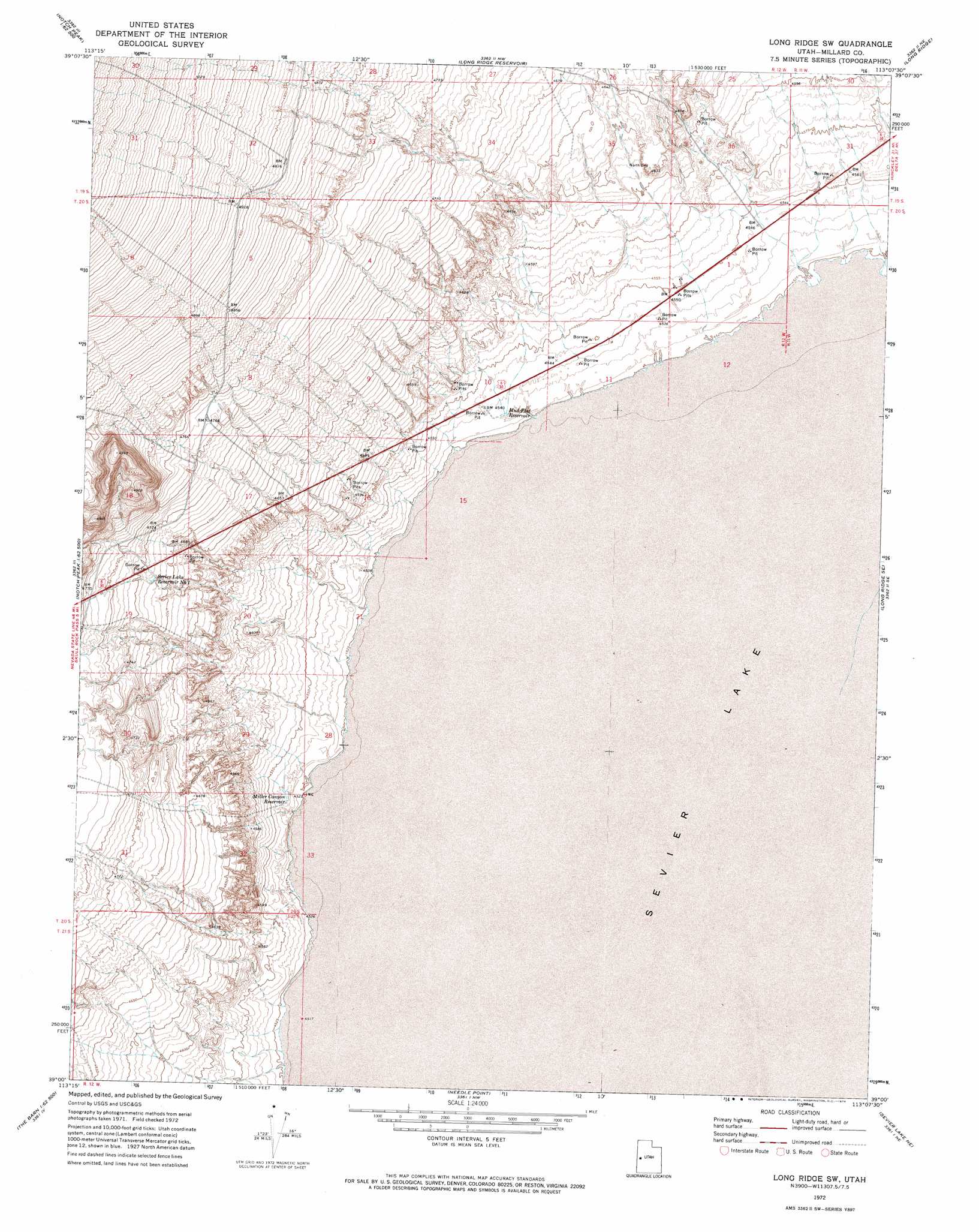
USGS Topo Quad 39113a2 - 1:24,000 scale
| Topo Map Name: | Long Ridge Sw |
| USGS Topo Quad ID: | 39113a2 |
| Print Size: | ca. 21 1/4" wide x 27" high |
| Southeast Coordinates: | 39° N latitude / 113.125° W longitude |
| Map Center Coordinates: | 39.0625° N latitude / 113.1875° W longitude |
| U.S. State: | UT |
| Filename: | o39113a2.jpg |
| Download Map JPG Image: | Long Ridge Sw topo map 1:24,000 scale |
| Map Type: | Topographic |
| Topo Series: | 7.5´ |
| Map Scale: | 1:24,000 |
| Source of Map Images: | United States Geological Survey (USGS) |
| Alternate Map Versions: |
Long Ridge SW UT 1972, updated 1974 Download PDF Buy paper map Long Ridge SW UT 2010 Download PDF Buy paper map Long Ridge SW UT 2014 Download PDF Buy paper map |
1:24,000 Topo Quads surrounding Long Ridge Sw
Swasey Peak Sw |
Marjum Pass |
Whirlwind Valley Sw |
Red Knolls |
Clay Knoll |
Notch Peak |
Miller Cove |
Long Ridge Reservoir |
Long Ridge |
Rocky Knoll |
Hell'N Maria Canyon |
Skull Rock Pass |
Long Ridge Sw |
Long Ridge Se |
Red Pass |
The Barn |
Burnout Canyon |
Needle Point |
Sevier Lake Ne |
Candland Spring |
Warm Point |
Red Tops |
Sevier Lake Sw |
Headlight Mountain |
Cat Canyon |
> Back to 39113a1 at 1:100,000 scale
> Back to 39112a1 at 1:250,000 scale
> Back to U.S. Topo Maps home
Long Ridge Sw topo map: Gazetteer
Long Ridge Sw: Reservoirs
Miller Canyon Reservoir elevation 1385m 4543′Mud Flat Reservoir elevation 1383m 4537′
Sevier Lake Reservoir Number 1 elevation 1438m 4717′
Long Ridge Sw: Streams
Sevier River elevation 1379m 4524′Long Ridge Sw digital topo map on disk
Buy this Long Ridge Sw topo map showing relief, roads, GPS coordinates and other geographical features, as a high-resolution digital map file on DVD: