Blair Junction Topo Map Nevada
To zoom in, hover over the map of Blair Junction
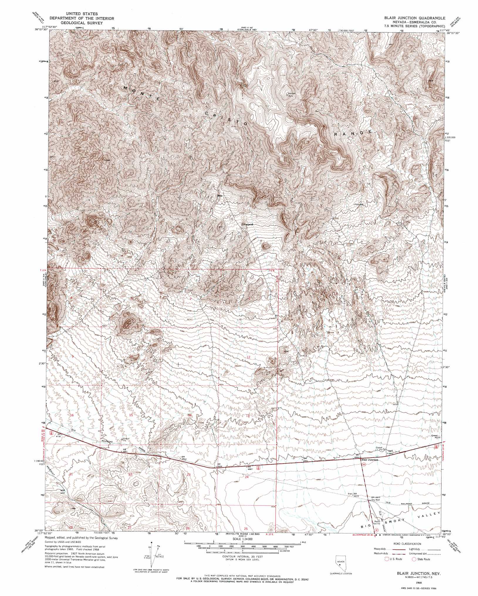
USGS Topo Quad 38117a7 - 1:24,000 scale
| Topo Map Name: | Blair Junction |
| USGS Topo Quad ID: | 38117a7 |
| Print Size: | ca. 21 1/4" wide x 27" high |
| Southeast Coordinates: | 38° N latitude / 117.75° W longitude |
| Map Center Coordinates: | 38.0625° N latitude / 117.8125° W longitude |
| U.S. State: | NV |
| Filename: | o38117a7.jpg |
| Download Map JPG Image: | Blair Junction topo map 1:24,000 scale |
| Map Type: | Topographic |
| Topo Series: | 7.5´ |
| Map Scale: | 1:24,000 |
| Source of Map Images: | United States Geological Survey (USGS) |
| Alternate Map Versions: |
Blair Junction NV 1968, updated 1970 Download PDF Buy paper map Blair Junction NV 2012 Download PDF Buy paper map Blair Junction NV 2014 Download PDF Buy paper map |
1:24,000 Topo Quads surrounding Blair Junction
Sodaville |
Eddyville |
Kirby Flat |
Outlaw Springs |
Outlaw Springs Se |
Candelaria |
Rock Hill |
Coaldale Ne |
Gilbert |
Crow Springs |
Columbus |
Coaldale |
Blair Junction |
Devils Gate |
Gilbert Se |
Volcanic Hills East |
Rhyolite Ridge Nw |
Rhyolite Ridge Ne |
North Of Silver Peak |
Weepah |
East Of Davis Mountain |
Rhyolite Ridge Sw |
Rhyolite Ridge |
Silver Peak |
Goat Island |
> Back to 38117a1 at 1:100,000 scale
> Back to 38116a1 at 1:250,000 scale
> Back to U.S. Topo Maps home
Blair Junction topo map: Gazetteer
Blair Junction: Populated Places
Blair Junction (historical) elevation 1469m 4819′Blair Junction: Post Offices
Blair Junction Post Office (historical) elevation 1469m 4819′Blair Junction digital topo map on disk
Buy this Blair Junction topo map showing relief, roads, GPS coordinates and other geographical features, as a high-resolution digital map file on DVD: