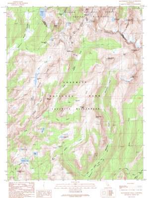
Matterhorn Peak Topo Map California
To zoom in, hover over the map of Matterhorn Peak
USGS Topo Quad 38119a4 - 1:24,000 scale
| Topo Map Name: | Matterhorn Peak |
| USGS Topo Quad ID: | 38119a4 |
| Print Size: | ca. 21 1/4" wide x 27" high |
| Southeast Coordinates: | 38° N latitude / 119.375° W longitude |
| Map Center Coordinates: | 38.0625° N latitude / 119.4375° W longitude |
| U.S. State: | CA |
| Filename: | o38119a4.jpg |
| Download Map JPG Image: | Matterhorn Peak topo map 1:24,000 scale |
| Map Type: | Topographic |
| Topo Series: | 7.5´ |
| Map Scale: | 1:24,000 |
| Source of Map Images: | United States Geological Survey (USGS) |
| Alternate Map Versions: |
Matterhorn Peak CA 1990, updated 1990 Download PDF Buy paper map Matterhorn Peak CA 2012 Download PDF Buy paper map Matterhorn Peak CA 2015 Download PDF Buy paper map |
| FStopo: | US Forest Service topo Matterhorn Peak is available: Download FStopo PDF Download FStopo TIF |
1:24,000 Topo Quads surrounding Matterhorn Peak
> Back to 38119a1 at 1:100,000 scale
> Back to 38118a1 at 1:250,000 scale
> Back to U.S. Topo Maps home
Matterhorn Peak topo map: Gazetteer
Matterhorn Peak: Flats
Kerrick Meadow elevation 2840m 9317′Matterhorn Peak: Gaps
Benson Pass elevation 3086m 10124′Burro Pass elevation 3233m 10606′
Mule Pass elevation 3278m 10754′
Rock Island Pass elevation 3096m 10157′
Matterhorn Peak: Lakes
Avalanche Lake elevation 2989m 9806′Crown Lake elevation 2897m 9504′
Doe Lake elevation 2802m 9192′
Glacier Lake elevation 3065m 10055′
Ice Lake elevation 3018m 9901′
Maltby Lake elevation 2961m 9714′
Peeler Lake elevation 2892m 9488′
Robinson Lakes elevation 2801m 9189′
Rock Island Lake elevation 2997m 9832′
Shamrock Lake elevation 3082m 10111′
Sister Lake elevation 2914m 9560′
Smedberg Lake elevation 2808m 9212′
Snow Lake elevation 3082m 10111′
Surprise Lake elevation 2982m 9783′
Tallulah Lake elevation 3004m 9855′
Matterhorn Peak: Ridges
Sawtooth Ridge elevation 3549m 11643′Suicide Ridge elevation 3347m 10980′
The Cleaver elevation 3280m 10761′
Matterhorn Peak: Slopes
The Slide elevation 3096m 10157′Matterhorn Peak: Streams
Big Meadow Creek elevation 2691m 8828′Camp Creek elevation 2682m 8799′
McCabe Creek elevation 2588m 8490′
Rock Creek elevation 2551m 8369′
Wilson Creek elevation 2571m 8435′
Matterhorn Peak: Summits
Bath Mountain elevation 3195m 10482′Crown Point elevation 3444m 11299′
Doghead Peak elevation 3338m 10951′
Finger Peaks elevation 3422m 11227′
Kettle Peak elevation 3341m 10961′
Matterhorn Peak elevation 3653m 11984′
Quarry Peak elevation 3385m 11105′
Slide Mountain elevation 3168m 10393′
Slide Mountain elevation 3375m 11072′
Volunteer Peak elevation 3200m 10498′
Whorl Mountain elevation 3642m 11948′
Matterhorn Peak: Valleys
Crazy Mule Gulch elevation 2556m 8385′Rock Canyon elevation 2997m 9832′
Slide Canyon elevation 2692m 8832′
Matterhorn Peak digital topo map on disk
Buy this Matterhorn Peak topo map showing relief, roads, GPS coordinates and other geographical features, as a high-resolution digital map file on DVD:


