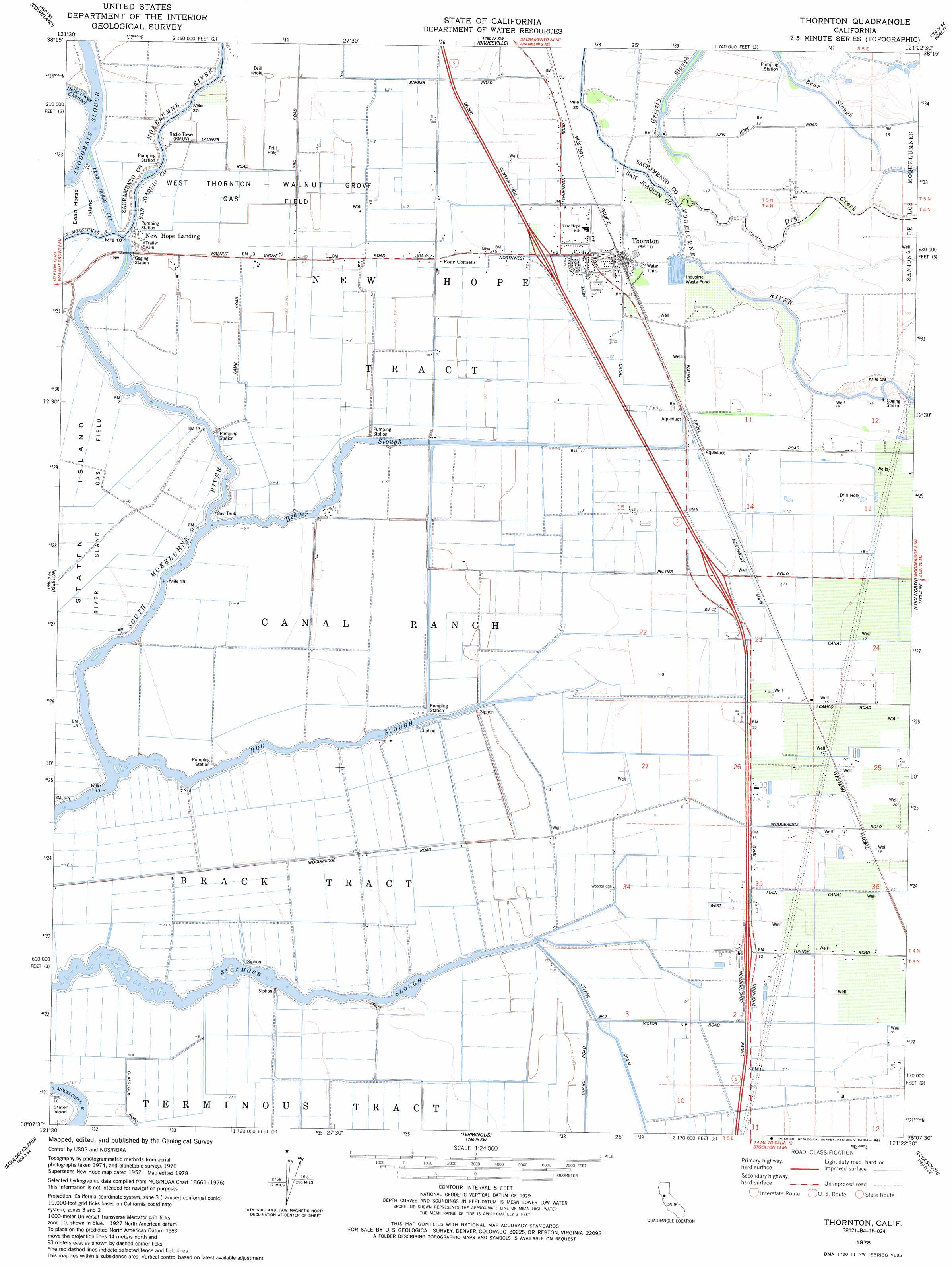
Thornton Topo Map California
To zoom in, hover over the map of Thornton
USGS Topo Quad 38121b4 - 1:24,000 scale
| Topo Map Name: | Thornton |
| USGS Topo Quad ID: | 38121b4 |
| Print Size: | ca. 21 1/4" wide x 27" high |
| Southeast Coordinates: | 38.125° N latitude / 121.375° W longitude |
| Map Center Coordinates: | 38.1875° N latitude / 121.4375° W longitude |
| U.S. State: | CA |
| Filename: | o38121b4.jpg |
| Download Map JPG Image: | Thornton topo map 1:24,000 scale |
| Map Type: | Topographic |
| Topo Series: | 7.5´ |
| Map Scale: | 1:24,000 |
| Source of Map Images: | United States Geological Survey (USGS) |
| Alternate Map Versions: |
New Hope CA 1952, updated 1954 Download PDF Buy paper map New Hope CA 1952, updated 1966 Download PDF Buy paper map New Hope CA 1952, updated 1969 Download PDF Buy paper map Thornton CA 1978, updated 1985 Download PDF Buy paper map Thornton CA 2012 Download PDF Buy paper map Thornton CA 2015 Download PDF Buy paper map |
1:24,000 Topo Quads surrounding Thornton
Saxon |
Clarksburg |
Florin |
Elk Grove |
Sloughhouse |
Liberty Island |
Courtland |
Bruceville |
Galt |
Clay |
Rio Vista |
Isleton |
Thornton |
Lodi North |
Lockeford |
Jersey Island |
Bouldin Island |
Terminous |
Lodi South |
Waterloo |
Brentwood |
Woodward Island |
Holt |
Stockton West |
Stockton East |
> Back to 38121a1 at 1:100,000 scale
> Back to 38120a1 at 1:250,000 scale
> Back to U.S. Topo Maps home
Thornton topo map: Gazetteer
Thornton: Canals
Dead Horse Cut elevation 0m 0′Northwest Main Canal elevation 5m 16′
Upland Canal elevation 2m 6′
Thornton: Guts
Bear Slough elevation 4m 13′Beaver Slough elevation 0m 0′
Grizzly Slough elevation 2m 6′
Hog Slough elevation 1m 3′
Sycamore Slough elevation 1m 3′
Thornton: Oilfields
River Island Gas Field elevation -2m -7′West Thornton-Walnut Grove Gas Field elevation 0m 0′
Thornton: Populated Places
New Hope elevation 4m 13′New Hope Landing elevation 1m 3′
Taison (historical) elevation 4m 13′
Thornton elevation 4m 13′
Thornton: Post Offices
Thornton Post Office elevation 4m 13′Thornton: Streams
Dry Creek elevation 4m 13′Thornton digital topo map on disk
Buy this Thornton topo map showing relief, roads, GPS coordinates and other geographical features, as a high-resolution digital map file on DVD: