Galt Topo Map California
To zoom in, hover over the map of Galt
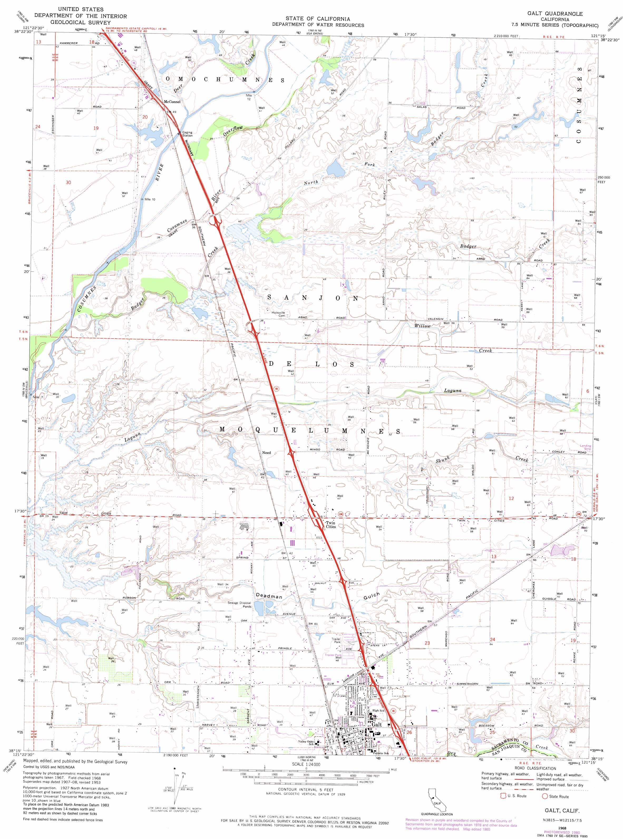
USGS Topo Quad 38121c3 - 1:24,000 scale
| Topo Map Name: | Galt |
| USGS Topo Quad ID: | 38121c3 |
| Print Size: | ca. 21 1/4" wide x 27" high |
| Southeast Coordinates: | 38.25° N latitude / 121.25° W longitude |
| Map Center Coordinates: | 38.3125° N latitude / 121.3125° W longitude |
| U.S. State: | CA |
| Filename: | o38121c3.jpg |
| Download Map JPG Image: | Galt topo map 1:24,000 scale |
| Map Type: | Topographic |
| Topo Series: | 7.5´ |
| Map Scale: | 1:24,000 |
| Source of Map Images: | United States Geological Survey (USGS) |
| Alternate Map Versions: |
Galt CA 1953, updated 1954 Download PDF Buy paper map Galt CA 1953, updated 1965 Download PDF Buy paper map Galt CA 1968, updated 1972 Download PDF Buy paper map Galt CA 1968, updated 1977 Download PDF Buy paper map Galt CA 1968, updated 1980 Download PDF Buy paper map Galt CA 2012 Download PDF Buy paper map Galt CA 2015 Download PDF Buy paper map |
1:24,000 Topo Quads surrounding Galt
Sacramento West |
Sacramento East |
Carmichael |
Buffalo Creek |
Folsom Se |
Clarksburg |
Florin |
Elk Grove |
Sloughhouse |
Carbondale |
Courtland |
Bruceville |
Galt |
Clay |
Goose Creek |
Isleton |
Thornton |
Lodi North |
Lockeford |
Clements |
Bouldin Island |
Terminous |
Lodi South |
Waterloo |
Linden |
> Back to 38121a1 at 1:100,000 scale
> Back to 38120a1 at 1:250,000 scale
> Back to U.S. Topo Maps home
Galt topo map: Gazetteer
Galt: Airports
Bottimore Ranch Airport elevation 22m 72′Flying R Airport elevation 21m 68′
Mustang Airport elevation 14m 45′
Galt: Parks
Canyon Creek Park elevation 16m 52′Chabolla Park elevation 16m 52′
Emerald Vista Park elevation 13m 42′
Harvey Park elevation 14m 45′
Lake Canyon Park elevation 17m 55′
Oak Park elevation 15m 49′
Smud Park elevation 15m 49′
Galt: Populated Places
Arno (historical) elevation 10m 32′Galt elevation 16m 52′
Hicksville elevation 13m 42′
Need elevation 13m 42′
Twin Cities elevation 16m 52′
Galt: Post Offices
Galt Post Office elevation 18m 59′Galt: Streams
Badger Creek elevation 8m 26′Cosumnes River Overflow elevation 9m 29′
Deer Creek elevation 10m 32′
North Fork Badger Creek elevation 10m 32′
Skunk Creek elevation 11m 36′
Willow Creek elevation 11m 36′
Galt: Valleys
Deadman Gulch elevation 5m 16′Galt digital topo map on disk
Buy this Galt topo map showing relief, roads, GPS coordinates and other geographical features, as a high-resolution digital map file on DVD: