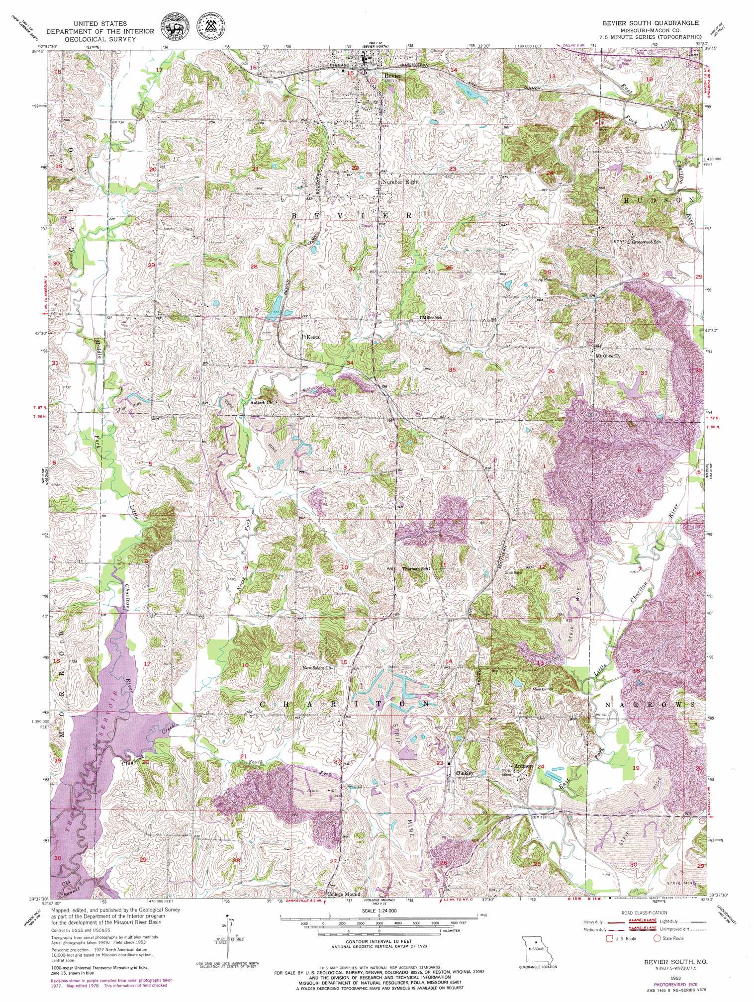
Bevier South Topo Map Missouri
To zoom in, hover over the map of Bevier South
USGS Topo Quad 39092f5 - 1:24,000 scale
| Topo Map Name: | Bevier South |
| USGS Topo Quad ID: | 39092f5 |
| Print Size: | ca. 21 1/4" wide x 27" high |
| Southeast Coordinates: | 39.625° N latitude / 92.5° W longitude |
| Map Center Coordinates: | 39.6875° N latitude / 92.5625° W longitude |
| U.S. State: | MO |
| Filename: | o39092f5.jpg |
| Download Map JPG Image: | Bevier South topo map 1:24,000 scale |
| Map Type: | Topographic |
| Topo Series: | 7.5´ |
| Map Scale: | 1:24,000 |
| Source of Map Images: | United States Geological Survey (USGS) |
| Alternate Map Versions: |
Bevier South MO 1953, updated 1955 Download PDF Buy paper map Bevier South MO 1953, updated 1979 Download PDF Buy paper map Bevier South MO 2012 Download PDF Buy paper map Bevier South MO 2014 Download PDF Buy paper map |
1:24,000 Topo Quads surrounding Bevier South
New Boston |
Elmer |
Barnesville |
Atlanta |
Sue City |
New Cambria West |
New Cambria East |
Bevier North |
Axtell |
Redman |
Wien |
Lagonda |
Bevier South |
Macon |
Clarence |
Bynumville |
Prairie Hill |
College Mound |
Jacksonville |
Duncans Bridge |
Salisbury |
Clifton Hill |
Huntsville |
Moberly |
Middle Grove |
> Back to 39092e1 at 1:100,000 scale
> Back to 39092a1 at 1:250,000 scale
> Back to U.S. Topo Maps home
Bevier South topo map: Gazetteer
Bevier South: Dams
Central Coal and Coke Corporation Lake Dam elevation 260m 853′Keota Lake Dam elevation 250m 820′
Bevier South: Populated Places
Ardmore elevation 245m 803′Bevier elevation 241m 790′
Binkley elevation 251m 823′
Chariton elevation 239m 784′
Keota elevation 249m 816′
Number Eight elevation 261m 856′
Bevier South: Reservoirs
Bevier Lake elevation 260m 853′Keota Lake elevation 250m 820′
Bevier South: Streams
Claybank Creek elevation 216m 708′Duck Creek elevation 229m 751′
North Fork Claybank Creek elevation 216m 708′
South Fork Claybank Creek elevation 216m 708′
Bevier South digital topo map on disk
Buy this Bevier South topo map showing relief, roads, GPS coordinates and other geographical features, as a high-resolution digital map file on DVD: