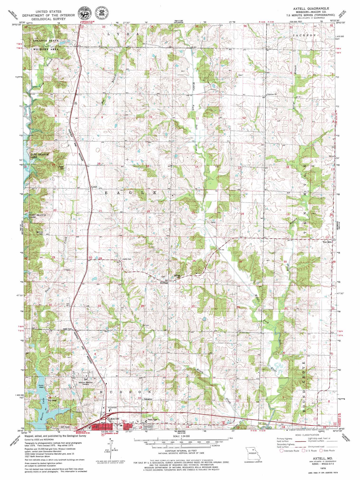
Axtell Topo Map Missouri
To zoom in, hover over the map of Axtell
USGS Topo Quad 39092g4 - 1:24,000 scale
| Topo Map Name: | Axtell |
| USGS Topo Quad ID: | 39092g4 |
| Print Size: | ca. 21 1/4" wide x 27" high |
| Southeast Coordinates: | 39.75° N latitude / 92.375° W longitude |
| Map Center Coordinates: | 39.8125° N latitude / 92.4375° W longitude |
| U.S. State: | MO |
| Filename: | o39092g4.jpg |
| Download Map JPG Image: | Axtell topo map 1:24,000 scale |
| Map Type: | Topographic |
| Topo Series: | 7.5´ |
| Map Scale: | 1:24,000 |
| Source of Map Images: | United States Geological Survey (USGS) |
| Alternate Map Versions: |
Axtell MO 1979, updated 1979 Download PDF Buy paper map Axtell MO 2012 Download PDF Buy paper map Axtell MO 2014 Download PDF Buy paper map |
1:24,000 Topo Quads surrounding Axtell
Gifford |
Millard |
La Plata |
Locust Hill |
Novelty |
Elmer |
Barnesville |
Atlanta |
Sue City |
Leonard |
New Cambria East |
Bevier North |
Axtell |
Redman |
Hagers Grove |
Lagonda |
Bevier South |
Macon |
Clarence |
Lentner |
Prairie Hill |
College Mound |
Jacksonville |
Duncans Bridge |
Woodlawn |
> Back to 39092e1 at 1:100,000 scale
> Back to 39092a1 at 1:250,000 scale
> Back to U.S. Topo Maps home
Axtell topo map: Gazetteer
Axtell: Dams
B Thieman Dam elevation 249m 816′Larson Lake Dam elevation 256m 839′
Mechlin Lake Dam elevation 253m 830′
Number 22 Dam elevation 249m 816′
Axtell: Populated Places
Axtell elevation 271m 889′Kellogg elevation 263m 862′
Lyda (historical) elevation 272m 892′
Ten Mile elevation 260m 853′
Axtell: Post Offices
Lyda Post Office elevation 272m 892′Axtell: Reservoirs
Macon Lake elevation 241m 790′Axtell: Streams
Billys Branch elevation 232m 761′Brush Creek elevation 231m 757′
Sewer Creek elevation 232m 761′
Axtell digital topo map on disk
Buy this Axtell topo map showing relief, roads, GPS coordinates and other geographical features, as a high-resolution digital map file on DVD: