Macon Topo Map Missouri
To zoom in, hover over the map of Macon
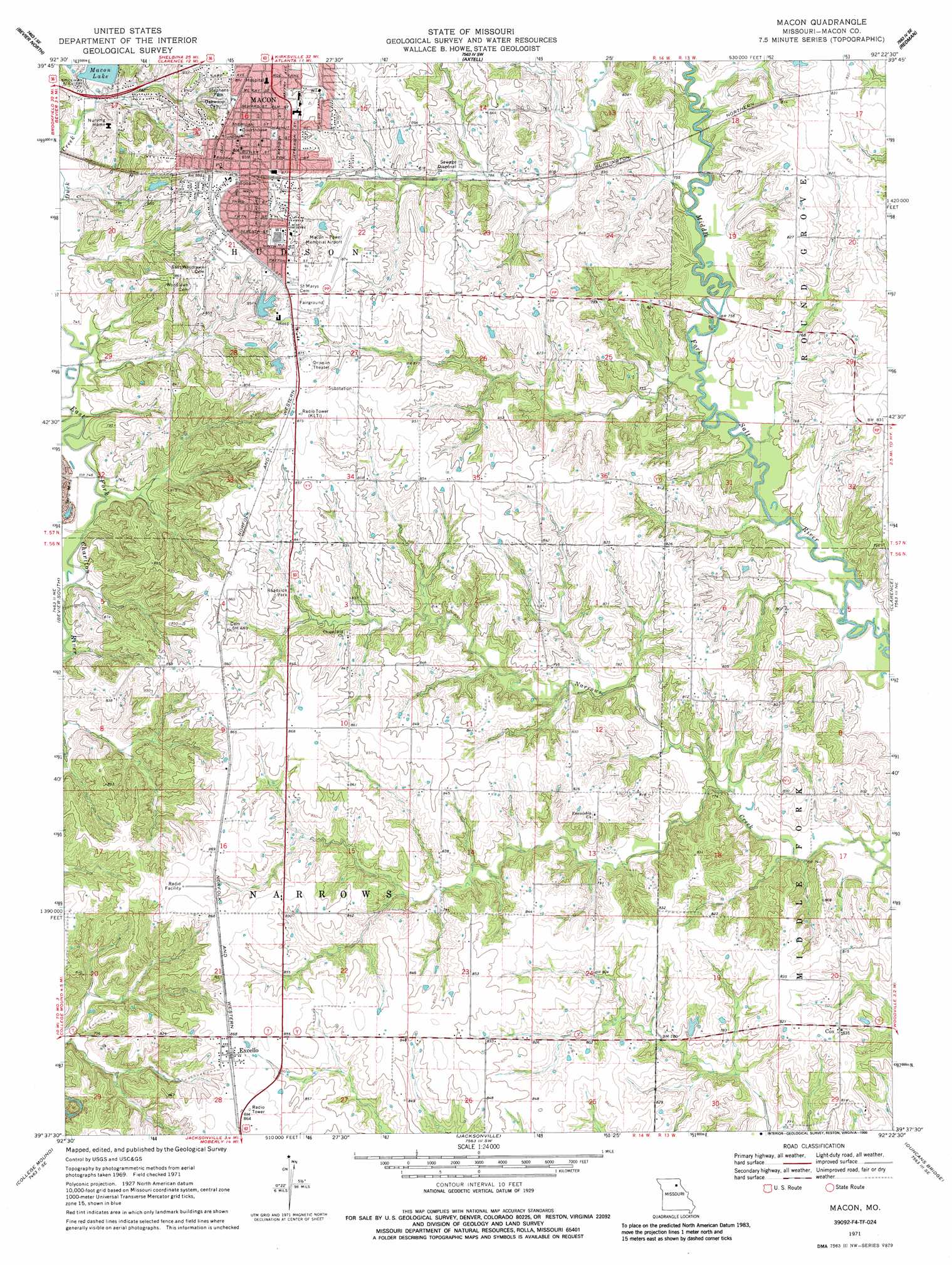
USGS Topo Quad 39092f4 - 1:24,000 scale
| Topo Map Name: | Macon |
| USGS Topo Quad ID: | 39092f4 |
| Print Size: | ca. 21 1/4" wide x 27" high |
| Southeast Coordinates: | 39.625° N latitude / 92.375° W longitude |
| Map Center Coordinates: | 39.6875° N latitude / 92.4375° W longitude |
| U.S. State: | MO |
| Filename: | o39092f4.jpg |
| Download Map JPG Image: | Macon topo map 1:24,000 scale |
| Map Type: | Topographic |
| Topo Series: | 7.5´ |
| Map Scale: | 1:24,000 |
| Source of Map Images: | United States Geological Survey (USGS) |
| Alternate Map Versions: |
Macon MO 1971, updated 1972 Download PDF Buy paper map Macon MO 1971, updated 1986 Download PDF Buy paper map Macon MO 2012 Download PDF Buy paper map Macon MO 2014 Download PDF Buy paper map |
1:24,000 Topo Quads surrounding Macon
Elmer |
Barnesville |
Atlanta |
Sue City |
Leonard |
New Cambria East |
Bevier North |
Axtell |
Redman |
Hagers Grove |
Lagonda |
Bevier South |
Macon |
Clarence |
Lentner |
Prairie Hill |
College Mound |
Jacksonville |
Duncans Bridge |
Woodlawn |
Clifton Hill |
Huntsville |
Moberly |
Middle Grove |
Madison |
> Back to 39092e1 at 1:100,000 scale
> Back to 39092a1 at 1:250,000 scale
> Back to U.S. Topo Maps home
Macon topo map: Gazetteer
Macon: Airports
Macon-Fower Memorial Airport elevation 265m 869′Macon: Dams
Macon Lake Dam elevation 239m 784′Still Hildreth Sanitorium Dam elevation 258m 846′
Macon: Parks
Stephens Park elevation 263m 862′Macon: Populated Places
Cox elevation 252m 826′Excello elevation 264m 866′
Macon elevation 265m 869′
Narrows Creek (historical) elevation 254m 833′
Macon: Post Offices
Narrows Creek Post Office elevation 254m 833′Macon: Reservoirs
Macon Lake elevation 239m 784′Still Hildreth Lake elevation 258m 846′
Macon digital topo map on disk
Buy this Macon topo map showing relief, roads, GPS coordinates and other geographical features, as a high-resolution digital map file on DVD: