Lila Point Topo Map Utah
To zoom in, hover over the map of Lila Point
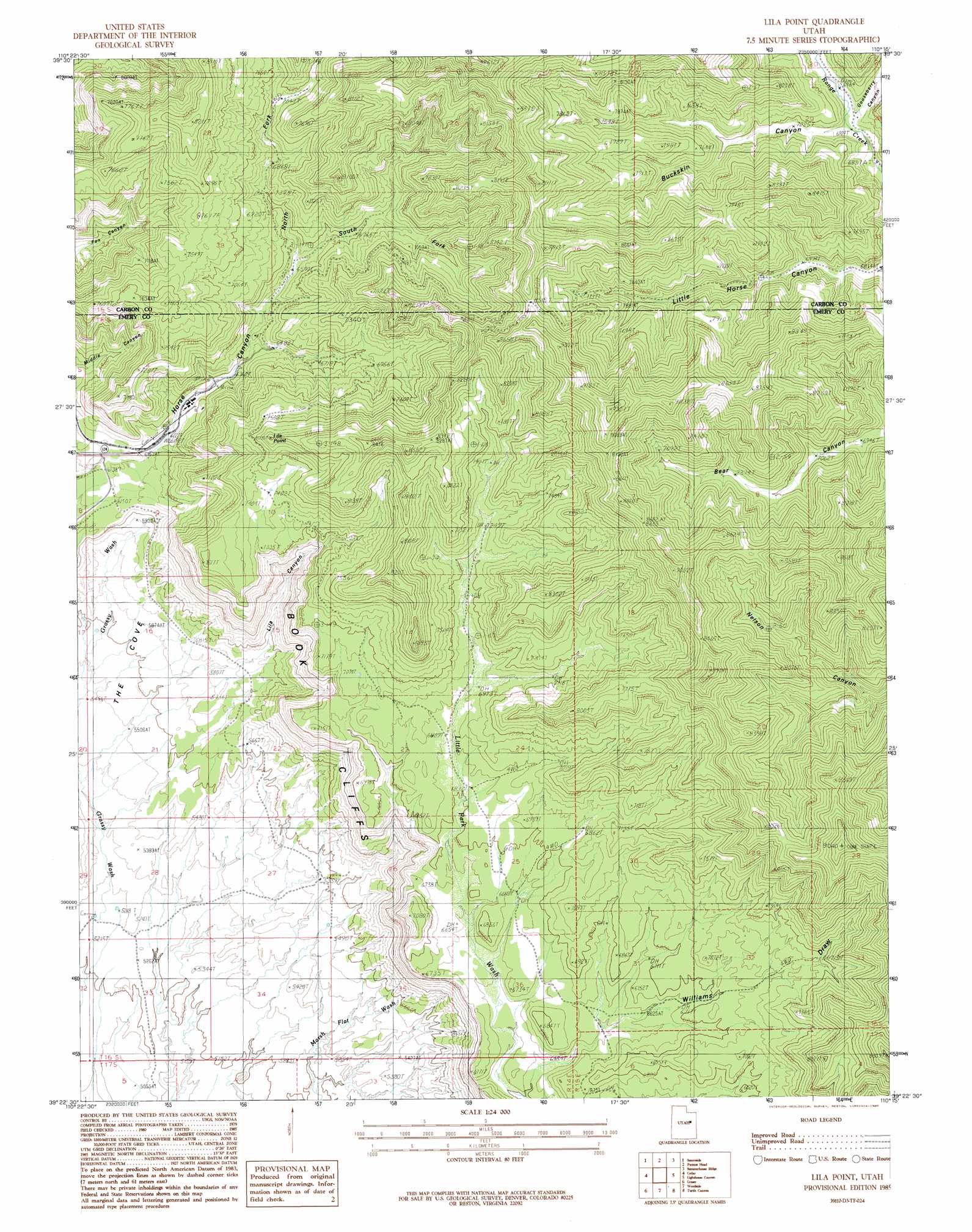
USGS Topo Quad 39110d3 - 1:24,000 scale
| Topo Map Name: | Lila Point |
| USGS Topo Quad ID: | 39110d3 |
| Print Size: | ca. 21 1/4" wide x 27" high |
| Southeast Coordinates: | 39.375° N latitude / 110.25° W longitude |
| Map Center Coordinates: | 39.4375° N latitude / 110.3125° W longitude |
| U.S. State: | UT |
| Filename: | o39110d3.jpg |
| Download Map JPG Image: | Lila Point topo map 1:24,000 scale |
| Map Type: | Topographic |
| Topo Series: | 7.5´ |
| Map Scale: | 1:24,000 |
| Source of Map Images: | United States Geological Survey (USGS) |
| Alternate Map Versions: |
Lila Point UT 1985, updated 1985 Download PDF Buy paper map Lila Point UT 2011 Download PDF Buy paper map Lila Point UT 2014 Download PDF Buy paper map |
1:24,000 Topo Quads surrounding Lila Point
Pine Canyon |
Mount Bartles |
Bruin Point |
Twin Hollow |
Cedar Ridge Canyon |
Sunnyside Junction |
Sunnyside |
Patmos Head |
Summerhouse Ridge |
Steer Ridge Canyon |
Mounds |
Cedar |
Lila Point |
Lighthouse Canyon |
Chandler Falls |
Flattop Mountain |
Grassy |
Woodside |
Turtle Canyon |
Three Fords Canyon |
Chimney Rock |
Dry Mesa |
Cliff |
Jenny Canyon |
Butler Canyon |
> Back to 39110a1 at 1:100,000 scale
> Back to 39110a1 at 1:250,000 scale
> Back to U.S. Topo Maps home
Lila Point topo map: Gazetteer
Lila Point: Cliffs
Lila Point elevation 2440m 8005′Lila Point: Mines
Geneva Coal Mine elevation 1976m 6482′Lila Point: Populated Places
Horse Canyon elevation 1910m 6266′Lila Point: Valleys
Buckskin Canyon elevation 2106m 6909′Gooseberry Canyon elevation 2142m 7027′
Lila Canyon elevation 1763m 5784′
North Fork Horse Canyon elevation 2052m 6732′
South Fork Horse Canyon elevation 2040m 6692′
Williams Draw elevation 2002m 6568′
Lila Point digital topo map on disk
Buy this Lila Point topo map showing relief, roads, GPS coordinates and other geographical features, as a high-resolution digital map file on DVD: