Green Springs Topo Map Nevada
To zoom in, hover over the map of Green Springs
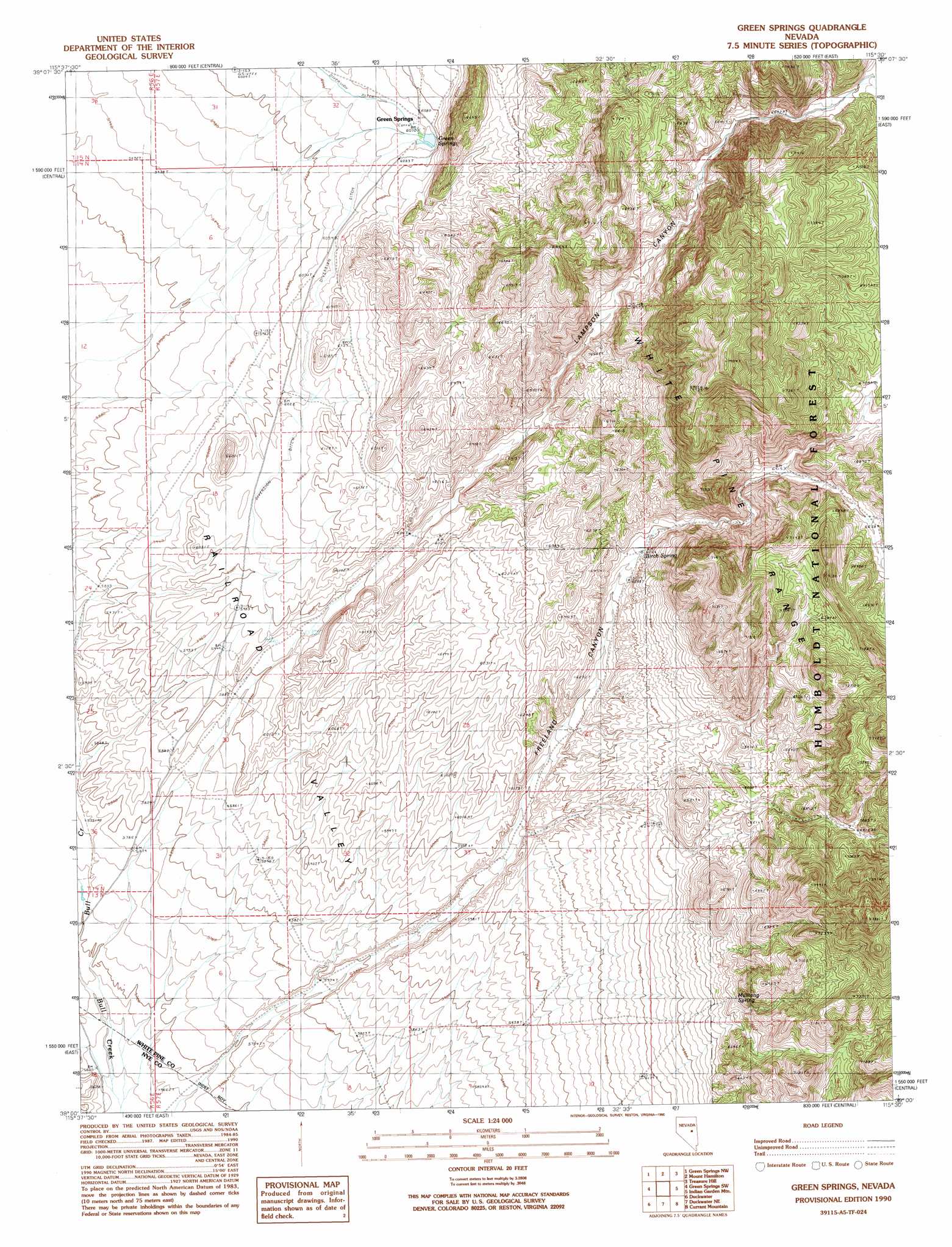
USGS Topo Quad 39115a5 - 1:24,000 scale
| Topo Map Name: | Green Springs |
| USGS Topo Quad ID: | 39115a5 |
| Print Size: | ca. 21 1/4" wide x 27" high |
| Southeast Coordinates: | 39° N latitude / 115.5° W longitude |
| Map Center Coordinates: | 39.0625° N latitude / 115.5625° W longitude |
| U.S. State: | NV |
| Filename: | o39115a5.jpg |
| Download Map JPG Image: | Green Springs topo map 1:24,000 scale |
| Map Type: | Topographic |
| Topo Series: | 7.5´ |
| Map Scale: | 1:24,000 |
| Source of Map Images: | United States Geological Survey (USGS) |
| Alternate Map Versions: |
Green Springs NV 1990, updated 1990 Download PDF Buy paper map Green Springs NV 2012 Download PDF Buy paper map Green Springs NV 2014 Download PDF Buy paper map |
| FStopo: | US Forest Service topo Green Springs is available: Download FStopo PDF Download FStopo TIF |
1:24,000 Topo Quads surrounding Green Springs
Black Point |
Pancake Summit Sw |
Seligman Canyon |
Hamilton |
Illipah |
Pogues Station |
Green Springs Nw |
Mount Hamilton |
Treasure Hill |
Limestone Peak |
Bull Fork |
Green Springs Sw |
Green Springs |
Indian Garden Mountain |
Easter Springs |
Brown Summit |
Duckwater |
Duckwater Ne |
Currant Mountain |
Horse Track Spring |
Sand Spring |
Bradshaw Spring |
Duckwater Se |
White Pine Peak |
Currant Summit |
> Back to 39115a1 at 1:100,000 scale
> Back to 39114a1 at 1:250,000 scale
> Back to U.S. Topo Maps home
Green Springs topo map: Gazetteer
Green Springs: Populated Places
Green Springs elevation 1852m 6076′Green Springs: Reservoirs
Green Springs Reservoir elevation 1854m 6082′Green Springs: Springs
Birch Spring elevation 1909m 6263′Green Springs elevation 1857m 6092′
Mustang Spring elevation 1982m 6502′
Green Springs: Valleys
Freeland Canyon elevation 1752m 5748′Lampson Canyon elevation 1863m 6112′
Green Springs digital topo map on disk
Buy this Green Springs topo map showing relief, roads, GPS coordinates and other geographical features, as a high-resolution digital map file on DVD: