New Pass Peak Topo Map Nevada
To zoom in, hover over the map of New Pass Peak
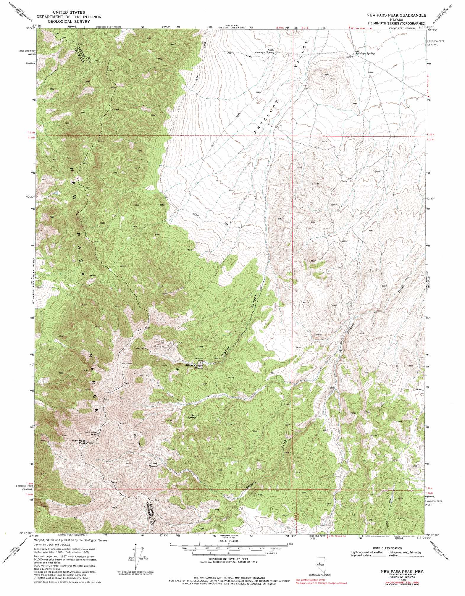
USGS Topo Quad 39117f4 - 1:24,000 scale
| Topo Map Name: | New Pass Peak |
| USGS Topo Quad ID: | 39117f4 |
| Print Size: | ca. 21 1/4" wide x 27" high |
| Southeast Coordinates: | 39.625° N latitude / 117.375° W longitude |
| Map Center Coordinates: | 39.6875° N latitude / 117.4375° W longitude |
| U.S. State: | NV |
| Filename: | o39117f4.jpg |
| Download Map JPG Image: | New Pass Peak topo map 1:24,000 scale |
| Map Type: | Topographic |
| Topo Series: | 7.5´ |
| Map Scale: | 1:24,000 |
| Source of Map Images: | United States Geological Survey (USGS) |
| Alternate Map Versions: |
Mount Airy NW NV 1969, updated 1971 Download PDF Buy paper map New Pass Peak NV 1969, updated 1984 Download PDF Buy paper map New Pass Peak NV 2011 Download PDF Buy paper map New Pass Peak NV 2014 Download PDF Buy paper map |
1:24,000 Topo Quads surrounding New Pass Peak
Hole In The Wall |
Shoshone Meadows Ne |
Gilbert Creek Nw |
Gilbert Creek Ne |
Manhattan Mountain Nw |
Shoshone Meadows |
Shoshone Meadows Se |
Gilbert Creek Sw |
Gilbert Creek Se |
Manhattan Mountain |
Tungsten Mountain |
New Pass Well |
New Pass Peak |
Mount Airy Ne |
Vigus Butte Nw |
Byers Ranch |
New Pass |
Mount Airy |
Mount Airy Mesa |
Vigus Butte |
Basque Summit |
Carroll Summit Ne |
Emigrant Peak |
Gandolfo Canyon |
West Of Austin |
> Back to 39117e1 at 1:100,000 scale
> Back to 39116a1 at 1:250,000 scale
> Back to U.S. Topo Maps home
New Pass Peak topo map: Gazetteer
New Pass Peak: Mines
Peterson Mine elevation 2073m 6801′Santa Rosa Mine elevation 2670m 8759′
New Pass Peak: Ranges
New Pass Range elevation 2093m 6866′New Pass Peak: Springs
Big Antelope Spring elevation 1684m 5524′Deer Spring elevation 2149m 7050′
Gilbert Spring elevation 2279m 7477′
Little Antelope Spring elevation 1712m 5616′
Water Canyon Spring elevation 2071m 6794′
New Pass Peak: Summits
New Pass Peak elevation 2745m 9005′New Pass Peak: Valleys
Water Canyon elevation 1757m 5764′New Pass Peak digital topo map on disk
Buy this New Pass Peak topo map showing relief, roads, GPS coordinates and other geographical features, as a high-resolution digital map file on DVD: