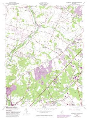
Monmouth Junction Topo Map New Jersey
To zoom in, hover over the map of Monmouth Junction
USGS Topo Quad 40074d5 - 1:24,000 scale
| Topo Map Name: | Monmouth Junction |
| USGS Topo Quad ID: | 40074d5 |
| Print Size: | ca. 21 1/4" wide x 27" high |
| Southeast Coordinates: | 40.375° N latitude / 74.5° W longitude |
| Map Center Coordinates: | 40.4375° N latitude / 74.5625° W longitude |
| U.S. State: | NJ |
| Filename: | o40074d5.jpg |
| Download Map JPG Image: | Monmouth Junction topo map 1:24,000 scale |
| Map Type: | Topographic |
| Topo Series: | 7.5´ |
| Map Scale: | 1:24,000 |
| Source of Map Images: | United States Geological Survey (USGS) |
| Alternate Map Versions: |
Monmouth Junction NJ 1947 Download PDF Buy paper map Monmouth Junction NJ 1954, updated 1956 Download PDF Buy paper map Monmouth Junction NJ 1954, updated 1964 Download PDF Buy paper map Monmouth Junction NJ 1954, updated 1968 Download PDF Buy paper map Monmouth Junction NJ 1954, updated 1972 Download PDF Buy paper map Monmouth Junction NJ 1954, updated 1982 Download PDF Buy paper map Monmouth Junction NJ 1954, updated 1982 Download PDF Buy paper map Monmouth Junction NJ 2011 Download PDF Buy paper map Monmouth Junction NJ 2014 Download PDF Buy paper map Monmouth Junction NJ 2016 Download PDF Buy paper map |
1:24,000 Topo Quads surrounding Monmouth Junction
> Back to 40074a1 at 1:100,000 scale
> Back to 40074a1 at 1:250,000 scale
> Back to U.S. Topo Maps home
Monmouth Junction topo map: Gazetteer
Monmouth Junction: Airports
Raritan Center Heliport elevation 36m 118′Society Hill at North Brunswick Heliport elevation 36m 118′
Monmouth Junction: Dams
Deans Mills Dam elevation 23m 75′Monmouth Junction: Parks
Brunswick Acres Park elevation 37m 121′Hidden Lake Park elevation 30m 98′
Luke Park elevation 37m 121′
Reichler Park elevation 24m 78′
West New Road Park elevation 72m 236′
Monmouth Junction: Populated Places
Black Horse elevation 27m 88′Blackwells Mills elevation 13m 42′
Clyde elevation 37m 121′
Deans elevation 26m 85′
Franklin Park elevation 40m 131′
Griggstown elevation 11m 36′
Heathcote elevation 52m 170′
Kendall Park elevation 56m 183′
Kingston elevation 37m 121′
Little Rocky Hill elevation 73m 239′
Mettler elevation 36m 118′
Middlebush elevation 35m 114′
Millstone elevation 14m 45′
Monmouth Junction elevation 28m 91′
Pleasant Plains elevation 39m 127′
Rockingham elevation 59m 193′
Sand Hills elevation 80m 262′
Sixmile Run elevation 31m 101′
South Brunswick Terrace elevation 29m 95′
Sunset Hill Garden elevation 31m 101′
Ten Mile Run elevation 61m 200′
Monmouth Junction: Reservoirs
Deans Pond elevation 23m 75′Monmouth Junction: Streams
Cow Yard Brook elevation 30m 98′Heathcote Brook Branch elevation 22m 72′
Middlebush Brook elevation 18m 59′
Ninemile Run elevation 18m 59′
Simonson Brook elevation 11m 36′
Sixmile Run elevation 12m 39′
Tenmile Run elevation 12m 39′
Terhune Run elevation 24m 78′
Monmouth Junction: Summits
Bunker Hill elevation 56m 183′Tenmile Run Mountain elevation 92m 301′
Monmouth Junction digital topo map on disk
Buy this Monmouth Junction topo map showing relief, roads, GPS coordinates and other geographical features, as a high-resolution digital map file on DVD:
Atlantic Coast (NY, NJ, PA, DE, MD, VA, NC)
Buy digital topo maps: Atlantic Coast (NY, NJ, PA, DE, MD, VA, NC)


