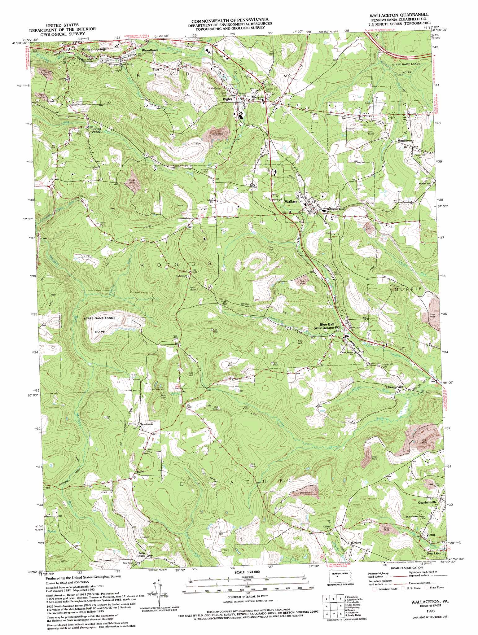
Wallaceton Topo Map Pennsylvania
To zoom in, hover over the map of Wallaceton
USGS Topo Quad 40078h3 - 1:24,000 scale
| Topo Map Name: | Wallaceton |
| USGS Topo Quad ID: | 40078h3 |
| Print Size: | ca. 21 1/4" wide x 27" high |
| Southeast Coordinates: | 40.875° N latitude / 78.25° W longitude |
| Map Center Coordinates: | 40.9375° N latitude / 78.3125° W longitude |
| U.S. State: | PA |
| Filename: | o40078h3.jpg |
| Download Map JPG Image: | Wallaceton topo map 1:24,000 scale |
| Map Type: | Topographic |
| Topo Series: | 7.5´ |
| Map Scale: | 1:24,000 |
| Source of Map Images: | United States Geological Survey (USGS) |
| Alternate Map Versions: |
Wallaceton PA 1945, updated 1956 Download PDF Buy paper map Wallaceton PA 1945, updated 1968 Download PDF Buy paper map Wallaceton PA 1945, updated 1970 Download PDF Buy paper map Wallaceton PA 1945, updated 1980 Download PDF Buy paper map Wallaceton PA 1993, updated 1994 Download PDF Buy paper map Wallaceton PA 2010 Download PDF Buy paper map Wallaceton PA 2013 Download PDF Buy paper map Wallaceton PA 2016 Download PDF Buy paper map |
1:24,000 Topo Quads surrounding Wallaceton
Penfield |
Huntley |
The Knobs |
Devils Elbow |
Pottersdale |
Elliott Park |
Clearfield |
Lecontes Mills |
Frenchville |
Karthaus |
Curwensville |
Glen Richey |
Wallaceton |
Philipsburg |
Black Moshannon |
Irvona |
Ramey |
Houtzdale |
Sandy Ridge |
Port Matilda |
Coalport |
Blandburg |
Tipton |
Tyrone |
Franklinville |
> Back to 40078e1 at 1:100,000 scale
> Back to 40078a1 at 1:250,000 scale
> Back to U.S. Topo Maps home
Wallaceton topo map: Gazetteer
Wallaceton: Airports
ACCI Heliport elevation 555m 1820′Frans Airport elevation 510m 1673′
Wallaceton: Parks
State Game Lands Number 98 elevation 578m 1896′Wallaceton: Populated Places
Bigler elevation 515m 1689′Blue Ball elevation 478m 1568′
Burly elevation 577m 1893′
Decaturville elevation 447m 1466′
Drane elevation 500m 1640′
Gearhartville elevation 486m 1594′
Mineral Springs elevation 426m 1397′
New Castle elevation 606m 1988′
New Liberty elevation 437m 1433′
Newtown elevation 562m 1843′
Pine Top elevation 477m 1564′
Spring Valley elevation 481m 1578′
Victor elevation 453m 1486′
Wallaceton elevation 532m 1745′
West Decatur elevation 465m 1525′
Woodland elevation 456m 1496′
Wallaceton: Streams
Albert Run elevation 440m 1443′Forcey Run elevation 466m 1528′
Jake Run elevation 443m 1453′
Simeling Run elevation 464m 1522′
Valley Fork Run elevation 450m 1476′
Wallaceton digital topo map on disk
Buy this Wallaceton topo map showing relief, roads, GPS coordinates and other geographical features, as a high-resolution digital map file on DVD:
 map DVD")