La Rue Topo Map Ohio
To zoom in, hover over the map of La Rue
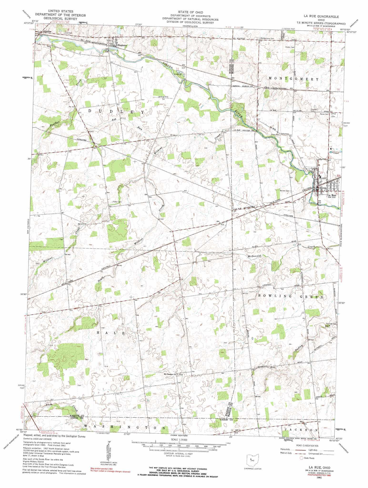
USGS Topo Quad 40083e4 - 1:24,000 scale
| Topo Map Name: | La Rue |
| USGS Topo Quad ID: | 40083e4 |
| Print Size: | ca. 21 1/4" wide x 27" high |
| Southeast Coordinates: | 40.5° N latitude / 83.375° W longitude |
| Map Center Coordinates: | 40.5625° N latitude / 83.4375° W longitude |
| U.S. State: | OH |
| Filename: | o40083e4.jpg |
| Download Map JPG Image: | La Rue topo map 1:24,000 scale |
| Map Type: | Topographic |
| Topo Series: | 7.5´ |
| Map Scale: | 1:24,000 |
| Source of Map Images: | United States Geological Survey (USGS) |
| Alternate Map Versions: |
La Rue OH 1961, updated 1962 Download PDF Buy paper map La Rue OH 1961, updated 1990 Download PDF Buy paper map La Rue OH 2010 Download PDF Buy paper map La Rue OH 2013 Download PDF Buy paper map La Rue OH 2016 Download PDF Buy paper map |
1:24,000 Topo Quads surrounding La Rue
Dunkirk |
Forest |
Wharton |
Upper Sandusky |
Nevada |
Foraker |
Kenton |
Marseilles |
Meeker |
Morral |
Silver Creek |
Mount Victory |
La Rue |
New Bloomington |
Marion West |
Rushsylvania |
West Mansfield |
York Center |
Richwood |
Prospect |
Zanesfield |
East Liberty |
Peoria |
Magnetic Springs |
Ostrander |
> Back to 40083e1 at 1:100,000 scale
> Back to 40082a1 at 1:250,000 scale
> Back to U.S. Topo Maps home
La Rue topo map: Gazetteer
La Rue: Populated Places
Hepburn elevation 290m 951′La Rue elevation 282m 925′
Marshs (historical) elevation 295m 967′
Pfeiffer elevation 290m 951′
Winnemac (historical) elevation 283m 928′
La Rue: Post Offices
Hepburn Post Office (historical) elevation 289m 948′La Rue Post Office elevation 282m 925′
Pfeiffer Post Office (historical) elevation 289m 948′
La Rue: Streams
Ash Run elevation 286m 938′North Wildcat Creek elevation 291m 954′
Panther Creek elevation 281m 921′
South Wildcat Creek elevation 291m 954′
Wildcat Creek elevation 282m 925′
La Rue digital topo map on disk
Buy this La Rue topo map showing relief, roads, GPS coordinates and other geographical features, as a high-resolution digital map file on DVD:
 map DVD")