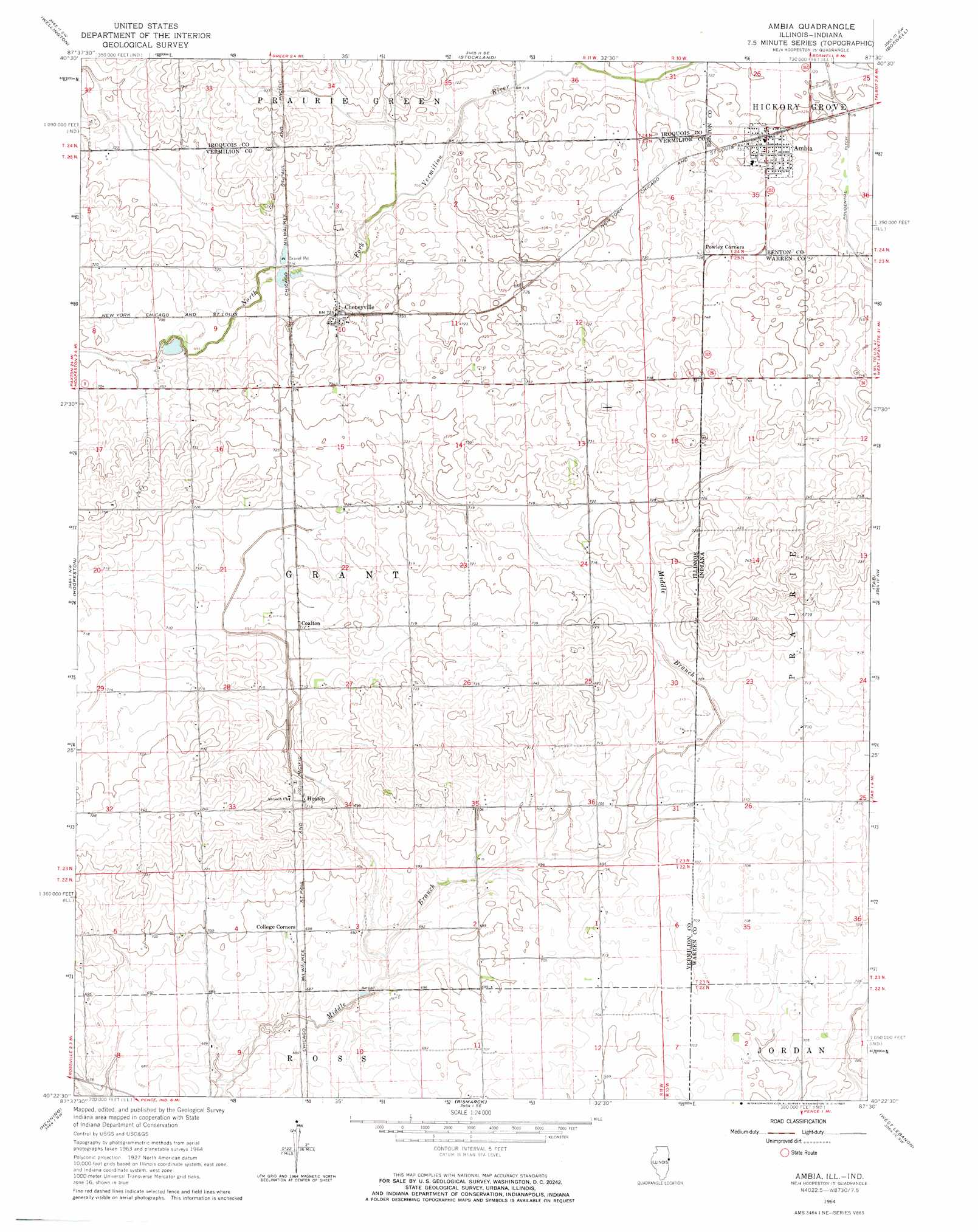
Ambia Topo Map Illinois
To zoom in, hover over the map of Ambia
USGS Topo Quad 40087d5 - 1:24,000 scale
| Topo Map Name: | Ambia |
| USGS Topo Quad ID: | 40087d5 |
| Print Size: | ca. 21 1/4" wide x 27" high |
| Southeast Coordinates: | 40.375° N latitude / 87.5° W longitude |
| Map Center Coordinates: | 40.4375° N latitude / 87.5625° W longitude |
| U.S. States: | IL, IN |
| Filename: | o40087d5.jpg |
| Download Map JPG Image: | Ambia topo map 1:24,000 scale |
| Map Type: | Topographic |
| Topo Series: | 7.5´ |
| Map Scale: | 1:24,000 |
| Source of Map Images: | United States Geological Survey (USGS) |
| Alternate Map Versions: |
Ambia IN 1964, updated 1965 Download PDF Buy paper map Ambia IN 2011 Download PDF Buy paper map Ambia IN 2013 Download PDF Buy paper map Ambia IN 2016 Download PDF Buy paper map |
1:24,000 Topo Quads surrounding Ambia
Woodworth |
Milford |
Darrow |
Earl Park |
Wadena |
Claytonville |
Wellington |
Stockland |
Boswell |
Fowler |
East Lynn |
Hoopeston |
Ambia |
Tab |
Pine Village |
Potomac |
Henning |
Bismarck |
West Lebanon |
Williamsport |
Collison |
Danville Nw |
Danville Ne |
Covington |
Stone Bluff |
> Back to 40087a1 at 1:100,000 scale
> Back to 40086a1 at 1:250,000 scale
> Back to U.S. Topo Maps home
Ambia topo map: Gazetteer
Ambia: Canals
Prudential Ditch elevation 223m 731′Ambia: Populated Places
Ambia elevation 225m 738′Cheneyville elevation 221m 725′
Coalton elevation 223m 731′
Heaton elevation 219m 718′
Powley Corners elevation 225m 738′
Ambia digital topo map on disk
Buy this Ambia topo map showing relief, roads, GPS coordinates and other geographical features, as a high-resolution digital map file on DVD:
Northern Illinois, Northern Indiana & Southwestern Michigan
Buy digital topo maps: Northern Illinois, Northern Indiana & Southwestern Michigan