L'Erable Topo Map Illinois
To zoom in, hover over the map of L'Erable
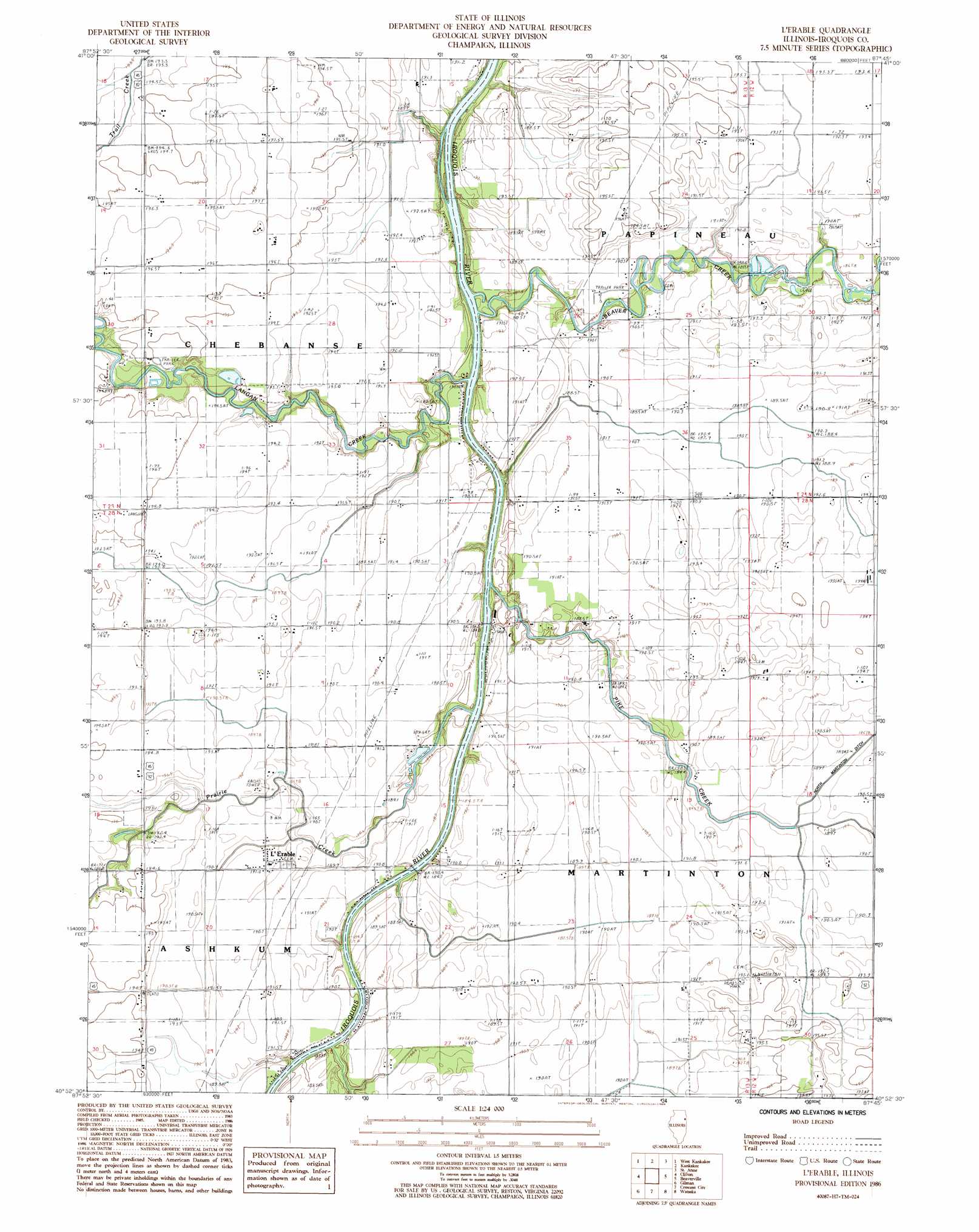
USGS Topo Quad 40087h7 - 1:24,000 scale
| Topo Map Name: | L'Erable |
| USGS Topo Quad ID: | 40087h7 |
| Print Size: | ca. 21 1/4" wide x 27" high |
| Southeast Coordinates: | 40.875° N latitude / 87.75° W longitude |
| Map Center Coordinates: | 40.9375° N latitude / 87.8125° W longitude |
| U.S. State: | IL |
| Filename: | o40087h7.jpg |
| Download Map JPG Image: | L'Erable topo map 1:24,000 scale |
| Map Type: | Topographic |
| Topo Series: | 7.5´ |
| Map Scale: | 1:24,000 |
| Source of Map Images: | United States Geological Survey (USGS) |
| Alternate Map Versions: |
L'Erable IL 1986, updated 1986 Download PDF Buy paper map L'Erable IL 2012 Download PDF Buy paper map L'Erable IL 2015 Download PDF Buy paper map |
1:24,000 Topo Quads surrounding L'Erable
Bonfield |
Bourbonnais |
Bradley |
Momence |
Illiana Heights |
Herscher |
West Kankakee |
Kankakee |
Saint Anne |
Leesville |
Piper City Ne |
Clifton |
L'Erable |
Beaverville |
Donovan |
La Hogue |
Gilman |
Crescent |
Watseka |
Sheldon |
Onarga West |
Onarga East |
Woodworth |
Milford |
Darrow |
> Back to 40087e1 at 1:100,000 scale
> Back to 40086a1 at 1:250,000 scale
> Back to U.S. Topo Maps home
L'Erable topo map: Gazetteer
L'Erable: Airports
Nottke Airport elevation 192m 629′L'Erable: Bridges
L'Erable Bridge elevation 186m 610′Perry Bridge elevation 190m 623′
L'Erable: Canals
North Martinton Ditch elevation 188m 616′L'Erable: Populated Places
L'Erable elevation 191m 626′L'Erable: Streams
Beaver Creek elevation 185m 606′Langan Creek elevation 187m 613′
Pike Creek elevation 187m 613′
Prairie Creek elevation 187m 613′
L'Erable digital topo map on disk
Buy this L'Erable topo map showing relief, roads, GPS coordinates and other geographical features, as a high-resolution digital map file on DVD:
Northern Illinois, Northern Indiana & Southwestern Michigan
Buy digital topo maps: Northern Illinois, Northern Indiana & Southwestern Michigan