Northeast Pontiac Topo Map Illinois
To zoom in, hover over the map of Northeast Pontiac
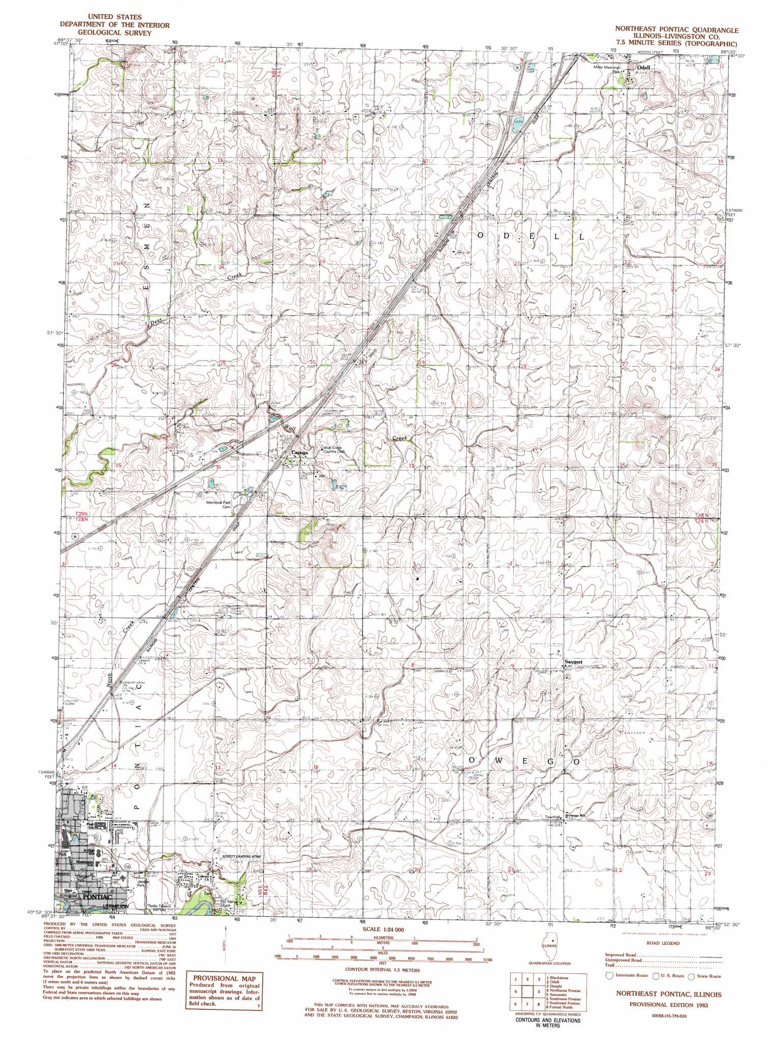
USGS Topo Quad 40088h5 - 1:24,000 scale
| Topo Map Name: | Northeast Pontiac |
| USGS Topo Quad ID: | 40088h5 |
| Print Size: | ca. 21 1/4" wide x 27" high |
| Southeast Coordinates: | 40.875° N latitude / 88.5° W longitude |
| Map Center Coordinates: | 40.9375° N latitude / 88.5625° W longitude |
| U.S. State: | IL |
| Filename: | o40088h5.jpg |
| Download Map JPG Image: | Northeast Pontiac topo map 1:24,000 scale |
| Map Type: | Topographic |
| Topo Series: | 7.5´ |
| Map Scale: | 1:24,000 |
| Source of Map Images: | United States Geological Survey (USGS) |
| Alternate Map Versions: |
Northeast Pontiac IL 1983, updated 1983 Download PDF Buy paper map Northeast Pontiac IL 2001, updated 2003 Download PDF Buy paper map Northeast Pontiac IL 2012 Download PDF Buy paper map Northeast Pontiac IL 2015 Download PDF Buy paper map |
1:24,000 Topo Quads surrounding Northeast Pontiac
Streator North |
Ransom |
Kinsman |
Mazon |
Gardner |
Streator South |
Blackstone |
Odell |
Dwight |
Campus |
Flanagan North |
Northwest Pontiac |
Northeast Pontiac |
Saunemin |
Cullom |
Flanagan South |
Southwest Pontiac |
Southeast Pontiac |
Forrest North |
Chatsworth North |
Lexington |
Chenoa |
Fairbury |
Forrest South |
Chatsworth South |
> Back to 40088e1 at 1:100,000 scale
> Back to 40088a1 at 1:250,000 scale
> Back to U.S. Topo Maps home
Northeast Pontiac topo map: Gazetteer
Northeast Pontiac: Airports
Schott Airport elevation 200m 656′Northeast Pontiac: Parks
Dargan Park elevation 197m 646′Jaycee Park elevation 194m 636′
Lions Park elevation 197m 646′
Miller Memorial Park elevation 213m 698′
Northeast Pontiac: Populated Places
Cayuga elevation 210m 688′McCulley Subdivision elevation 198m 649′
Swygert elevation 223m 731′
Northeast Pontiac digital topo map on disk
Buy this Northeast Pontiac topo map showing relief, roads, GPS coordinates and other geographical features, as a high-resolution digital map file on DVD:
Northern Illinois, Northern Indiana & Southwestern Michigan
Buy digital topo maps: Northern Illinois, Northern Indiana & Southwestern Michigan