Lexington East Topo Map Nebraska
To zoom in, hover over the map of Lexington East
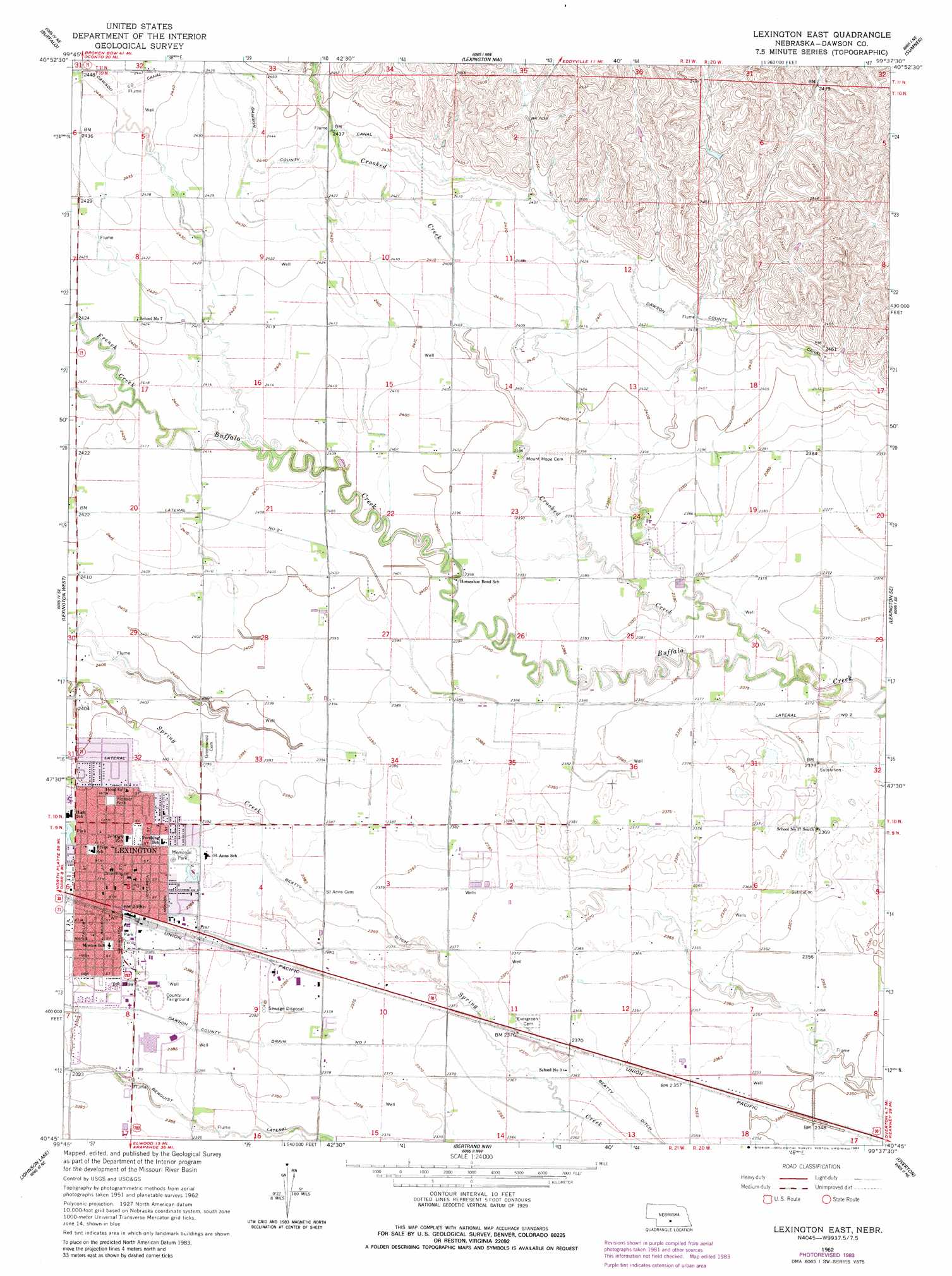
USGS Topo Quad 40099g6 - 1:24,000 scale
| Topo Map Name: | Lexington East |
| USGS Topo Quad ID: | 40099g6 |
| Print Size: | ca. 21 1/4" wide x 27" high |
| Southeast Coordinates: | 40.75° N latitude / 99.625° W longitude |
| Map Center Coordinates: | 40.8125° N latitude / 99.6875° W longitude |
| U.S. State: | NE |
| Filename: | O40099g6.jpg |
| Download Map JPG Image: | Lexington East topo map 1:24,000 scale |
| Map Type: | Topographic |
| Topo Series: | 7.5´ |
| Map Scale: | 1:24,000 |
| Source of Map Images: | United States Geological Survey (USGS) |
| Alternate Map Versions: |
Lexington East NE 1962, updated 1964 Download PDF Buy paper map Lexington East NE 1962, updated 1984 Download PDF Buy paper map Lexington East NE 2011 Download PDF Buy paper map Lexington East NE 2014 Download PDF Buy paper map |
1:24,000 Topo Quads surrounding Lexington East
Oconto Sw |
Oconto Se |
Eddyville Sw |
Eddyville |
Mason City Sw |
Cozad Nw |
Buffalo |
Lexington Nw |
Sumner |
Miller |
Cozad |
Lexington West |
Lexington East |
Lexington Se |
Miller Sw |
Elwood Nw |
Johnson Lake |
Bertrand Nw |
Overton |
Elm Creek West |
Elwood Sw |
Elwood |
Bertrand |
Bertrand Se |
Elm Creek Sw |
> Back to 40099e1 at 1:100,000 scale
> Back to 40098a1 at 1:250,000 scale
> Back to U.S. Topo Maps home
Lexington East topo map: Gazetteer
Lexington East: Canals
Berquist Lateral elevation 726m 2381′Lateral Number 2 elevation 729m 2391′
Lexington East: Dams
Sherman Dam elevation 753m 2470′Lexington East: Parks
Arbor Park elevation 728m 2388′Memorial Park elevation 728m 2388′
Oak Park elevation 729m 2391′
Pioneer Park elevation 731m 2398′
Lexington East: Populated Places
Donald Price Mobile Home Park elevation 730m 2395′Lexington elevation 729m 2391′
Lexington East: Post Offices
Lexington Post Office elevation 729m 2391′Lexington East: Reservoirs
Sherman Reservoir elevation 753m 2470′Lexington East: Streams
Crooked Creek elevation 723m 2372′French Creek elevation 736m 2414′
Lexington East digital topo map on disk
Buy this Lexington East topo map showing relief, roads, GPS coordinates and other geographical features, as a high-resolution digital map file on DVD: