Cozad Nw Topo Map Nebraska
To zoom in, hover over the map of Cozad Nw
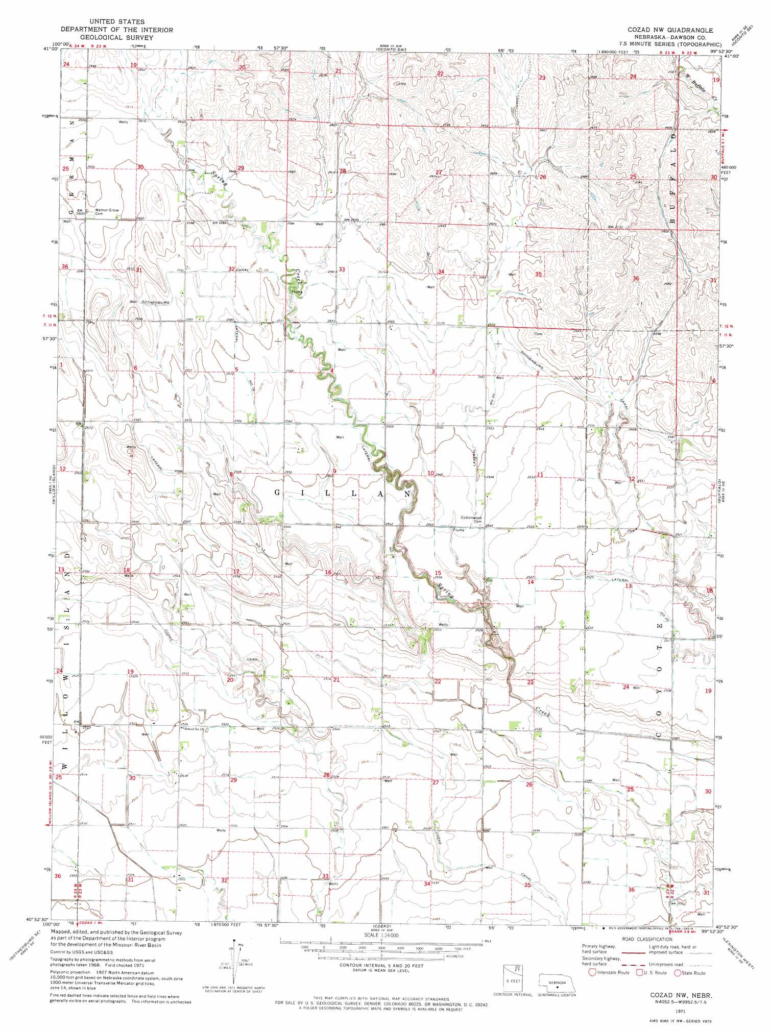
USGS Topo Quad 40099h8 - 1:24,000 scale
| Topo Map Name: | Cozad Nw |
| USGS Topo Quad ID: | 40099h8 |
| Print Size: | ca. 21 1/4" wide x 27" high |
| Southeast Coordinates: | 40.875° N latitude / 99.875° W longitude |
| Map Center Coordinates: | 40.9375° N latitude / 99.9375° W longitude |
| U.S. State: | NE |
| Filename: | O40099h8.jpg |
| Download Map JPG Image: | Cozad Nw topo map 1:24,000 scale |
| Map Type: | Topographic |
| Topo Series: | 7.5´ |
| Map Scale: | 1:24,000 |
| Source of Map Images: | United States Geological Survey (USGS) |
| Alternate Map Versions: |
Cozad NW NE 1971, updated 1973 Download PDF Buy paper map Cozad NW NE 2011 Download PDF Buy paper map Cozad NW NE 2014 Download PDF Buy paper map |
1:24,000 Topo Quads surrounding Cozad Nw
Odencranze Table North |
Roten Valley North |
Oconto Nw |
Oconto |
Eddyville Nw |
Odencranze Table South |
Roten Valley South |
Oconto Sw |
Oconto Se |
Eddyville Sw |
Gothenburg |
Willow Island |
Cozad Nw |
Buffalo |
Lexington Nw |
Gothenburg Sw |
Gothenburg Se |
Cozad |
Lexington West |
Lexington East |
Farnam |
Eustis |
Elwood Nw |
Johnson Lake |
Bertrand Nw |
> Back to 40099e1 at 1:100,000 scale
> Back to 40098a1 at 1:250,000 scale
> Back to U.S. Topo Maps home
Cozad Nw topo map: Gazetteer
Cozad Nw: Canals
Lateral Number 13 elevation 782m 2565′Lateral Number 16 elevation 778m 2552′
Lateral Number 20 elevation 774m 2539′
Cozad Nw: Dams
Floodwater Retarding Dam 9-A elevation 791m 2595′Cozad Nw: Reservoirs
Spring Creek Reservoir 9-A elevation 791m 2595′Cozad Nw digital topo map on disk
Buy this Cozad Nw topo map showing relief, roads, GPS coordinates and other geographical features, as a high-resolution digital map file on DVD: