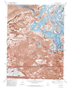
Saltair Topo Map Utah
To zoom in, hover over the map of Saltair
USGS Topo Quad 40112g1 - 1:24,000 scale
| Topo Map Name: | Saltair |
| USGS Topo Quad ID: | 40112g1 |
| Print Size: | ca. 21 1/4" wide x 27" high |
| Southeast Coordinates: | 40.75° N latitude / 112° W longitude |
| Map Center Coordinates: | 40.8125° N latitude / 112.0625° W longitude |
| U.S. State: | UT |
| Filename: | p40112g1.jpg |
| Download Map JPG Image: | Saltair topo map 1:24,000 scale |
| Map Type: | Orthophoto |
| Topo Series: | 7.5´ |
| Map Scale: | 1:24,000 |
| Source of Map Images: | United States Geological Survey (USGS) |
| Alternate Map Versions: |
Saltair UT 1951, updated 1952 Download PDF Buy paper map Saltair UT 1951, updated 1963 Download PDF Buy paper map Saltair UT 1972, updated 1975 Download PDF Buy paper map Saltair UT 1972, updated 1983 Download PDF Buy paper map Saltair UT 1972, updated 1993 Download PDF Buy paper map Saltair UT 1972, updated 1993 Download PDF Buy paper map Baileys Lake UT 1997, updated 2001 Download PDF Buy paper map Baileys Lake UT 2011 Download PDF Buy paper map Baileys Lake UT 2014 Download PDF Buy paper map |
1:24,000 Topo Quads surrounding Saltair
> Back to 40112e1 at 1:100,000 scale
> Back to 40112a1 at 1:250,000 scale
> Back to U.S. Topo Maps home
Saltair topo map: Gazetteer
Saltair: Canals
Brighton Drain elevation 1286m 4219′Goggin Drain elevation 1285m 4215′
North Point Consolidated Canal elevation 1287m 4222′
Riter Drain elevation 1286m 4219′
West Branch Brighton Canal elevation 1292m 4238′
Saltair: Crossings
Interchange 113 elevation 1290m 4232′Saltair: Islands
Browns Island elevation 1284m 4212′Saltair: Lakes
Baileys Lake elevation 1285m 4215′Saltair: Populated Places
Bonneville Center elevation 1288m 4225′Maplewood Addition elevation 1289m 4229′
Riter elevation 1286m 4219′
Salt Lake International Center elevation 1288m 4225′
Terminal elevation 1290m 4232′
Saltair: Springs
Salt Spring elevation 1287m 4222′Saltair: Summits
Cow Bay Knoll elevation 1284m 4212′Rabbit Knoll elevation 1284m 4212′
Round Knoll elevation 1283m 4209′
Saltair digital topo map on disk
Buy this Saltair topo map showing relief, roads, GPS coordinates and other geographical features, as a high-resolution digital map file on DVD:


