Sharp Peak Topo Map Nevada
To zoom in, hover over the map of Sharp Peak
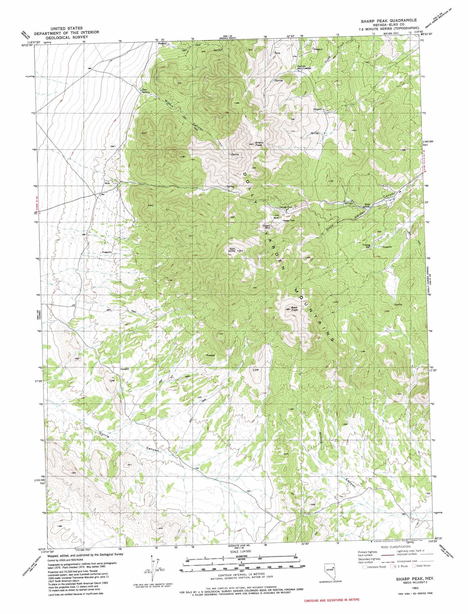
USGS Topo Quad 40114c5 - 1:24,000 scale
| Topo Map Name: | Sharp Peak |
| USGS Topo Quad ID: | 40114c5 |
| Print Size: | ca. 21 1/4" wide x 27" high |
| Southeast Coordinates: | 40.25° N latitude / 114.5° W longitude |
| Map Center Coordinates: | 40.3125° N latitude / 114.5625° W longitude |
| U.S. State: | NV |
| Filename: | o40114c5.jpg |
| Download Map JPG Image: | Sharp Peak topo map 1:24,000 scale |
| Map Type: | Topographic |
| Topo Series: | 7.5´ |
| Map Scale: | 1:24,000 |
| Source of Map Images: | United States Geological Survey (USGS) |
| Alternate Map Versions: |
Sharp Peak NV 1982, updated 1982 Download PDF Buy paper map Sharp Peak NV 2012 Download PDF Buy paper map Sharp Peak NV 2014 Download PDF Buy paper map |
1:24,000 Topo Quads surrounding Sharp Peak
Spruce Mountain |
Boone Spring |
Dolly Varden |
Decoy Sw |
Lion Spring |
Palomino Ridge |
Mizpah |
Mizpah Point |
White Horse Mountain Nw |
Goshute Peak |
Currie Gardens |
Currie |
Sharp Peak |
Dolly Varden Spring |
White Horse Mountain |
Mcdermid Ranch |
Goshute Lake North |
Goshute Lake Ne |
Boone Canyon |
Kinsley Mountain |
Goshute Creek |
Goshute Lake South |
Lages Station |
Chin Creek Spring |
Chin Creek Reservoir |
> Back to 40114a1 at 1:100,000 scale
> Back to 40114a1 at 1:250,000 scale
> Back to U.S. Topo Maps home
Sharp Peak topo map: Gazetteer
Sharp Peak: Dams
Victoria Tailings Dam elevation 2195m 7201′Sharp Peak: Mines
Dolly Varden Mines elevation 2101m 6893′Victoria Mine elevation 2231m 7319′
Sharp Peak: Ranges
Dolly Varden Mountains elevation 2251m 7385′Sharp Peak: Springs
Black Rock Spring elevation 2015m 6610′Deer Spring elevation 2255m 7398′
Deer Spring elevation 1960m 6430′
Joe Moore Spring elevation 2040m 6692′
Mizpah Springs elevation 2107m 6912′
North Creek Spring elevation 2051m 6729′
Summit Spring elevation 2321m 7614′
Sharp Peak: Summits
Bald Peak elevation 2476m 8123′Sharp Peak elevation 2553m 8375′
Sharp Peak: Valleys
Willow Canyon elevation 1946m 6384′Sharp Peak: Wells
Fourmile Well elevation 2123m 6965′Sharp Peak digital topo map on disk
Buy this Sharp Peak topo map showing relief, roads, GPS coordinates and other geographical features, as a high-resolution digital map file on DVD: