White Horse Mountain Topo Map Nevada
To zoom in, hover over the map of White Horse Mountain
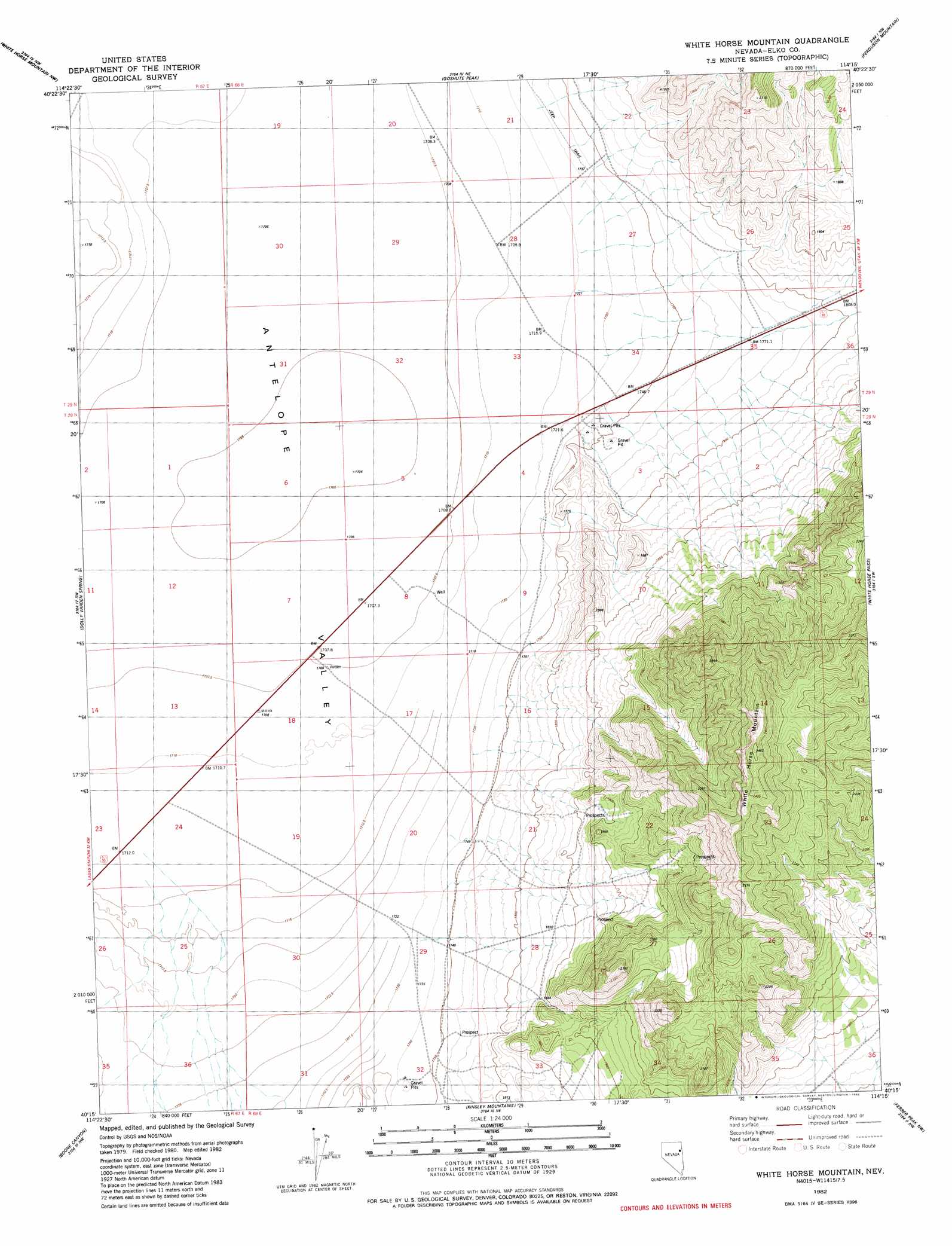
USGS Topo Quad 40114c3 - 1:24,000 scale
| Topo Map Name: | White Horse Mountain |
| USGS Topo Quad ID: | 40114c3 |
| Print Size: | ca. 21 1/4" wide x 27" high |
| Southeast Coordinates: | 40.25° N latitude / 114.25° W longitude |
| Map Center Coordinates: | 40.3125° N latitude / 114.3125° W longitude |
| U.S. State: | NV |
| Filename: | o40114c3.jpg |
| Download Map JPG Image: | White Horse Mountain topo map 1:24,000 scale |
| Map Type: | Topographic |
| Topo Series: | 7.5´ |
| Map Scale: | 1:24,000 |
| Source of Map Images: | United States Geological Survey (USGS) |
| Alternate Map Versions: |
White Horse Mountain NV 1982, updated 1982 Download PDF Buy paper map White Horse Mountain NV 2012 Download PDF Buy paper map White Horse Mountain NV 2014 Download PDF Buy paper map |
1:24,000 Topo Quads surrounding White Horse Mountain
Dolly Varden |
Decoy Sw |
Lion Spring |
Spring Gulch |
Wendover Se |
Mizpah Point |
White Horse Mountain Nw |
Goshute Peak |
Ferguson Mountain |
Ferguson Flat |
Sharp Peak |
Dolly Varden Spring |
White Horse Mountain |
White Horse Pass |
Utah Peak |
Goshute Lake Ne |
Boone Canyon |
Kinsley Mountain |
Ferber Peak Nw |
Ferber Peak |
Lages Station |
Chin Creek Spring |
Chin Creek Reservoir |
Ayarbe Spring |
Ferber Peak Se |
> Back to 40114a1 at 1:100,000 scale
> Back to 40114a1 at 1:250,000 scale
> Back to U.S. Topo Maps home
White Horse Mountain topo map: Gazetteer
White Horse Mountain: Flats
Dolly Varden Flat elevation 1713m 5620′White Horse Mountain: Ranges
Goshute Mountains elevation 2151m 7057′White Horse Mountain: Springs
Battle Spring Number One elevation 2024m 6640′Battle Spring Number Three elevation 2057m 6748′
Battle Spring Number Two elevation 1917m 6289′
Little White Horse Spring elevation 1950m 6397′
White Horse Springs elevation 1967m 6453′
White Horse Mountain: Summits
Sugar Loaf Peak elevation 2431m 7975′White Horse Mountain elevation 2386m 7828′
White Horse Mountain: Wells
Highway Well elevation 1709m 5606′White Horse Mountain digital topo map on disk
Buy this White Horse Mountain topo map showing relief, roads, GPS coordinates and other geographical features, as a high-resolution digital map file on DVD: