Telegraph Canyon Topo Map Nevada
To zoom in, hover over the map of Telegraph Canyon
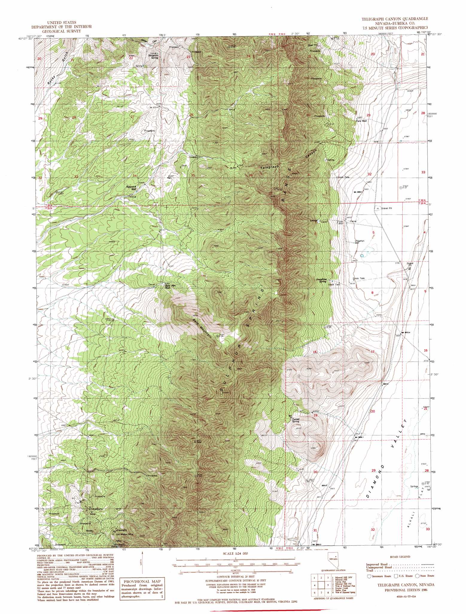
USGS Topo Quad 40116a1 - 1:24,000 scale
| Topo Map Name: | Telegraph Canyon |
| USGS Topo Quad ID: | 40116a1 |
| Print Size: | ca. 21 1/4" wide x 27" high |
| Southeast Coordinates: | 40° N latitude / 116° W longitude |
| Map Center Coordinates: | 40.0625° N latitude / 116.0625° W longitude |
| U.S. State: | NV |
| Filename: | o40116a1.jpg |
| Download Map JPG Image: | Telegraph Canyon topo map 1:24,000 scale |
| Map Type: | Topographic |
| Topo Series: | 7.5´ |
| Map Scale: | 1:24,000 |
| Source of Map Images: | United States Geological Survey (USGS) |
| Alternate Map Versions: |
Telegraph Canyon NV 1986, updated 1986 Download PDF Buy paper map Telegraph Canyon NV 2012 Download PDF Buy paper map Telegraph Canyon NV 2014 Download PDF Buy paper map |
1:24,000 Topo Quads surrounding Telegraph Canyon
Thatcher Spring |
West Of Coffin Mountain |
Coffin Mountain |
Bailey Mountain |
East Of Bailey Mountain |
Curlow Flat |
Mineral Hill Nw |
Mineral Hill |
Garcia Flat |
Sadler Basin |
Pete Hanson Creek |
Mineral Hill Sw |
Telegraph Canyon |
West Of Railroad Pass |
Railroad Pass |
Cooper Peak |
Frazier Creek |
Bailey Pass |
West Of Diamond Springs |
Diamond Springs |
Roberts Creek Mountain |
Garden Pass |
Tule Dam Spring |
West Of Christina Peak |
Christina Peak |
> Back to 40116a1 at 1:100,000 scale
> Back to 40116a1 at 1:250,000 scale
> Back to U.S. Topo Maps home
Telegraph Canyon topo map: Gazetteer
Telegraph Canyon: Lakes
Lake Dou-Pah-Gade elevation 1766m 5793′Telegraph Canyon: Mines
Bear Mine elevation 1995m 6545′Old Whalen Mine elevation 2090m 6856′
Telegraph Canyon: Springs
Bald Mountain Spring elevation 2025m 6643′Bennett Spring elevation 1763m 5784′
Bennett Spring Number One elevation 1762m 5780′
Flynn Ranch Springs elevation 1857m 6092′
Josephine Spring elevation 1830m 6003′
Siri Spring elevation 1956m 6417′
Stimpson Spring elevation 2007m 6584′
Tunnel Spring elevation 1922m 6305′
Telegraph Canyon: Summits
Bald Mountain elevation 2332m 7650′Telegraph Canyon: Valleys
Telegraph Canyon elevation 1836m 6023′Telegraph Canyon: Wells
Bald Mountain Well elevation 2039m 6689′Fera Well elevation 1820m 5971′
Ryepatch Well elevation 1996m 6548′
Telegraph Canyon digital topo map on disk
Buy this Telegraph Canyon topo map showing relief, roads, GPS coordinates and other geographical features, as a high-resolution digital map file on DVD: