Coffin Mountain Topo Map Nevada
To zoom in, hover over the map of Coffin Mountain
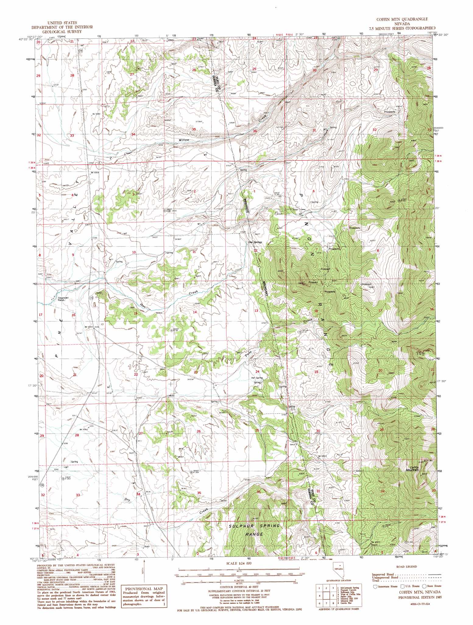
USGS Topo Quad 40116c1 - 1:24,000 scale
| Topo Map Name: | Coffin Mountain |
| USGS Topo Quad ID: | 40116c1 |
| Print Size: | ca. 21 1/4" wide x 27" high |
| Southeast Coordinates: | 40.25° N latitude / 116° W longitude |
| Map Center Coordinates: | 40.3125° N latitude / 116.0625° W longitude |
| U.S. State: | NV |
| Filename: | o40116c1.jpg |
| Download Map JPG Image: | Coffin Mountain topo map 1:24,000 scale |
| Map Type: | Topographic |
| Topo Series: | 7.5´ |
| Map Scale: | 1:24,000 |
| Source of Map Images: | United States Geological Survey (USGS) |
| Alternate Map Versions: |
Coffin Mtn NV 1985, updated 1986 Download PDF Buy paper map Coffin Mountain NV 2012 Download PDF Buy paper map Coffin Mountain NV 2015 Download PDF Buy paper map |
1:24,000 Topo Quads surrounding Coffin Mountain
Scotts Gulch |
Palisade |
Ravens Nest |
Bullion |
Red Spring |
Frenchie Flat |
Mccormack Spring |
Papoose Canyon |
Robinson Mountain |
Cedar Ridge |
Thatcher Spring |
West Of Coffin Mountain |
Coffin Mountain |
Bailey Mountain |
East Of Bailey Mountain |
Curlow Flat |
Mineral Hill Nw |
Mineral Hill |
Garcia Flat |
Sadler Basin |
Pete Hanson Creek |
Mineral Hill Sw |
Telegraph Canyon |
West Of Railroad Pass |
Railroad Pass |
> Back to 40116a1 at 1:100,000 scale
> Back to 40116a1 at 1:250,000 scale
> Back to U.S. Topo Maps home
Coffin Mountain topo map: Gazetteer
Coffin Mountain: Springs
Carlotti Ranch Springs elevation 1706m 5597′Hot Springs elevation 1745m 5725′
Coffin Mountain: Summits
Coffin Mountain elevation 2476m 8123′Coffin Mountain: Valleys
Copper Canyon elevation 1715m 5626′Coffin Mountain digital topo map on disk
Buy this Coffin Mountain topo map showing relief, roads, GPS coordinates and other geographical features, as a high-resolution digital map file on DVD: