Hog Spring Topo Map Nevada
To zoom in, hover over the map of Hog Spring
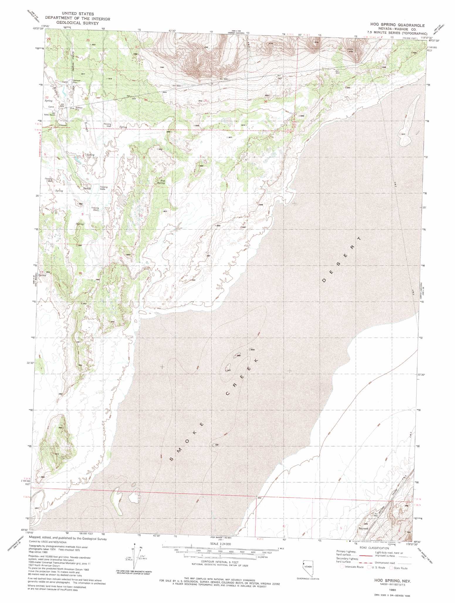
USGS Topo Quad 40119e6 - 1:24,000 scale
| Topo Map Name: | Hog Spring |
| USGS Topo Quad ID: | 40119e6 |
| Print Size: | ca. 21 1/4" wide x 27" high |
| Southeast Coordinates: | 40.5° N latitude / 119.625° W longitude |
| Map Center Coordinates: | 40.5625° N latitude / 119.6875° W longitude |
| U.S. State: | NV |
| Filename: | o40119e6.jpg |
| Download Map JPG Image: | Hog Spring topo map 1:24,000 scale |
| Map Type: | Topographic |
| Topo Series: | 7.5´ |
| Map Scale: | 1:24,000 |
| Source of Map Images: | United States Geological Survey (USGS) |
| Alternate Map Versions: |
Hog Spring NV 1980, updated 1981 Download PDF Buy paper map Hog Spring NV 2011 Download PDF Buy paper map Hog Spring NV 2014 Download PDF Buy paper map |
1:24,000 Topo Quads surrounding Hog Spring
Hole In The Ground |
Eddies Garden |
Poodle Mountain |
Squaw Valley |
The Banjo |
Mixie Flat |
Buffalo Creek |
Horse Canyon |
Wall Spring |
Godeys Rock |
Smoke Creek Ranch |
Salt Marsh |
Hog Spring |
Smith Canyon |
West Of Empire |
Red Rock Canyon |
Sheepshead Spring |
Reynard |
Pah-Rum Peak |
San Emidio Desert North |
Parker Canyon |
Sand Pass |
Emerson Pass |
Fox Canyon |
San Emidio Desert South |
> Back to 40119e1 at 1:100,000 scale
> Back to 40118a1 at 1:250,000 scale
> Back to U.S. Topo Maps home
Hog Spring topo map: Gazetteer
Hog Spring: Mines
Buffalo Springs Salt Works elevation 1182m 3877′Hog Spring: Populated Places
Buffalo Meadows (historical) elevation 1189m 3900′Reynard elevation 1187m 3894′
Hog Spring: Post Offices
Buffalo Meadows Post Office (historical) elevation 1189m 3900′Hog Spring: Springs
Hog Spring elevation 1179m 3868′Hog Spring: Streams
Buffalo Creek elevation 1174m 3851′Buffalo Slough elevation 1182m 3877′
Hog Spring digital topo map on disk
Buy this Hog Spring topo map showing relief, roads, GPS coordinates and other geographical features, as a high-resolution digital map file on DVD: