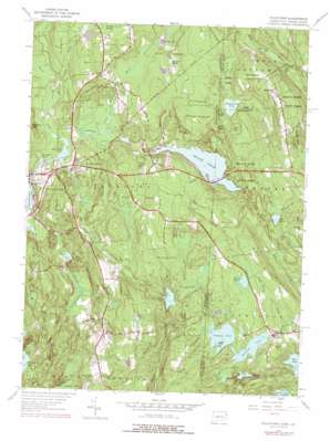
Voluntown Topo Map Connecticut
To zoom in, hover over the map of Voluntown
USGS Topo Quad 41071e7 - 1:24,000 scale
| Topo Map Name: | Voluntown |
| USGS Topo Quad ID: | 41071e7 |
| Print Size: | ca. 21 1/4" wide x 27" high |
| Southeast Coordinates: | 41.5° N latitude / 71.75° W longitude |
| Map Center Coordinates: | 41.5625° N latitude / 71.8125° W longitude |
| U.S. States: | CT, RI |
| Filename: | o41071e7.jpg |
| Download Map JPG Image: | Voluntown topo map 1:24,000 scale |
| Map Type: | Topographic |
| Topo Series: | 7.5´ |
| Map Scale: | 1:24,000 |
| Source of Map Images: | United States Geological Survey (USGS) |
| Alternate Map Versions: |
Voluntown CT 1943, updated 1972 Download PDF Buy paper map Voluntown CT 1953, updated 1957 Download PDF Buy paper map Voluntown CT 1953, updated 1962 Download PDF Buy paper map Voluntown CT 1953, updated 1976 Download PDF Buy paper map Voluntown CT 1953, updated 1976 Download PDF Buy paper map Voluntown CT 2001, updated 2003 Download PDF Buy paper map Voluntown CT 2012 Download PDF Buy paper map Voluntown CT 2015 Download PDF Buy paper map |
1:24,000 Topo Quads surrounding Voluntown
> Back to 41071e1 at 1:100,000 scale
> Back to 41070a1 at 1:250,000 scale
> Back to U.S. Topo Maps home
Voluntown topo map: Gazetteer
Voluntown: Airports
Gallup Farm Airport elevation 128m 419′Voluntown: Bays
Upper Deep Hole elevation 87m 285′Voluntown: Bridges
Tanners Bridge elevation 82m 269′Voluntown: Dams
Ashville Pond Dam elevation 50m 164′Beach Pond Dam elevation 90m 295′
Beachdale Pond Dam elevation 81m 265′
Douglas Pond Dam elevation 133m 436′
Great Meadow Brook Pond Dam elevation 98m 321′
Green Fall Pond Dam elevation 95m 311′
Long Pond Dam elevation 97m 318′
Sawmill Pond Dam elevation 73m 239′
Wiclcabouet Marsh Dam elevation 115m 377′
Wincheck Pond Dam elevation 93m 305′
Yawgoog Pond Dam elevation 98m 321′
Voluntown: Falls
Stepstone Falls elevation 82m 269′Voluntown: Islands
Phillips Island elevation 102m 334′Voluntown: Lakes
Ashville Pond elevation 51m 167′Beach Pond elevation 90m 295′
Dawley Pond elevation 114m 374′
Deep Pond elevation 96m 314′
Ell Pond elevation 98m 321′
Grassy Pond elevation 108m 354′
Green Fall Pond elevation 95m 311′
Hodge Pond elevation 64m 209′
Long Pond elevation 97m 318′
Mason-Gray Pond elevation 92m 301′
Palmer Pond elevation 139m 456′
Tippecansett Pond elevation 120m 393′
Wincheck Pond elevation 93m 305′
Voluntown: Parks
Rockville Management and Public Fishing Area elevation 71m 232′Voluntown: Populated Places
Beachdale elevation 83m 272′Escoheag elevation 156m 511′
Rockville elevation 98m 321′
Voluntown elevation 82m 269′
Voluntown: Post Offices
Voluntown Post Office elevation 85m 278′Voluntown: Reservoirs
Beach Pond elevation 90m 295′Beachdale Pond elevation 81m 265′
Douglas Pond elevation 133m 436′
Great Meadow Brook Pond elevation 98m 321′
Sawmill Pond elevation 73m 239′
Wiclcabouet Marsh elevation 115m 377′
Wincheck Pond elevation 93m 305′
Yawgoog Pond elevation 98m 321′
Voluntown: Streams
Bliven Brook elevation 84m 275′Dark Hollow Brook elevation 67m 219′
Denison Brook elevation 81m 265′
Great Meadow Brook elevation 82m 269′
Kelley Brook elevation 62m 203′
Koistenen Brook elevation 68m 223′
Log House Brook elevation 72m 236′
Lowden Brook elevation 82m 269′
Mount Misery Brook elevation 87m 285′
Myron Kinney Brook elevation 57m 187′
Peg Mill Brook elevation 65m 213′
Voluntown: Summits
Dye Hill elevation 138m 452′Escoheag Hill elevation 168m 551′
Mount Misery elevation 130m 426′
Pendleton Hill elevation 153m 501′
Voluntown: Swamps
Erickson Wildlife Marsh elevation 97m 318′Great Meadow Wildlife Marsh elevation 97m 318′
Voluntown: Trails
Narragansett Trail elevation 117m 383′Voluntown digital topo map on disk
Buy this Voluntown topo map showing relief, roads, GPS coordinates and other geographical features, as a high-resolution digital map file on DVD:
Maine, New Hampshire, Rhode Island & Eastern Massachusetts
Buy digital topo maps: Maine, New Hampshire, Rhode Island & Eastern Massachusetts


