Paulding Topo Map Ohio
To zoom in, hover over the map of Paulding
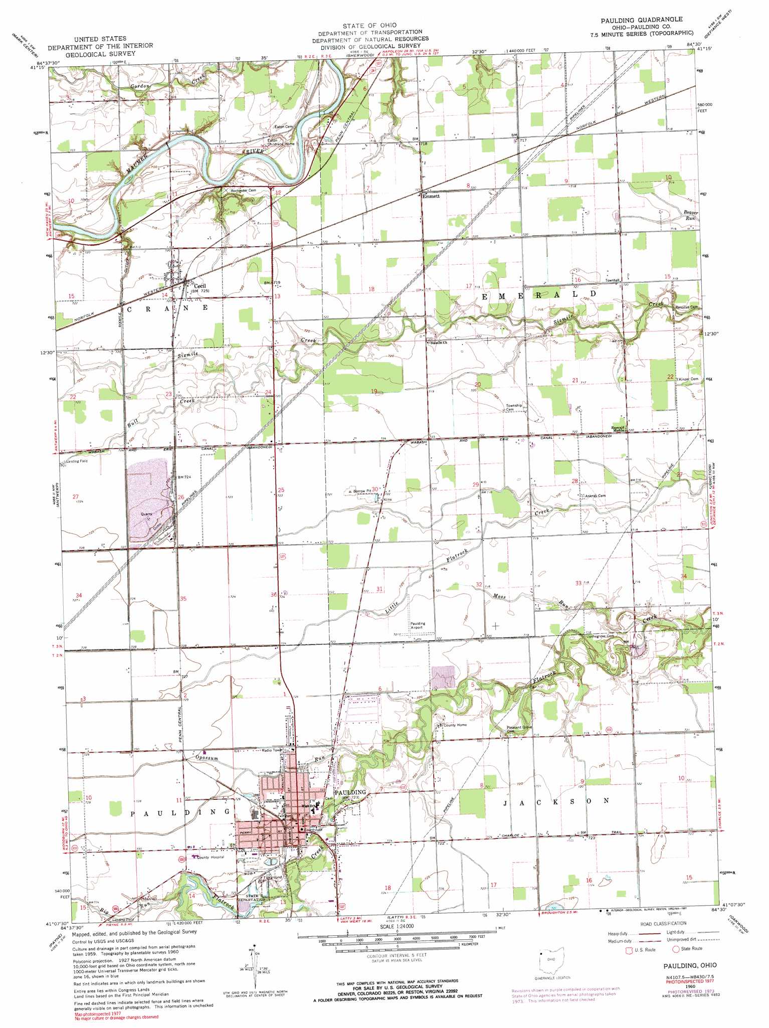
USGS Topo Quad 41084b5 - 1:24,000 scale
| Topo Map Name: | Paulding |
| USGS Topo Quad ID: | 41084b5 |
| Print Size: | ca. 21 1/4" wide x 27" high |
| Southeast Coordinates: | 41.125° N latitude / 84.5° W longitude |
| Map Center Coordinates: | 41.1875° N latitude / 84.5625° W longitude |
| U.S. State: | OH |
| Filename: | o41084b5.jpg |
| Download Map JPG Image: | Paulding topo map 1:24,000 scale |
| Map Type: | Topographic |
| Topo Series: | 7.5´ |
| Map Scale: | 1:24,000 |
| Source of Map Images: | United States Geological Survey (USGS) |
| Alternate Map Versions: |
Paulding OH 1960, updated 1961 Download PDF Buy paper map Paulding OH 1960, updated 1973 Download PDF Buy paper map Paulding OH 1960, updated 1991 Download PDF Buy paper map Paulding OH 2010 Download PDF Buy paper map Paulding OH 2013 Download PDF Buy paper map Paulding OH 2016 Download PDF Buy paper map |
1:24,000 Topo Quads surrounding Paulding
Butler East |
Edgerton |
Bryan |
Evansport |
Ridgeville Corners |
Hicksville |
Mark Center |
Sherwood |
Defiance West |
Defiance East |
Woodburn North |
Antwerp |
Paulding |
Junction |
Ayersville |
Woodburn South |
Payne |
Latty |
Oakwood |
Continental |
Dixon |
Convoy |
Scott |
Wetsel |
Ottoville |
> Back to 41084a1 at 1:100,000 scale
> Back to 41084a1 at 1:250,000 scale
> Back to U.S. Topo Maps home
Paulding topo map: Gazetteer
Paulding: Airports
Paulding Airport Inc Airport elevation 220m 721′Paulding: Canals
Sixmile Cutoff elevation 215m 705′Paulding: Mines
Paulding Quarry elevation 219m 718′Paulding: Parks
Black Swamp Nature Center elevation 219m 718′Cecil Community Park elevation 219m 718′
LaFountain Park elevation 218m 715′
New Rochester Park elevation 217m 711′
Paulding Athletic Field elevation 218m 715′
Paulding County Fairgrounds elevation 221m 725′
Paulding: Populated Places
Cecil elevation 220m 721′Emmett elevation 219m 718′
New Rochester elevation 219m 718′
Paulding elevation 219m 718′
Reids (historical) elevation 218m 715′
Paulding: Post Offices
Cecil Post Office elevation 221m 725′Emmett Post Office (historical) elevation 219m 718′
Paulding Post Office elevation 220m 721′
Reid Post Office (historical) elevation 219m 718′
Paulding: Streams
Big Run elevation 218m 715′Bull Creek elevation 216m 708′
Moss Run elevation 211m 692′
Opossum Run elevation 216m 708′
Paulding digital topo map on disk
Buy this Paulding topo map showing relief, roads, GPS coordinates and other geographical features, as a high-resolution digital map file on DVD:
Northern Illinois, Northern Indiana & Southwestern Michigan
Buy digital topo maps: Northern Illinois, Northern Indiana & Southwestern Michigan