Bristol Topo Map Indiana
To zoom in, hover over the map of Bristol
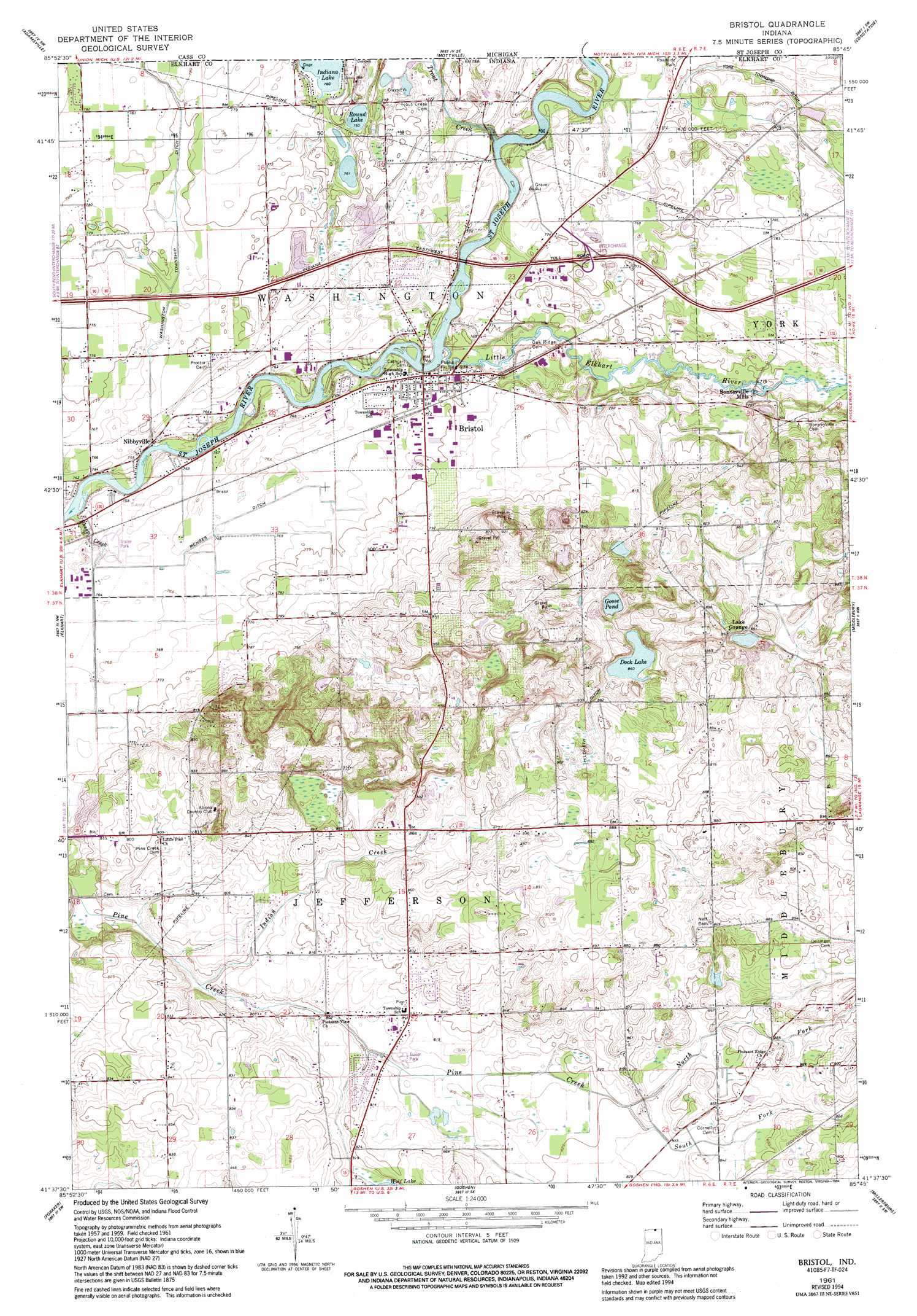
USGS Topo Quad 41085f7 - 1:24,000 scale
| Topo Map Name: | Bristol |
| USGS Topo Quad ID: | 41085f7 |
| Print Size: | ca. 21 1/4" wide x 27" high |
| Southeast Coordinates: | 41.625° N latitude / 85.75° W longitude |
| Map Center Coordinates: | 41.6875° N latitude / 85.8125° W longitude |
| U.S. State: | IN |
| Filename: | o41085f7.jpg |
| Download Map JPG Image: | Bristol topo map 1:24,000 scale |
| Map Type: | Topographic |
| Topo Series: | 7.5´ |
| Map Scale: | 1:24,000 |
| Source of Map Images: | United States Geological Survey (USGS) |
| Alternate Map Versions: |
Bristol IN 1961, updated 1963 Download PDF Buy paper map Bristol IN 1961, updated 1976 Download PDF Buy paper map Bristol IN 1961, updated 1982 Download PDF Buy paper map Bristol IN 1961, updated 1994 Download PDF Buy paper map Bristol IN 2011 Download PDF Buy paper map Bristol IN 2013 Download PDF Buy paper map Bristol IN 2016 Download PDF Buy paper map |
1:24,000 Topo Quads surrounding Bristol
Dowagiac |
Vandalia |
Jones |
Three Rivers West |
Three Rivers East |
Edwardsburg |
Adamsville |
Mottville |
Constantine |
Klinger Lake |
Osceola |
Elkhart |
Bristol |
Middlebury |
Shipshewana |
Wakarusa |
Foraker |
Goshen |
Millersburg |
Topeka |
Nappanee West |
Nappanee East |
Milford |
Lake Wawasee |
Ligonier |
> Back to 41085e1 at 1:100,000 scale
> Back to 41084a1 at 1:250,000 scale
> Back to U.S. Topo Maps home
Bristol topo map: Gazetteer
Bristol: Airports
Hatfield Airport elevation 259m 849′Bristol: Canals
Hildreth Ditch elevation 270m 885′Menges Ditch elevation 233m 764′
Washington Township Ditch elevation 234m 767′
York Township Ditch elevation 237m 777′
Bristol: Lakes
Dock Lake elevation 257m 843′Goose Pond elevation 250m 820′
Wolf Lake elevation 249m 816′
Bristol: Populated Places
Bonneyville Mills elevation 238m 780′Bristol elevation 236m 774′
Lake Grange elevation 264m 866′
Nibbyville elevation 230m 754′
Bristol: Streams
Indian Creek elevation 240m 787′Little Elkhart River elevation 225m 738′
North Fork Pine Creek elevation 252m 826′
Sheep Creek elevation 228m 748′
South Fork Pine Creek elevation 250m 820′
Trout Creek elevation 236m 774′
Trout Creek elevation 231m 757′
Bristol digital topo map on disk
Buy this Bristol topo map showing relief, roads, GPS coordinates and other geographical features, as a high-resolution digital map file on DVD:
Northern Illinois, Northern Indiana & Southwestern Michigan
Buy digital topo maps: Northern Illinois, Northern Indiana & Southwestern Michigan