Inwood Topo Map Indiana
To zoom in, hover over the map of Inwood
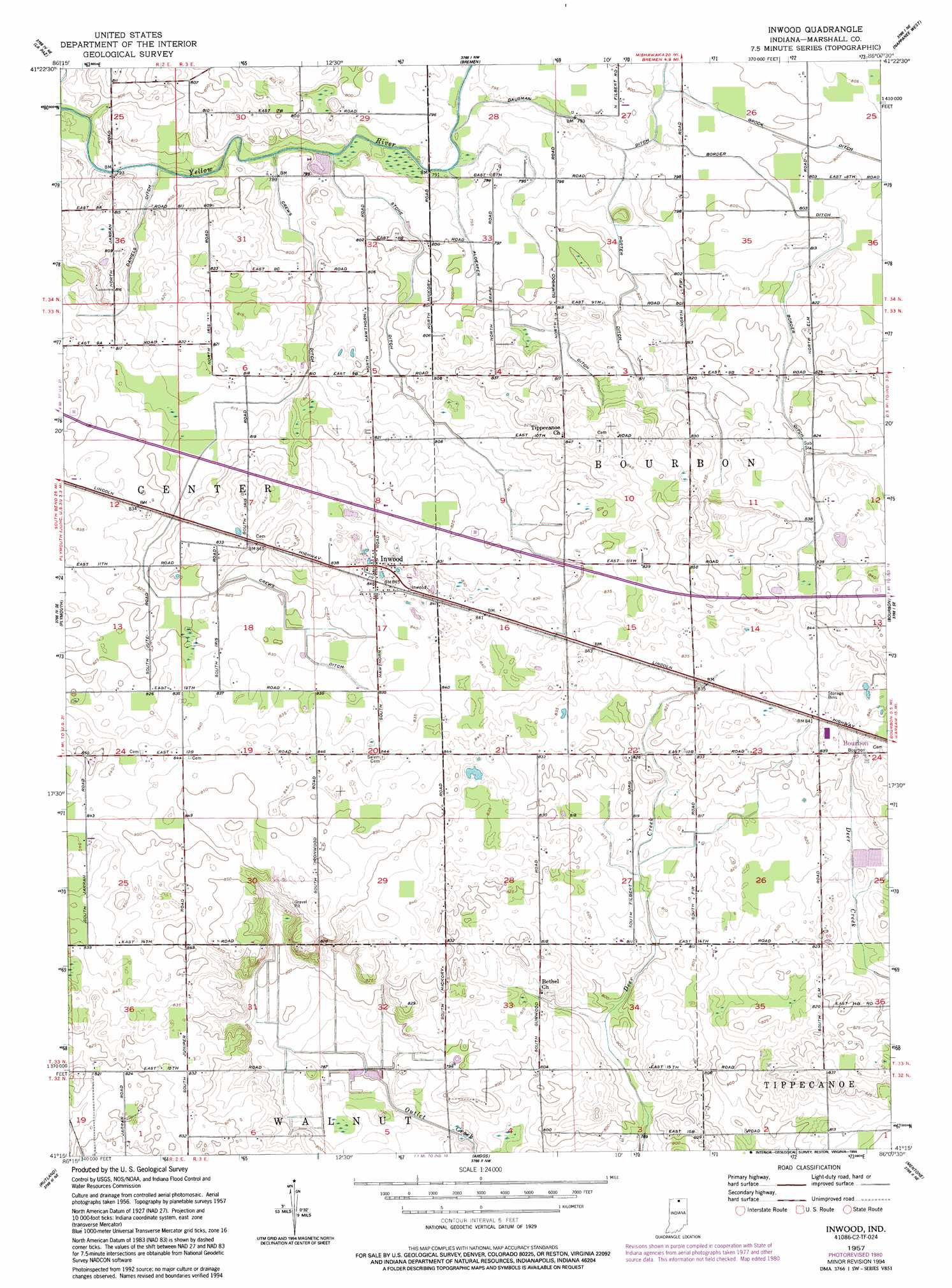
USGS Topo Quad 41086c2 - 1:24,000 scale
| Topo Map Name: | Inwood |
| USGS Topo Quad ID: | 41086c2 |
| Print Size: | ca. 21 1/4" wide x 27" high |
| Southeast Coordinates: | 41.25° N latitude / 86.125° W longitude |
| Map Center Coordinates: | 41.3125° N latitude / 86.1875° W longitude |
| U.S. State: | IN |
| Filename: | o41086c2.jpg |
| Download Map JPG Image: | Inwood topo map 1:24,000 scale |
| Map Type: | Topographic |
| Topo Series: | 7.5´ |
| Map Scale: | 1:24,000 |
| Source of Map Images: | United States Geological Survey (USGS) |
| Alternate Map Versions: |
Inwood IN 1957, updated 1958 Download PDF Buy paper map Inwood IN 1957, updated 1980 Download PDF Buy paper map Inwood IN 1957, updated 1994 Download PDF Buy paper map Inwood IN 2010 Download PDF Buy paper map Inwood IN 2013 Download PDF Buy paper map Inwood IN 2016 Download PDF Buy paper map |
1:24,000 Topo Quads surrounding Inwood
North Liberty |
Lakeville |
Wyatt |
Wakarusa |
Foraker |
Walkerton |
La Paz |
Bremen |
Nappanee West |
Nappanee East |
Donaldson |
Plymouth |
Inwood |
Bourbon |
Atwood |
Culver |
Rutland |
Argos |
Mentone |
Burket |
Kewanna |
Pershing |
Rochester |
Akron |
Silver Lake |
> Back to 41086a1 at 1:100,000 scale
> Back to 41086a1 at 1:250,000 scale
> Back to U.S. Topo Maps home
Inwood topo map: Gazetteer
Inwood: Airports
Scott Airfield elevation 247m 810′Tri State Airport elevation 253m 830′
Inwood: Canals
Alderfer Ditch elevation 243m 797′Bair Ditch elevation 247m 810′
Border Ditch elevation 248m 813′
Crews Ditch elevation 247m 810′
Daniels Ditch elevation 246m 807′
Porter Ditch elevation 245m 803′
Stone Ditch elevation 244m 800′
Inwood: Populated Places
Inwood elevation 257m 843′Inwood digital topo map on disk
Buy this Inwood topo map showing relief, roads, GPS coordinates and other geographical features, as a high-resolution digital map file on DVD:
Northern Illinois, Northern Indiana & Southwestern Michigan
Buy digital topo maps: Northern Illinois, Northern Indiana & Southwestern Michigan