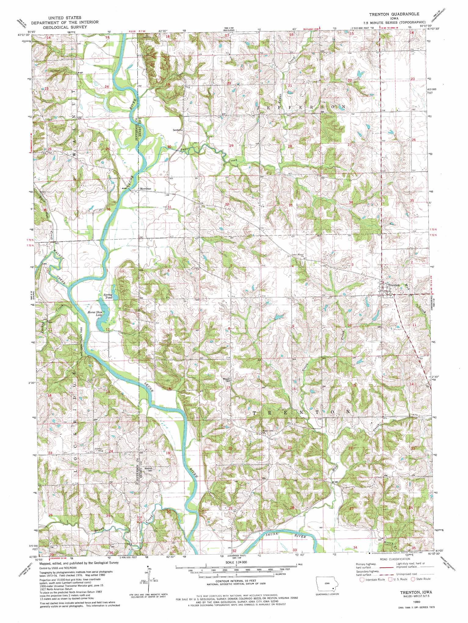
Trenton Topo Map Iowa
To zoom in, hover over the map of Trenton
USGS Topo Quad 41091a6 - 1:24,000 scale
| Topo Map Name: | Trenton |
| USGS Topo Quad ID: | 41091a6 |
| Print Size: | ca. 21 1/4" wide x 27" high |
| Southeast Coordinates: | 41° N latitude / 91.625° W longitude |
| Map Center Coordinates: | 41.0625° N latitude / 91.6875° W longitude |
| U.S. State: | IA |
| Filename: | o41091a6.jpg |
| Download Map JPG Image: | Trenton topo map 1:24,000 scale |
| Map Type: | Topographic |
| Topo Series: | 7.5´ |
| Map Scale: | 1:24,000 |
| Source of Map Images: | United States Geological Survey (USGS) |
| Alternate Map Versions: |
Trenton IA 1980, updated 1981 Download PDF Buy paper map Trenton IA 2010 Download PDF Buy paper map Trenton IA 2013 Download PDF Buy paper map Trenton IA 2015 Download PDF Buy paper map |
1:24,000 Topo Quads surrounding Trenton
Keota |
West Chester |
Washington |
Ainsworth |
Cotter |
Richland |
Brighton |
Wayland |
Crawfordsville |
Winfield North |
Fairfield North |
Salina |
Trenton |
Swedesburg |
Winfield South |
Fairfield South |
Lockridge West |
Lockridge East |
Mount Pleasant |
New London |
Mount Zion |
Stockport |
Hillsboro |
Salem |
Lowell |
> Back to 41091a1 at 1:100,000 scale
> Back to 41090a1 at 1:250,000 scale
> Back to U.S. Topo Maps home
Trenton topo map: Gazetteer
Trenton: Lakes
Horse Shoe Lake elevation 178m 583′Spring Pond elevation 178m 583′
Trenton: Parks
Mac Coon County Park elevation 180m 590′Trenton: Populated Places
Merrimac elevation 180m 590′Trenton elevation 223m 731′
Trenton: Post Offices
Merrimack Post Office (historical) elevation 180m 590′Trenton Post Office (historical) elevation 223m 731′
Trenton: Streams
Brush Creek elevation 173m 567′Burr Oak Creek elevation 178m 583′
Green Creek elevation 177m 580′
Sugar Creek elevation 180m 590′
Turkey Creek elevation 177m 580′
Walnut Creek elevation 177m 580′
Trenton digital topo map on disk
Buy this Trenton topo map showing relief, roads, GPS coordinates and other geographical features, as a high-resolution digital map file on DVD: