Wayland Topo Map Iowa
To zoom in, hover over the map of Wayland
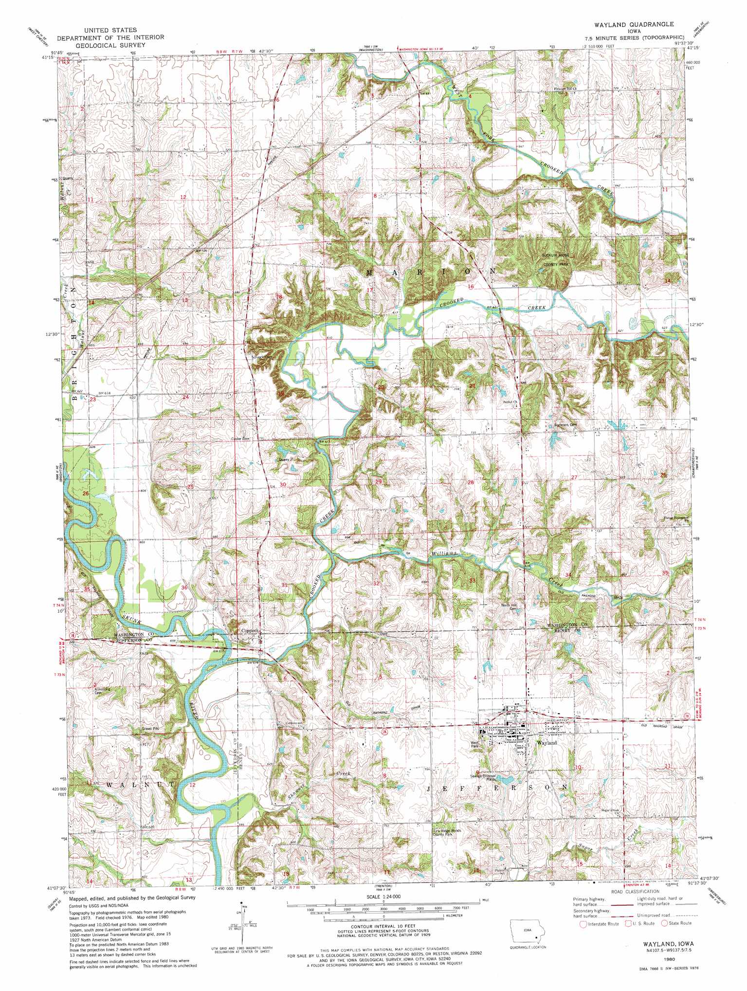
USGS Topo Quad 41091b6 - 1:24,000 scale
| Topo Map Name: | Wayland |
| USGS Topo Quad ID: | 41091b6 |
| Print Size: | ca. 21 1/4" wide x 27" high |
| Southeast Coordinates: | 41.125° N latitude / 91.625° W longitude |
| Map Center Coordinates: | 41.1875° N latitude / 91.6875° W longitude |
| U.S. State: | IA |
| Filename: | o41091b6.jpg |
| Download Map JPG Image: | Wayland topo map 1:24,000 scale |
| Map Type: | Topographic |
| Topo Series: | 7.5´ |
| Map Scale: | 1:24,000 |
| Source of Map Images: | United States Geological Survey (USGS) |
| Alternate Map Versions: |
Wayland IA 1980, updated 1981 Download PDF Buy paper map Wayland IA 2010 Download PDF Buy paper map Wayland IA 2013 Download PDF Buy paper map Wayland IA 2015 Download PDF Buy paper map |
1:24,000 Topo Quads surrounding Wayland
Kinross |
Wellman |
Kalona |
Riverside |
Lone Tree |
Keota |
West Chester |
Washington |
Ainsworth |
Cotter |
Richland |
Brighton |
Wayland |
Crawfordsville |
Winfield North |
Fairfield North |
Salina |
Trenton |
Swedesburg |
Winfield South |
Fairfield South |
Lockridge West |
Lockridge East |
Mount Pleasant |
New London |
> Back to 41091a1 at 1:100,000 scale
> Back to 41090a1 at 1:250,000 scale
> Back to U.S. Topo Maps home
Wayland topo map: Gazetteer
Wayland: Parks
Sockum Ridge County Park elevation 215m 705′Tick Ridge Woods County Park elevation 214m 702′
Tick Ridge Woods Park elevation 186m 610′
West Park elevation 210m 688′
Wayland: Populated Places
Coppock elevation 193m 633′Eureka (historical) elevation 226m 741′
Wayland elevation 223m 731′
Wayland: Post Offices
Coppock Post Office (historical) elevation 193m 633′Lake Post Office (historical) elevation 217m 711′
Marcellus Post Office (historical) elevation 225m 738′
Wayland Post Office elevation 223m 731′
Wayland: Streams
Crooked Creek elevation 183m 600′Shawnee Creek elevation 180m 590′
Walnut Creek elevation 185m 606′
Williams Creek elevation 184m 603′
Wayland: Trails
Sockum Ridge Park Trail elevation 215m 705′Wayland digital topo map on disk
Buy this Wayland topo map showing relief, roads, GPS coordinates and other geographical features, as a high-resolution digital map file on DVD: