Winfield North Topo Map Iowa
To zoom in, hover over the map of Winfield North
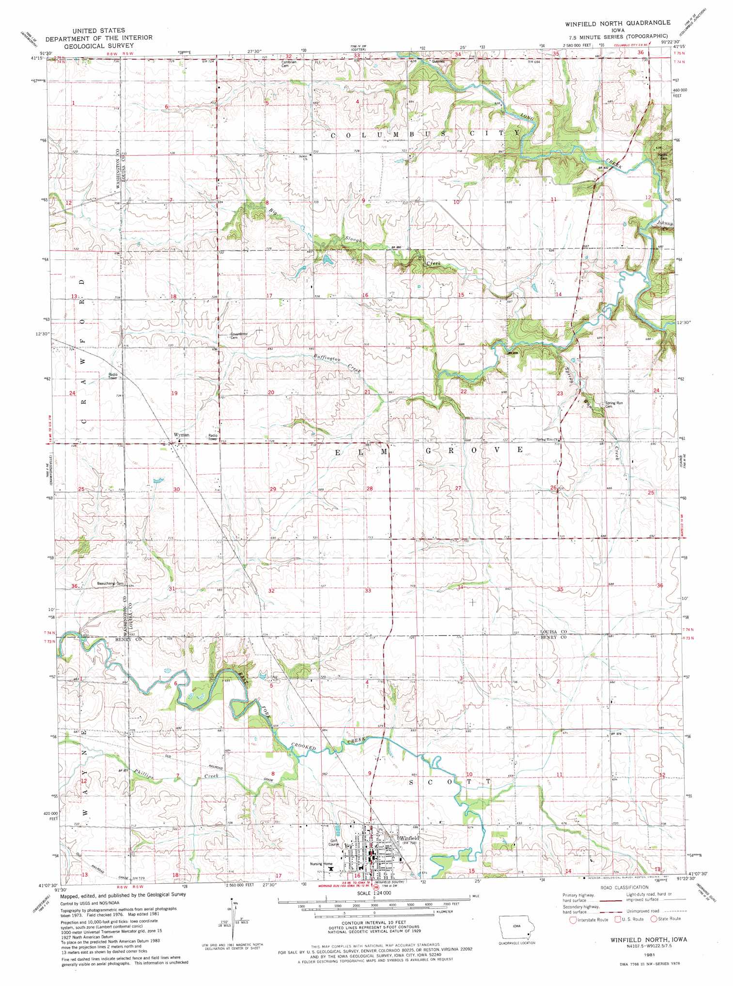
USGS Topo Quad 41091b4 - 1:24,000 scale
| Topo Map Name: | Winfield North |
| USGS Topo Quad ID: | 41091b4 |
| Print Size: | ca. 21 1/4" wide x 27" high |
| Southeast Coordinates: | 41.125° N latitude / 91.375° W longitude |
| Map Center Coordinates: | 41.1875° N latitude / 91.4375° W longitude |
| U.S. State: | IA |
| Filename: | o41091b4.jpg |
| Download Map JPG Image: | Winfield North topo map 1:24,000 scale |
| Map Type: | Topographic |
| Topo Series: | 7.5´ |
| Map Scale: | 1:24,000 |
| Source of Map Images: | United States Geological Survey (USGS) |
| Alternate Map Versions: |
Winfield North IA 1981, updated 1981 Download PDF Buy paper map Winfield North IA 2010 Download PDF Buy paper map Winfield North IA 2013 Download PDF Buy paper map Winfield North IA 2015 Download PDF Buy paper map |
1:24,000 Topo Quads surrounding Winfield North
Kalona |
Riverside |
Lone Tree |
Nichols |
Muscatine Nw |
Washington |
Ainsworth |
Cotter |
Columbus Junction |
Letts |
Wayland |
Crawfordsville |
Winfield North |
Cairo |
Wapello |
Trenton |
Swedesburg |
Winfield South |
Morning Sun |
Mediapolis |
Lockridge East |
Mount Pleasant |
New London |
Pleasant Grove |
Sperry |
> Back to 41091a1 at 1:100,000 scale
> Back to 41090a1 at 1:250,000 scale
> Back to U.S. Topo Maps home
Winfield North topo map: Gazetteer
Winfield North: Bridges
Gripple's Quarry Bridge elevation 191m 626′Winfield North: Populated Places
Wyman elevation 221m 725′Winfield North: Post Offices
Winfield Post Office elevation 214m 702′Wyman Post Office (historical) elevation 221m 725′
Winfield North: Streams
Big Slough Creek elevation 192m 629′Buffington Creek elevation 188m 616′
Johnny Creek elevation 186m 610′
Phillips Creek elevation 200m 656′
Spring Run Creek elevation 188m 616′
Winfield North digital topo map on disk
Buy this Winfield North topo map showing relief, roads, GPS coordinates and other geographical features, as a high-resolution digital map file on DVD: