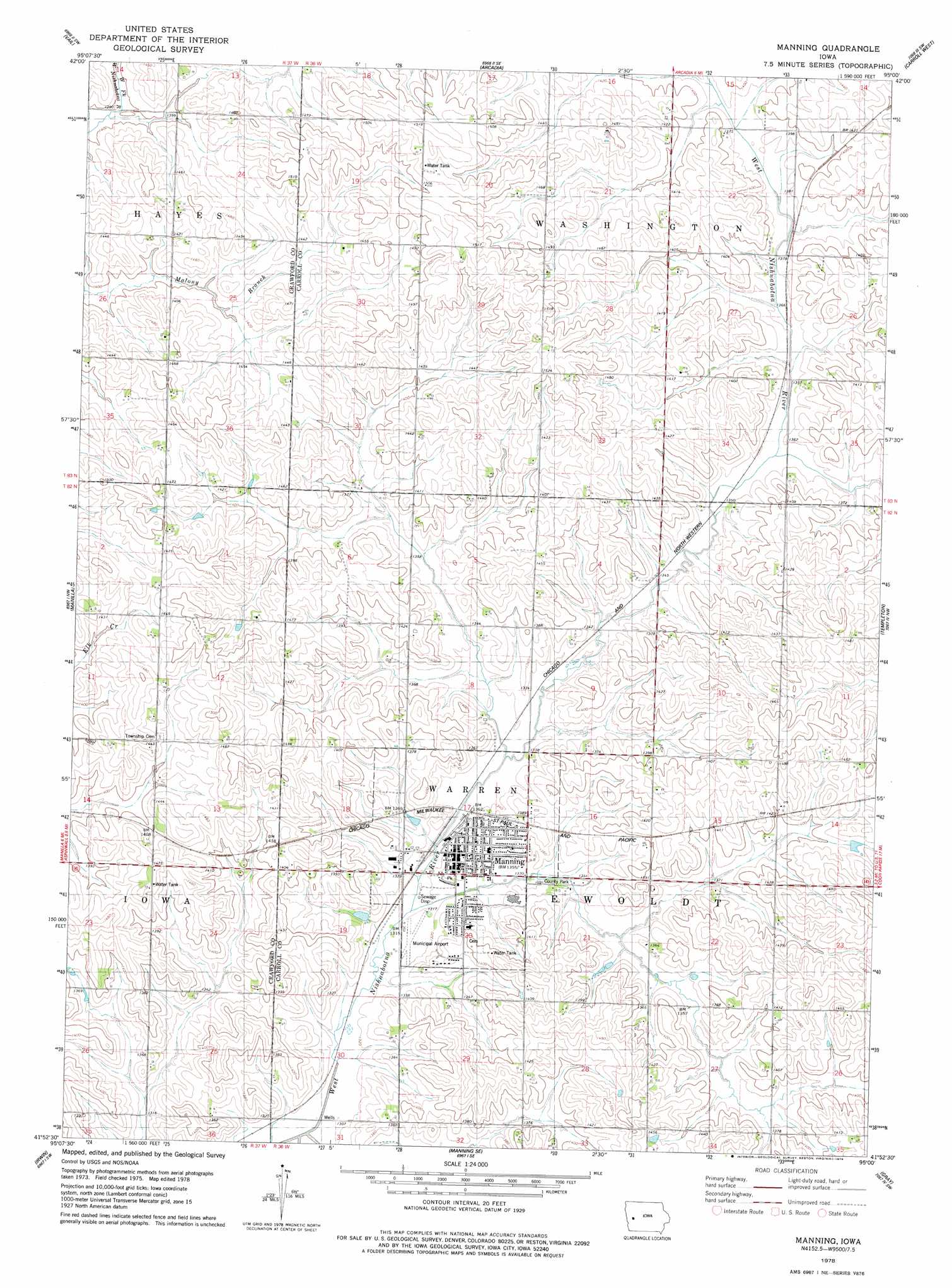
Manning Topo Map Iowa
To zoom in, hover over the map of Manning
USGS Topo Quad 41095h1 - 1:24,000 scale
| Topo Map Name: | Manning |
| USGS Topo Quad ID: | 41095h1 |
| Print Size: | ca. 21 1/4" wide x 27" high |
| Southeast Coordinates: | 41.875° N latitude / 95° W longitude |
| Map Center Coordinates: | 41.9375° N latitude / 95.0625° W longitude |
| U.S. State: | IA |
| Filename: | o41095h1.jpg |
| Download Map JPG Image: | Manning topo map 1:24,000 scale |
| Map Type: | Topographic |
| Topo Series: | 7.5´ |
| Map Scale: | 1:24,000 |
| Source of Map Images: | United States Geological Survey (USGS) |
| Alternate Map Versions: |
Manning IA 1978, updated 1978 Download PDF Buy paper map Manning IA 2010 Download PDF Buy paper map Manning IA 2013 Download PDF Buy paper map Manning IA 2015 Download PDF Buy paper map |
1:24,000 Topo Quads surrounding Manning
Kiron |
Boyer |
Vail Ne |
Breda |
Carroll Ne |
Denison |
Vail |
Arcadia |
Carroll West |
Carroll East |
Earling Ne |
Manilla |
Manning |
Templeton |
Dedham |
Defiance |
Irwin |
Manning Se |
Gray |
Viola Center |
Harlan |
Jacksonville |
Kimballton |
Audubon |
Gardner |
> Back to 41095e1 at 1:100,000 scale
> Back to 41094a1 at 1:250,000 scale
> Back to U.S. Topo Maps home
Manning topo map: Gazetteer
Manning: Airports
Manning Municipal Airport elevation 408m 1338′Manning: Parks
Carroll County Park elevation 406m 1332′Four Corners Recreation Area elevation 428m 1404′
Hausborn/Heritage Park elevation 408m 1338′
West Botna Park elevation 414m 1358′
Willow Creek Park elevation 407m 1335′
Manning: Populated Places
Manning elevation 414m 1358′Manning: Post Offices
Manning Post Office elevation 412m 1351′Manning digital topo map on disk
Buy this Manning topo map showing relief, roads, GPS coordinates and other geographical features, as a high-resolution digital map file on DVD: