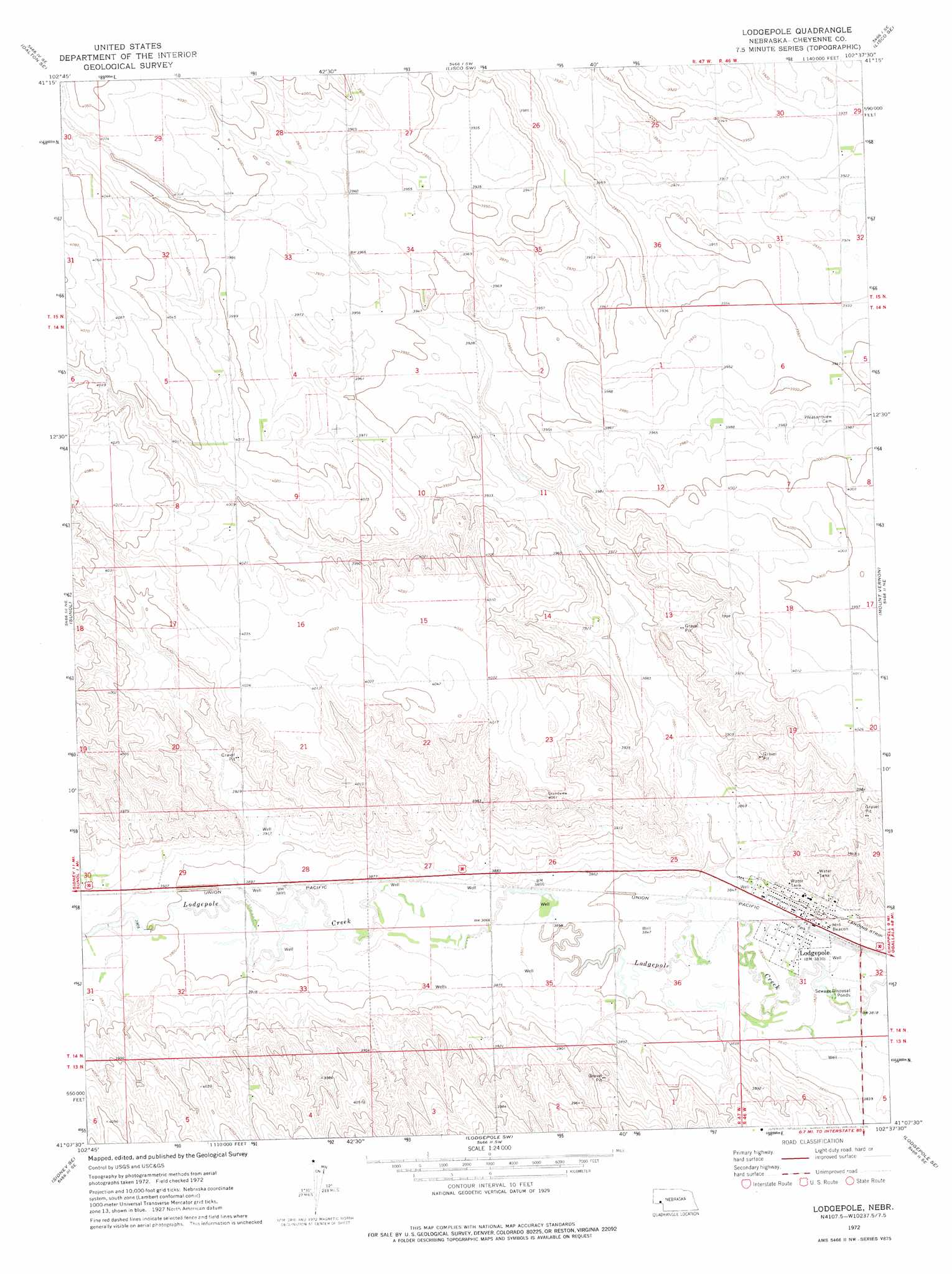
Lodgepole Topo Map Nebraska
To zoom in, hover over the map of Lodgepole
USGS Topo Quad 41102b6 - 1:24,000 scale
| Topo Map Name: | Lodgepole |
| USGS Topo Quad ID: | 41102b6 |
| Print Size: | ca. 21 1/4" wide x 27" high |
| Southeast Coordinates: | 41.125° N latitude / 102.625° W longitude |
| Map Center Coordinates: | 41.1875° N latitude / 102.6875° W longitude |
| U.S. State: | NE |
| Filename: | O41102B6.jpg |
| Download Map JPG Image: | Lodgepole topo map 1:24,000 scale |
| Map Type: | Topographic |
| Topo Series: | 7.5´ |
| Map Scale: | 1:24,000 |
| Source of Map Images: | United States Geological Survey (USGS) |
| Alternate Map Versions: |
Lodgepole NE 1972, updated 1975 Download PDF Buy paper map Lodgepole NE 2011 Download PDF Buy paper map Lodgepole NE 2014 Download PDF Buy paper map |
1:24,000 Topo Quads surrounding Lodgepole
Dalton |
Fairchild Ranch |
Lisco Nw |
Lisco |
Coumbe Bluff |
Gurley |
Dalton Se |
Lisco Sw |
Lisco Se |
Oskosh Sw |
Sidney |
Sunol |
Lodgepole |
Mount Vernon |
Chappell Nw |
Sidney Municipal Airport |
Sidney Se |
Lodgepole Sw |
Lodgepole Se |
Chappell |
Haystack Butte |
Twin Buttes |
Julesburg Reservoir |
Sedgwick |
Ovid |
> Back to 41102a1 at 1:100,000 scale
> Back to 41102a1 at 1:250,000 scale
> Back to U.S. Topo Maps home
Lodgepole topo map: Gazetteer
Lodgepole: Dams
Deford Dam elevation 1194m 3917′Fenske Dam elevation 1207m 3959′
Lodgepole: Parks
Lodgepole and the Union Pacific Railroad Historical Marker elevation 1168m 3832′Lodgepole: Populated Places
Lodgepole elevation 1172m 3845′Lodgepole: Post Offices
Lodgepole Post Office elevation 1172m 3845′Lodgepole: Reservoirs
Deford Reservoir elevation 1194m 3917′Fenske Reservoir elevation 1207m 3959′
Lodgepole digital topo map on disk
Buy this Lodgepole topo map showing relief, roads, GPS coordinates and other geographical features, as a high-resolution digital map file on DVD:
Eastern Wyoming & Western South Dakota
Buy digital topo maps: Eastern Wyoming & Western South Dakota