Ruthton Topo Map Nebraska
To zoom in, hover over the map of Ruthton
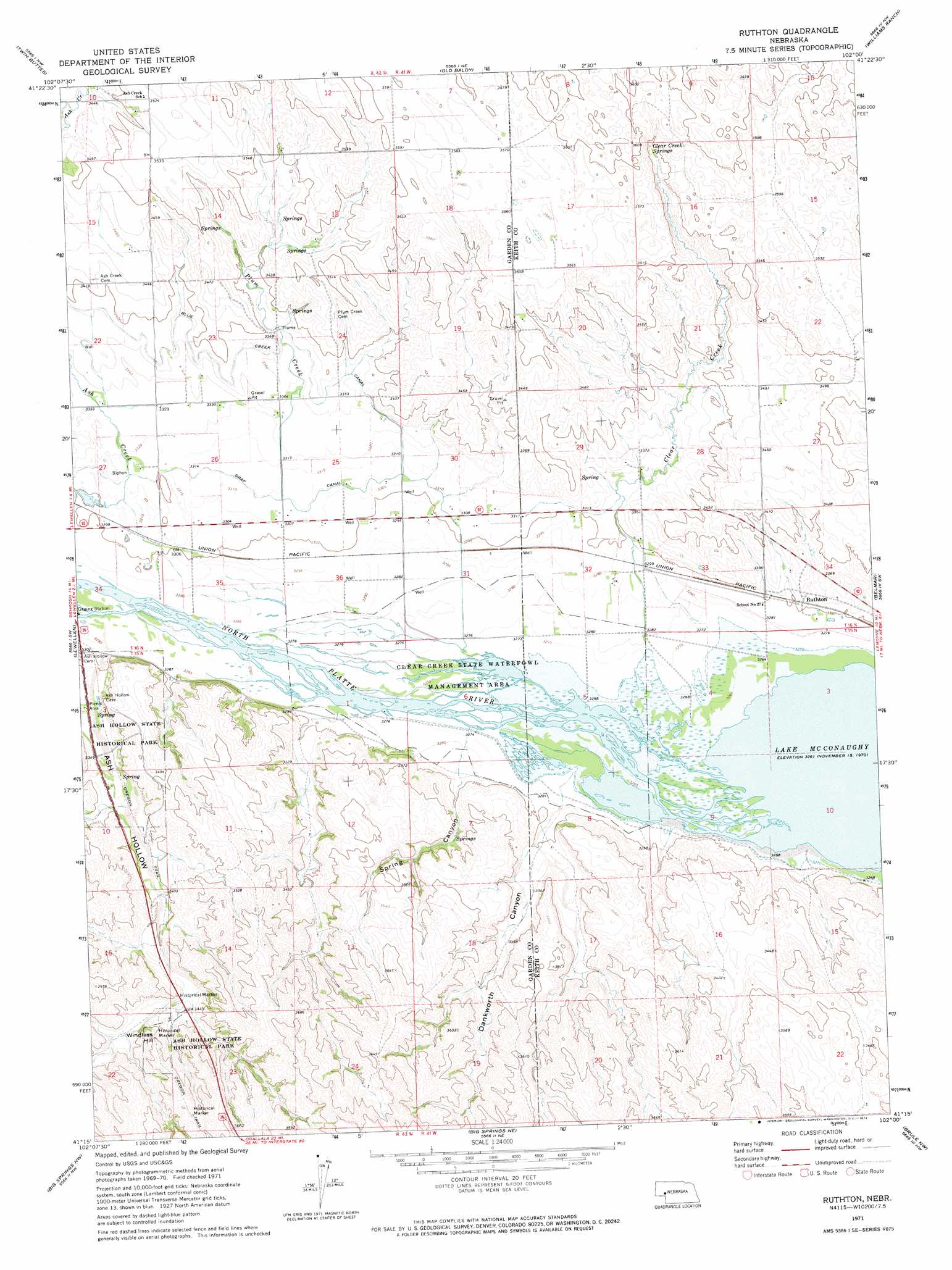
USGS Topo Quad 41102c1 - 1:24,000 scale
| Topo Map Name: | Ruthton |
| USGS Topo Quad ID: | 41102c1 |
| Print Size: | ca. 21 1/4" wide x 27" high |
| Southeast Coordinates: | 41.25° N latitude / 102° W longitude |
| Map Center Coordinates: | 41.3125° N latitude / 102.0625° W longitude |
| U.S. State: | NE |
| Filename: | O41102C1.jpg |
| Download Map JPG Image: | Ruthton topo map 1:24,000 scale |
| Map Type: | Topographic |
| Topo Series: | 7.5´ |
| Map Scale: | 1:24,000 |
| Source of Map Images: | United States Geological Survey (USGS) |
| Alternate Map Versions: |
Ruthton NE 1971, updated 1974 Download PDF Buy paper map Ruthton NE 2011 Download PDF Buy paper map Ruthton NE 2014 Download PDF Buy paper map |
1:24,000 Topo Quads surrounding Ruthton
Crescent Lake Se |
Gusher Spring |
Rackett Se |
Velma Sw |
Hulbert Lake |
Oshkosh |
Twin Buttes |
Old Baldy |
Williams Ranch |
Bear Hill |
Barn Butte |
Lewellen |
Ruthton |
Belmar |
Lemoyne |
Chappell Ne |
Big Springs Nw |
Big Springs Ne |
Brule Nw |
Brule Ne |
Chappell Se |
Barton |
Big Springs |
Brule |
Brule Se |
> Back to 41102a1 at 1:100,000 scale
> Back to 41102a1 at 1:250,000 scale
> Back to U.S. Topo Maps home
Ruthton topo map: Gazetteer
Ruthton: Canals
Graf Canal elevation 1010m 3313′Ruthton: Parks
Ash Hollow Geology Historical Marker elevation 1108m 3635′Ash Hollow Historical Marker elevation 1013m 3323′
Ash Hollow State Historical Park elevation 1025m 3362′
Clear Creek State Waterfowl Management Area elevation 999m 3277′
Windlass Hill Pioneer Homestead Historical Marker elevation 1099m 3605′
Ruthton: Populated Places
Ruthton elevation 1011m 3316′Ruthton: Springs
Clear Creek Springs elevation 1065m 3494′Ruthton: Streams
Ash Creek elevation 1004m 3293′Clear Creek elevation 1000m 3280′
Plum Creek elevation 1009m 3310′
Ruthton: Summits
Windlass Hill elevation 1104m 3622′Ruthton: Trails
Ash Hollow Trail elevation 1063m 3487′Ruthton: Valleys
Dankworth Canyon elevation 1005m 3297′Spring Canyon elevation 1006m 3300′
Ruthton digital topo map on disk
Buy this Ruthton topo map showing relief, roads, GPS coordinates and other geographical features, as a high-resolution digital map file on DVD:
Eastern Wyoming & Western South Dakota
Buy digital topo maps: Eastern Wyoming & Western South Dakota